
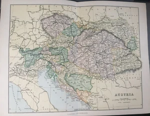
Antique Austria Map Dated C1870's Map Of Austria Europe Map Of The World Atlas
GBP 13.99GBP 13.99
Thu, May 08, 10:46 PMThu, May 08, 10:46 PM
Picture 1 of 7


Gallery
Picture 1 of 7


Have one to sell?
Antique Austria Map Dated C1870's Map Of Austria Europe Map Of The World Atlas
GBP 13.99
ApproximatelyUS $18.80
Condition:
Oops! Looks like we're having trouble connecting to our server.
Refresh your browser window to try again.
Shipping:
GBP 4.95 (approx US $6.65) Standard Int'l Postage.
International shipment of items may be subject to customs processing and additional charges.
Located in: Great Torrington, Devon, United Kingdom
Delivery:
Estimated between Wed, Jul 30 and Fri, Aug 8 to 94104
Returns:
Seller does not accept returns.
Payments:
Earn up to 5x points when you use your eBay Mastercard®. Learn moreabout earning points with eBay Mastercard
Shop with confidence
Seller assumes all responsibility for this listing.
eBay item number:135543481082
Item specifics
- Antique
- Yes
- Printing Technique
- Lithography
- Cartographer/Publisher
- William Mackenzie
- City
- Vienna
- County
- n/a
- Date Range
- 1800-1899
- Type
- World Atlas
- Format
- Atlas
- Year
- 1870
- Era
- 1800s
- State
- Various
- Original/Reproduction
- Antique Original
- Country/Region
- Austria
Item description from the seller
Seller Feedback
No feedback yet
More to explore :
- Austria Political Map Antique Europe Atlas Maps,
- Austria Antique Europe Atlas Maps,
- Austria Topographical Map Antique Europe Atlas Maps,
- Austria Lithography Antique Europe Atlas Maps,
- Austria Vienna Antique Europe Atlas Maps,
- Austria Physical Map Antique Europe Sheet Maps,
- Austria Lithography Antique Europe City Maps,
- Austria Lithography Antique Europe Sheet Maps,
- Austria 1900-1909 Date Range Antique Europe City Maps,
- Austria 1800-1899 Date Range Antique Europe Topographical Maps