
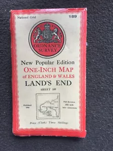
Ordnance Survey Map Land's End Isle's Of Scilly Dated C1946 Map 189 On Cloth
GBP 8.99GBP 8.99
Mon, May 26, 12:16 AMMon, May 26, 12:16 AM
Picture 1 of 9


Gallery
Picture 1 of 9


Have one to sell?
Ordnance Survey Map Land's End Isle's Of Scilly Dated C1946 Map 189 On Cloth
GBP 8.99
ApproximatelyUS $12.07
Condition:
Oops! Looks like we're having trouble connecting to our server.
Refresh your browser window to try again.
Shipping:
GBP 4.95 (approx US $6.64) Royal Mail International Standard.
International shipment of items may be subject to customs processing and additional charges.
Located in: Great Torrington, Devon, United Kingdom
Delivery:
Estimated between Mon, Jul 21 and Sat, Aug 2 to 94104
Ships today if you order in the next 8 hrs 46 mins
Returns:
Seller does not accept returns.
Payments:
Earn up to 5x points when you use your eBay Mastercard®. Learn moreabout earning points with eBay Mastercard
Shop with confidence
Seller assumes all responsibility for this listing.
eBay item number:135737911519
Item specifics
- Antique
- Yes
- Date Range
- 1940-1949
- Type
- Ordnance Survey Map
- Format
- Sheet Map
- Year
- 1946
- Era
- 1940s
- State
- n/a
- Cartographer/Publisher
- Ordnance Survey
- Original/Reproduction
- Antique Original
- City
- Land's End
- Country/Region
- United Kingdom
- County
- Cornwall
Item description from the seller
Seller Feedback
No feedback yet
More to explore :
- Antique Ordnance Survey Maps,
- Antique Europe Ordnance Survey Maps,
- 1800-1899 Date Range Antique Ordnance Survey Maps,
- Vintage Original Antique Ordnance Survey Maps,
- Antique North America Ordnance Survey Maps,
- Antique Original Antique Europe Ordnance Survey Maps,
- 1900-1909 Date Range Sheet Map County Map Antique Maps, Atlases & Globes,
- 1950-1959 Date Range Sheet Map Topographical Map Antique Maps, Atlases & Globes,
- Atlas Map Topographical Map 1600-1699 Date Range Antique Maps, Atlases & Globes,
- Physical Map Sheet Map 1900-1909 Date Range Antique Maps, Atlases & Globes