
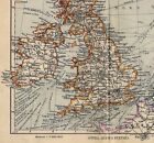


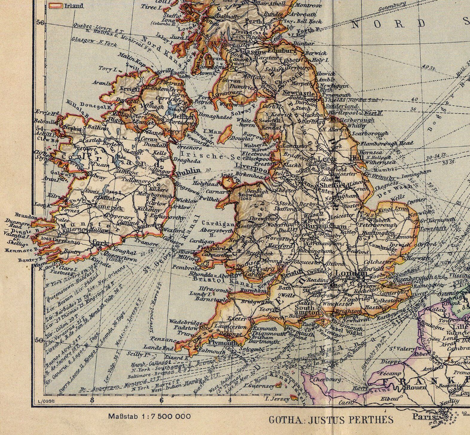


1943 VINTAGE WWII MAP OF GREAT BRITAIN UNITED KINGDOM SCOTLAND IRELAND
US $25.49
or Best Offer
Condition:
“THE MAP IS REINFORCED ON BACK ALONG THE CENTERFOLD. SIZE: 7 3/4" x 6 1/2" (20 x 16.5 CM).”
Oops! Looks like we're having trouble connecting to our server.
Refresh your browser window to try again.
Shipping:
Free Standard Shipping from Canada.
International shipment of items may be subject to customs processing and additional charges.
Located in: Montreal, Quebec, Canada
Delivery:
Estimated between Wed, May 7 and Tue, May 13 to 43230
Please allow additional time if international delivery is subject to customs processing.
Returns:
60 days returns. Seller pays for return shipping.
Payments:
Special financing available. See terms and apply now- for PayPal Credit, opens in a new window or tab
Earn up to 5x points when you use your eBay Mastercard®. Learn moreabout earning points with eBay Mastercard
Shop with confidence
Seller assumes all responsibility for this listing.
eBay item number:156692169246
Item specifics
- Seller Notes
- “THE MAP IS REINFORCED ON BACK ALONG THE CENTERFOLD. SIZE: 7 3/4" x 6 1/2" (20 x 16.5 CM).”
- Year
- 1943
- Date Range
- 1940-1949
- City
- London
- Country/Region
- United Kingdom, Scotland, Ireland
Item description from the seller

Popular categories from this store
Seller feedback (10,835)
This item (1)
All items (10,835)
- 7***r (304)- Feedback left by buyer.Past 6 monthsVerified purchaseVery nice to deal with experienced sellers, Andrew sure knows his way with dealing with shipping issues, he resolved a shipping problem with expertise. Item described accurately, great communication, packaged very well, super positive transaction, thank you !!
- 0***3 (489)- Feedback left by buyer.Past monthVerified purchase***********Multiple star seller. Thank you for taking the time while packing this item to ensure that there would be not any chance that this map would be damaged. Excellent Packaging. Fast shipping, Good value for the money spent. Item exceeded expectations, better than description. Excellent communication and service. If this seller keeps up this level of service and value then they will be in business for a long time. THANK YOU!!!
- i***h (13)- Feedback left by buyer.Past monthVerified purchaseExcellent communication throughout the process, great help combining several items into one order. Packaging was top-notch and survived international shipping without damage. Maps were in very good condition, exactly as described if not better. Loved the handwritten note and complimentary gift the seller slipped in.
- w***_ (3)- Feedback left by buyer.Past 6 monthsVerified purchaseMaps looks beautiful, it was undamaged and exactly as described. Shipping was fast and it was packed well so it didn’t bend in transit. Greta value for the price! P.s. thank you so much for the included gift! I appreciate it very much. I Highly recommend this seller.1910 ORIGINAL ANTIQUE MAP OF CITY OF KIEL VICINITY / GERMANY (#156547868171)
More to explore :
- Vintage Reproduction WWII United Kingdom Maritime Antiques,
- United Kingdom WWII Maritime Antiques,
- United Kingdom WWII Antique Maritime Compasses,
- United Kingdom WWII Antique Maritime Telescopes,
- United Kingdom Vintage Reproduction Antique Europe Maps & Atlases,
- United Kingdom Antique Europe Maps & Atlases,
- Scotland Antique Europe Maps & Atlases,
- Scotland Political Map Antique Europe Atlas Maps,
- Ireland Antique Europe Maps & Atlases,
- Scotland Antique Europe Atlas Maps
Popular categories from this store
Seller feedback (10,835)
This item (1)
All items (10,835)
- 7***r (304)- Feedback left by buyer.Past 6 monthsVerified purchaseVery nice to deal with experienced sellers, Andrew sure knows his way with dealing with shipping issues, he resolved a shipping problem with expertise. Item described accurately, great communication, packaged very well, super positive transaction, thank you !!
- 0***3 (489)- Feedback left by buyer.Past monthVerified purchase***********Multiple star seller. Thank you for taking the time while packing this item to ensure that there would be not any chance that this map would be damaged. Excellent Packaging. Fast shipping, Good value for the money spent. Item exceeded expectations, better than description. Excellent communication and service. If this seller keeps up this level of service and value then they will be in business for a long time. THANK YOU!!!
- i***h (13)- Feedback left by buyer.Past monthVerified purchaseExcellent communication throughout the process, great help combining several items into one order. Packaging was top-notch and survived international shipping without damage. Maps were in very good condition, exactly as described if not better. Loved the handwritten note and complimentary gift the seller slipped in.
- w***_ (3)- Feedback left by buyer.Past 6 monthsVerified purchaseMaps looks beautiful, it was undamaged and exactly as described. Shipping was fast and it was packed well so it didn’t bend in transit. Greta value for the price! P.s. thank you so much for the included gift! I appreciate it very much. I Highly recommend this seller.1910 ORIGINAL ANTIQUE MAP OF CITY OF KIEL VICINITY / GERMANY (#156547868171)