


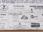


1960 Hamilton County Indiana Plat Wall Map Carmel Noblesville Westfield Fishers
US $59.99
or Best Offer
Condition:
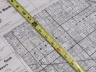
“Uncleaned, fresh from a local estate. Condition as shown in the pics. 36" by 24". Nice old, original ”... Read moreabout condition
Oops! Looks like we're having trouble connecting to our server.
Refresh your browser window to try again.
Shipping:
US $11.60 USPS Priority Mail®.
Located in: Franklin, Indiana, United States
Delivery:
Estimated between Mon, Apr 28 and Thu, May 1 to 43230
Returns:
30 days returns. Buyer pays for return shipping. If you use an eBay shipping label, it will be deducted from your refund amount.
Payments:
Special financing available. See terms and apply now- for PayPal Credit, opens in a new window or tab
Earn up to 5x points when you use your eBay Mastercard®. Learn moreabout earning points with eBay Mastercard
Shop with confidence
Seller assumes all responsibility for this listing.
eBay item number:156716517322
Item specifics
- Seller Notes
- Type
- County Map
- US State
- Indiana
- Format
- Wall Map
- Year
- 1960
Item description from the seller
Seller Feedback
No feedback yet
More to explore :
- County Map Antique Wall Maps,
- Lithography County Map Antique Wall Maps,
- Indiana Antique North America County Maps,
- Antique Original County Map Antique Wall Maps,
- Indiana County Map Antique North America Atlas Maps,
- Washington Indiana Antique North America County Maps,
- Antique County Maps,
- County Map Antique School Maps,
- Antique Europe County Maps,
- Antique Asia County Maps