
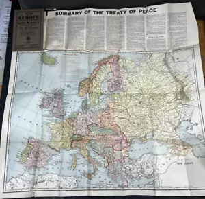
Antique 1919 WWI Treaty Boundry Map New Europe Rand-McNally Axis Allies 26" Old
US $69.97US $69.97
Tue, May 20, 10:58 PMTue, May 20, 10:58 PM
Picture 1 of 24


Gallery
Picture 1 of 24


Have one to sell?
Antique 1919 WWI Treaty Boundry Map New Europe Rand-McNally Axis Allies 26" Old
US $69.97
or Best Offer
Was US $99.95 (30% off)
Condition:
“Approx 26" x 26" WHOLE folded out, actual map (without text) approx 26" x 19" , shows boundries ”... Read moreabout condition
Ended: May 20, 2025 22:58:00 PDT
Oops! Looks like we're having trouble connecting to our server.
Refresh your browser window to try again.
Pickup:
Free local pickup from Kunkletown, Pennsylvania, United States 18058
Shipping:
US $6.75 Standard Shipping.
Located in: Kunkletown, Pennsylvania, United States
Delivery:
Estimated between Sat, Aug 2 and Wed, Aug 6 to 94104
Returns:
30 days returns. Buyer pays for return shipping. If you use an eBay shipping label, it will be deducted from your refund amount.
Payments:
.
Special financing available. See terms and apply now- for PayPal Credit, opens in a new window or tab
Earn up to 5x points when you use your eBay Mastercard®. Learn moreabout earning points with eBay Mastercard
Shop with confidence
Seller assumes all responsibility for this listing.
eBay item number:156862196985
Item specifics
- Seller Notes
- Date Range
- 1910-1919
- Type
- Post WW1 Treaty New Boundry Lines Political Map
- Format
- Folding Map
- Year
- 1919
- Original/Reproduction
- Antique Original
- Cartographer/Publisher
- Rand McNally & Co.
- Country/Region
- Belgium, France, Germany, Hungary, Netherlands, Ukraine, Soviet Union Russia, WW1 Europe
Item description from the seller
Seller Feedback
No feedback yet
More to explore :
- Rand McNally & Co. Antique Europe Atlas Maps,
- Rand McNally & Co. Antique Original Antique Europe Maps & Atlases,
- Rand McNally & Co. Antique Original Antique Europe Atlas Maps,
- Rand McNally & Co. 1910-1919 Date Range Antique City Maps,
- Rand McNally & Co. 1910-1919 Date Range Antique Topographical Maps,
- Rand McNally & Co. Antique Wall Maps,
- Rand McNally & Co. City Map Antique Folding Maps,
- Rand McNally & Co. Physical Map Antique Atlas Maps,
- Rand McNally & Co. Antique European Maps & Atlases,
- Rand McNally & Co. Antique World Wall Maps