


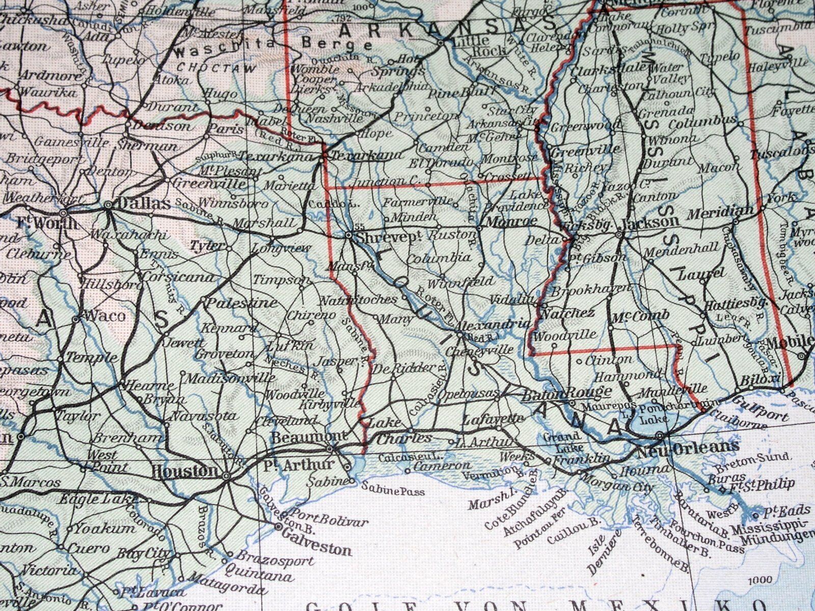


1938 ORIGINAL VINTAGE MAP OF CENTRAL USA TEXAS OKLAHOMA LOUISIANA COLORADO
US $29.26
or Best Offer
Condition:
“RUST STAINS ON THE RIGHT MARGIN - PLEASE SEE THE PHOTO.”
Oops! Looks like we're having trouble connecting to our server.
Refresh your browser window to try again.
Shipping:
Free Standard Shipping from Canada.
International shipment of items may be subject to customs processing and additional charges.
Located in: Montreal, Quebec, Canada
Delivery:
Estimated between Tue, May 27 and Mon, Jun 2 to 43230
Returns:
60 days returns. Seller pays for return shipping.
Payments:
Special financing available. See terms and apply now- for PayPal Credit, opens in a new window or tab
Earn up to 5x points when you use your eBay Mastercard®. Learn moreabout earning points with eBay Mastercard
Shop with confidence
Seller assumes all responsibility for this listing.
eBay item number:156931283258
Item specifics
- Seller Notes
- “RUST STAINS ON THE RIGHT MARGIN - PLEASE SEE THE PHOTO.”
- Date Range
- 1930-1939
Item description from the seller
Seller Feedback
No feedback yet
More to explore :
- Louisiana Vintage Original Antique North America Folding Maps,
- Louisiana Vintage Original Antique North American Maps & Atlases,
- Oklahoma Vintage Original Antique North America Topographical Maps,
- Oklahoma Vintage Original Antique North American Maps & Atlases,
- Oklahoma Vintage Original Antique North America Folding Maps,
- Vintage Original Antique Central American/Caribbean Maps & Atlases,
- Cuba Vintage Original Antique Central American/Caribbean Maps & Atlases,
- United States of America Oklahoma Vintage Original Antique North American Maps & Atlases,
- New Orleans Louisiana Antique Original Antique North American Maps & Atlases,
- Antique North American Maps & Atlases Louisiana