Picture 1 of 12


Gallery
Picture 1 of 12


Have one to sell?
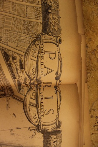
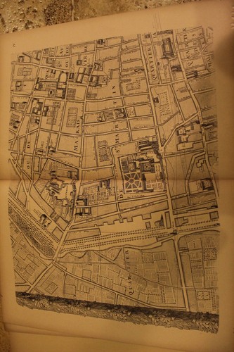
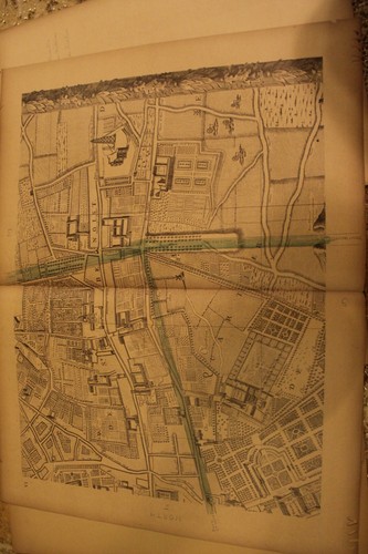
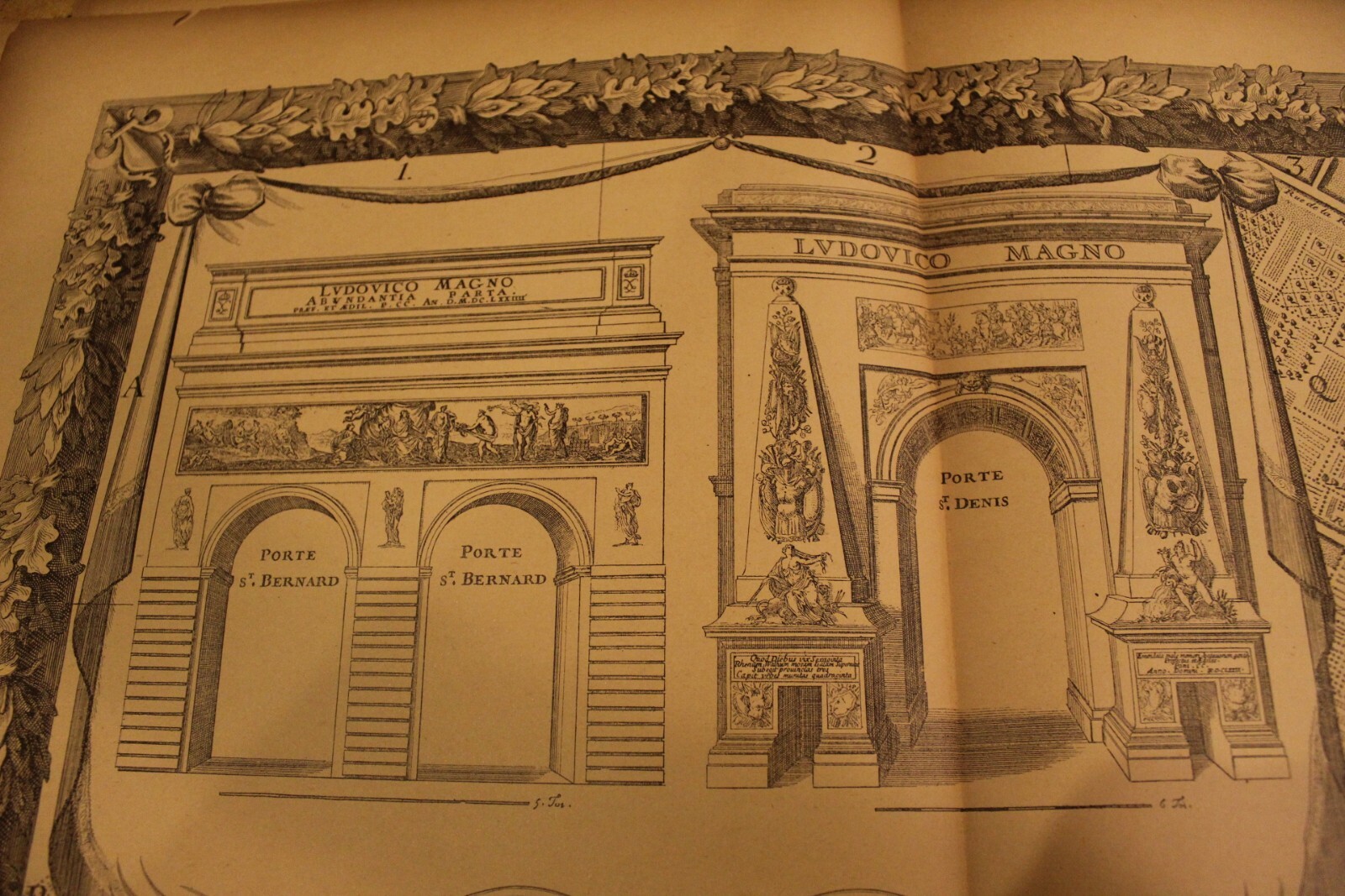
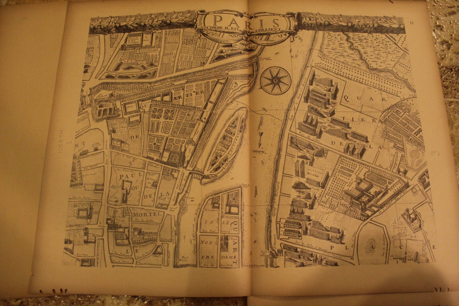
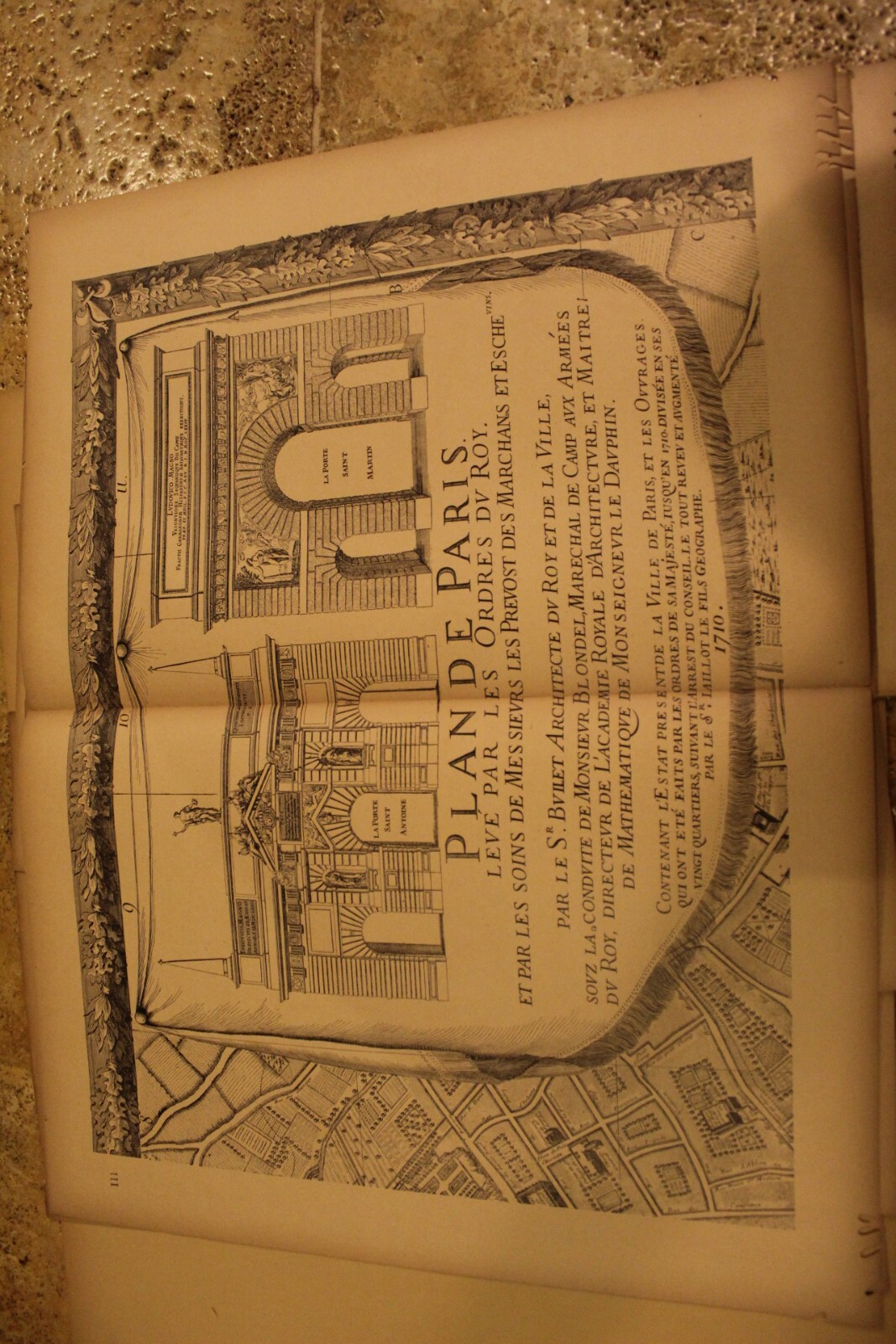
Antique 1900 A. Taride Paris in 1710 Plan de Paris connecting map 12 plates
US $258.51
or Best Offer
as low as $44.86/mo with
Condition:
- Buy It NowAntique 1900 A. Taride Paris in 1710 Plan de Paris connecting map 12 plates
Oops! Looks like we're having trouble connecting to our server.
Refresh your browser window to try again.
Shipping:
Free USPS First Class®.
Located in: North Manchester, Indiana, United States
Delivery:
Estimated between Tue, Aug 5 and Mon, Aug 11 to 94104
Returns:
Seller does not accept returns.
Payments:
.
As low as $44.86/mo with Klarna.
*No Interest if paid in full in 6 months on $149+. See terms and apply now- for PayPal Credit, opens in a new window or tab
Earn up to 5x points when you use your eBay Mastercard®. Learn moreabout earning points with eBay Mastercard
Shop with confidence
Seller assumes all responsibility for this listing.
eBay item number:167352356427
Item specifics
- Year
- 1900
- City
- Paris
Item description from the seller
Seller feedback (2,285)
- 3***7 (507)- Feedback left by buyer.Past yearVerified purchaseObjectif super bien emballé, livraison rapide et soignée, vendeur courtois, objectif conforme aux attentes et au descriptif. MerciRare WW2 Japanese Aerial Camera Lens ZUIKO TAKATIHO 200MM F/4.5 (#166878025933)
- o***o (435)- Feedback left by buyer.More than a year agoVerified purchaseThis seller is excellent! The item is gorgeous and as described. The seller kept me updated on everything. I received this item in just 2 days!! I will buy from this seller again.Antique Polyphon Music Box Disc Player Coin Operated Schutz Marke Comb (#166812751034)
- a***0 (708)- Feedback left by buyer.Past 6 monthsVerified purchasePackage arrived, thanks for the items.Art Deco Antique 4 pc Smoking set Bradley & Hubbard Cigarette Box Tray Ashtray (#167352356399)
More to explore :
- Paris France Antique Maps,
- Paris Copper Plate Antique Europe Maps & Atlases,
- Paris Antique Europe Folding Maps,
- Paris Antique Europe Atlas Maps,
- Paris Antique Europe County Maps,
- Paris Antique Europe Railroad Maps,
- Paris Antique Original Antique Europe City Maps,
- Paris France Antique Europe Folding Maps,
- Paris Antique Original Antique Europe Folding Maps,
- Paris France 1900-1909 Date Range Antique Europe Maps & Atlases