Picture 1 of 5


Gallery
Picture 1 of 5


Have one to sell?
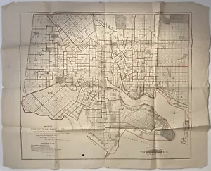
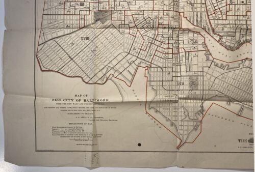
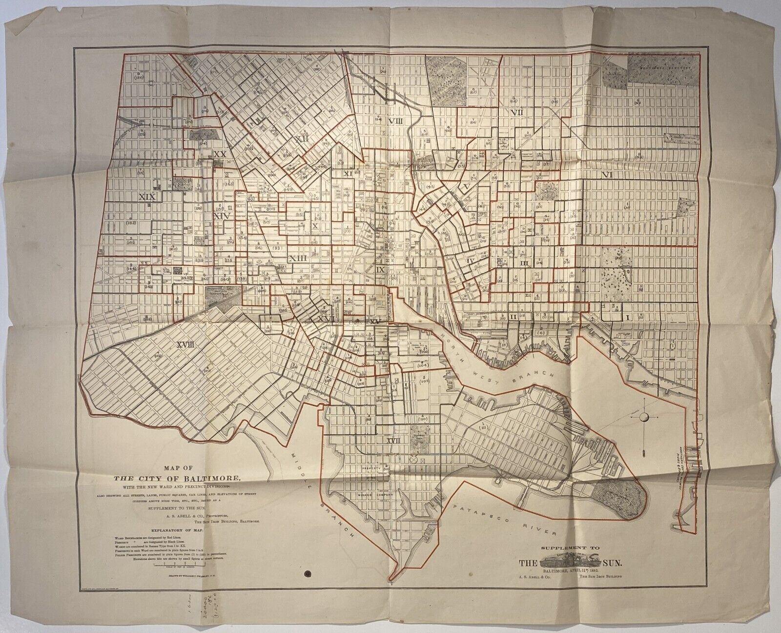
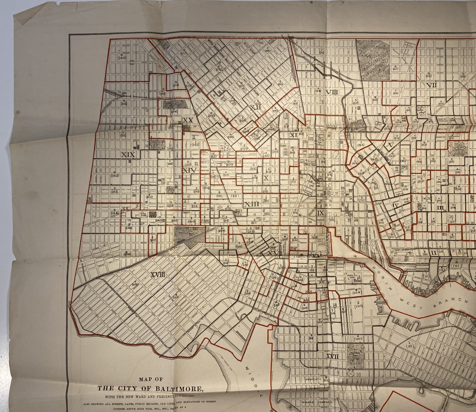
Baltimore map, Sun supplement Apr. 11, 1882, drawn by Twamley, printer Hoen & Co

US $145.00
or Best Offer
as low as $49.46/mo with
Condition:
“Good. Several small chips to edges; small ink stain within map rules but not affecting map itself; a ”... Read moreabout condition
- Buy It NowBaltimore map, Sun supplement Apr. 11, 1882, drawn by Twamley, printer Hoen & Co
Oops! Looks like we're having trouble connecting to our server.
Refresh your browser window to try again.
Shipping:
US $4.47 USPS Media MailTM.
Located in: Mishawaka, Indiana, United States
Delivery:
Estimated between Mon, Aug 4 and Thu, Aug 7 to 94104
Returns:
30 days returns. Seller pays for return shipping.
Payments:
.
As low as $49.46/mo with Klarna.
Special financing available. See terms and apply now- for PayPal Credit, opens in a new window or tab
Earn up to 5x points when you use your eBay Mastercard®. Learn moreabout earning points with eBay Mastercard
Shop with confidence
Seller assumes all responsibility for this listing.
eBay item number:167393522672
Item specifics
- Seller Notes
- Date Range
- 1800-1899
- Type
- City Map
- US State
- Maryland
- Format
- Folding Map
- Printing Technique
- Lithography
- Year
- 1882
- Original/Reproduction
- Antique Original
- Cartographer/Publisher
- William P. Twamley
- City
- Baltimore
- Country/Region
- United States of America
Item description from the seller
Seller feedback (155)
- u***r (403)- Feedback left by buyer.Past 6 monthsVerified purchaseItem described accurately, great communication, fast shipping, well packaged at a fair price
- l***i (148)- Feedback left by buyer.Past 6 monthsVerified purchaseGreat shipping, arrived on time, everything was well packaged and as shown and described in the original post. Overall great value for price.History of the Earth and Animated Nature, Vol II, cats, dogs, goats, deer, bears (#167382754861)
- o***f (208)- Feedback left by buyer.Past 6 monthsVerified purchasePerfect transaction! Fast shipping, great packing, excellent communication! AAA+++ seller! Will purchase again! Thank you so much!Crofutt’s New Overland Tourist & Pacific Coast Guide, 1880, 18 fold-out illus. (#167302755681)
More to explore :
- Manuscript/Hand drawn County Map Antique Sheet Maps,
- Manuscript/Hand drawn Antique Sheet Maps,
- Manuscript/Hand drawn Antique County Maps,
- Manuscript/Hand drawn Antique Maps, Atlases & Globes,
- Manuscript/Hand drawn County Map Antique North America Sheet Maps,
- Antique North American Manuscript/Hand drawn Maps & Atlases,
- Antique Original Manuscript/Hand drawn Antique Sheet Maps,
- Manuscript/Hand drawn Antique North America Sheet Maps,
- Baltimore Antique North America Atlas Maps,
- Baltimore Maryland Antique North America City Maps
Seller feedback (155)
- u***r (403)- Feedback left by buyer.Past 6 monthsVerified purchaseItem described accurately, great communication, fast shipping, well packaged at a fair price
- l***i (148)- Feedback left by buyer.Past 6 monthsVerified purchaseGreat shipping, arrived on time, everything was well packaged and as shown and described in the original post. Overall great value for price.History of the Earth and Animated Nature, Vol II, cats, dogs, goats, deer, bears (#167382754861)
- o***f (208)- Feedback left by buyer.Past 6 monthsVerified purchasePerfect transaction! Fast shipping, great packing, excellent communication! AAA+++ seller! Will purchase again! Thank you so much!Crofutt’s New Overland Tourist & Pacific Coast Guide, 1880, 18 fold-out illus. (#167302755681)