


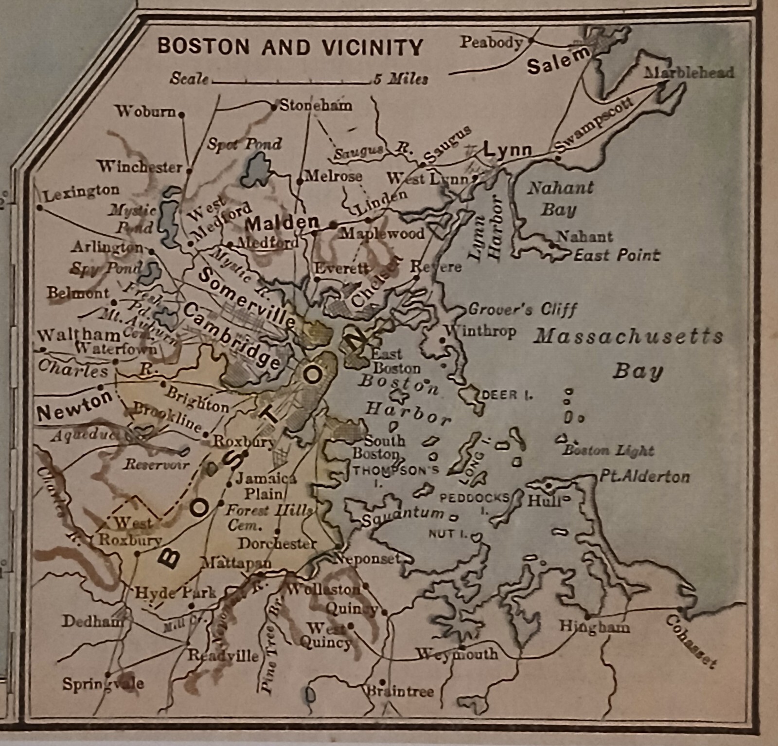


Antique Pre WWI 1912 Map Of The New England States
US $16.99
or Best Offer
Condition:
- Buy It NowAntique Pre WWI 1912 Map Of The New England States
Oops! Looks like we're having trouble connecting to our server.
Refresh your browser window to try again.
Shipping:
US $3.15 USPS First Class Large Envelope.
Located in: Columbia, Pennsylvania, United States
Delivery:
Estimated between Thu, May 29 and Wed, Jun 4 to 94104
Returns:
Seller does not accept returns.
Payments:
Special financing available. See terms and apply now- for PayPal Credit, opens in a new window or tab
Earn up to 5x points when you use your eBay Mastercard®. Learn moreabout earning points with eBay Mastercard
Shop with confidence
Seller assumes all responsibility for this listing.
eBay item number:176821687372
Item specifics
- Date Range
- 1910-1919
- Type
- Political Map
- US State
- New Hampshire, Rhode Island, Vermont, Massachusetts, Maine, CT, MA, ME, NH, RI, VT, Connecticut
- Format
- Atlas Map
- Year
- 1912
- Original/Reproduction
- Antique Original
- Cartographer/Publisher
- M. F. Maury
- City
- Boston
- Country/Region
- United States of America
Item description from the seller
Seller feedback (171)
- 8***s (470)- Feedback left by buyer.Past 6 monthsVerified purchasePerfect seller! Items exactly as described! Arrived quickly! Packaged very well! Cost less than what the kid’s meals would have cost me to collect all the figures!
- 6***7 (91)- Feedback left by buyer.Past 6 monthsVerified purchaseVery well packaged, post office still managed to put a small dent in the frame, but otherwise the map and frame is exactly as described - great transaction and recommended seller!
- f***i (1413)- Feedback left by buyer.Past monthVerified purchaseFast shipping, great communication, item arrived well packaged and in perfect condition. A++ seller!
More to explore :
- England Antique Europe Maps & Atlases,
- United States WWI Maritime Antiques,
- England Antique Europe City Maps,
- England County Map Antique Europe Atlas Maps,
- England Antique Europe Sheet Maps,
- England Antique Europe County Maps,
- England Antique Europe Railroad Maps,
- England Antique Original Antique Europe County Maps,
- London England Antique Europe Folding Maps,
- Antique European Maps & Atlases England Warwickshire