
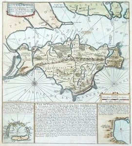
Antique Sea Chart ISLE of WIGHT Scilly Tor Bay original Nicolas de Fer map c1695
GBP 185.00GBP 185.00
Sun, Jun 08, 06:51 AMSun, Jun 08, 06:51 AM
Picture 1 of 6


Gallery
Picture 1 of 6


Have one to sell?
Antique Sea Chart ISLE of WIGHT Scilly Tor Bay original Nicolas de Fer map c1695
GBP 185.00
ApproximatelyUS $249.62
Condition:
“used”
Oops! Looks like we're having trouble connecting to our server.
Refresh your browser window to try again.
Shipping:
GBP 18.50 (approx US $24.96) Royal Mail International Tracked.
International shipment of items may be subject to customs processing and additional charges.
Located in: Shrewsbury, United Kingdom
Delivery:
Estimated between Mon, Jul 21 and Mon, Jul 28 to 94104
Returns:
30 days returns. Buyer pays for return shipping. If you use an eBay shipping label, it will be deducted from your refund amount.
Payments:
Earn up to 5x points when you use your eBay Mastercard®. Learn moreabout earning points with eBay Mastercard
Shop with confidence
Seller assumes all responsibility for this listing.
eBay item number:177034076881
Item specifics
- Seller Notes
- “used”
- Antique
- Yes
- Date Range
- 1600-1699
- Type
- Nautical Map
- Printing Technique
- Copper Plate
- Format
- Sea Chart
- Era
- 1600s
- Cartographer/Publisher
- Johannes Van Keulen
- Original/Reproduction
- Antique Original
- Country/Region
- United Kingdom
- County
- Hampshire, Isle of Wight
Item description from the seller
Seller Feedback
No feedback yet
More to explore :
- Isle of Wight Antique Original Antique Europe Maps & Atlases,
- Antique European Maps & Atlases Isle of Wight,
- England Isle of Wight Antique Europe Maps & Atlases,
- Isle of Wight 1800-1899 Date Range Antique Europe Maps & Atlases,
- Antique Original Antique Maritime Navigational Charts,
- Antique Original Topographical Map Antique Wall Maps,
- Antique Original Geological Map Antique Folding Maps,
- Antique Original County Map Antique Atlas Maps,
- Antique Original Antique Anthropomorphic Maps,
- Antique Original Topographical Map Antique Atlas Maps