
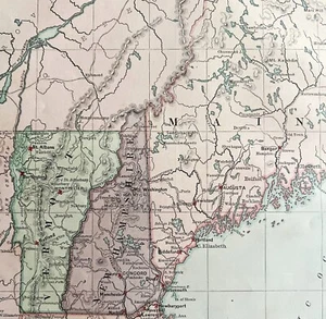
1879 Map New England USA Victorian Atlas Harpers Geography 1st Edition DWAA9
US $79.99US $79.99
Fri, May 09, 06:44 AMFri, May 09, 06:44 AM
Picture 1 of 2

Gallery
Picture 1 of 2


Have one to sell?
1879 Map New England USA Victorian Atlas Harpers Geography 1st Edition DWAA9
US $79.99
or Best Offer
Condition:
Oops! Looks like we're having trouble connecting to our server.
Refresh your browser window to try again.
Shipping:
US $8.75 USPS First Class®.
Located in: Cambridge, Maine, United States
Delivery:
Estimated between Thu, Jul 31 and Wed, Aug 6 to 94104
Returns:
30 days returns. Seller pays for return shipping.
Payments:
.
Special financing available. See terms and apply now- for PayPal Credit, opens in a new window or tab
Earn up to 5x points when you use your eBay Mastercard®. Learn moreabout earning points with eBay Mastercard
Shop with confidence
Seller assumes all responsibility for this listing.
eBay item number:187065702899
Item specifics
- US State
- Connecticut, Vermont, Massachusetts, New Hampshire, Maine, Rhode Island
- Printing Technique
- Lithography
- Cartographer/Publisher
- Harper's
- City
- Various
- California Prop 65 Warning
- NA
- Date Range
- 1800-1899
- Type
- Physical Map
- Format
- Sheet Map
- Mexican State
- NA
- Canadian Province
- NA
- Year
- 1879
- Original/Reproduction
- Antique Original
- Country/Region
- United States of America
Item description from the seller
Seller Feedback
No feedback yet
More to explore :
- England Antique Europe Atlas Maps,
- England County Map Antique Europe Atlas Maps,
- England City Map Antique Europe Atlas Maps,
- England Political Map Antique Europe Atlas Maps,
- London England Antique Europe Atlas Maps,
- England London Antique Europe Atlas Maps,
- Antique Atlas Maps,
- New York City Map Antique North America Atlas Maps,
- New Orleans Antique North America Atlas Maps,
- County Map Antique Atlas Maps