
Map War Of Secession East Coast 1871 Victorian Woodcut Print History DWAA12
US $29.99US $29.99
Fri, May 09, 07:38 AMFri, May 09, 07:38 AM
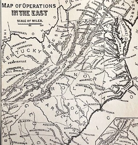


Map War Of Secession East Coast 1871 Victorian Woodcut Print History DWAA12
US $29.99
or Best Offer
Condition:
Oops! Looks like we're having trouble connecting to our server.
Refresh your browser window to try again.
Shipping:
US $5.85 USPS First Class®.
Located in: Cambridge, Maine, United States
Delivery:
Estimated between Fri, Jun 6 and Thu, Jun 12 to 94104
Returns:
30 days returns. Seller pays for return shipping.
Payments:
Special financing available. See terms and apply now- for PayPal Credit, opens in a new window or tab
Earn up to 5x points when you use your eBay Mastercard®. Learn moreabout earning points with eBay Mastercard
Shop with confidence
Seller assumes all responsibility for this listing.
eBay item number:187065772648
Item specifics
- US State
- Delaware, Maryland, Massachusetts, New Hampshire, New Jersey, Pennsylvania, Virginia, Florida, Georgia, North Carolina, South Carolina
- Printing Technique
- Woodcut
- Cartographer/Publisher
- Swinton
- City
- Various
- Date Range
- 1800-1899
- Type
- Physical Map
- Format
- Sheet Map
- Mexican State
- NA
- Year
- 1871
- Canadian Province
- NA
- Original/Reproduction
- Antique Original
- Country/Region
- United States of America
Item description from the seller
Seller Feedback
No feedback yet
More to explore :
- Woodcut Antique Topographical Maps,
- Woodcut Antique Wall Maps,
- Woodcut Antique City Maps,
- Woodcut Antique Atlas Maps,
- Woodcut Antique Sheet Maps,
- Woodcut Antique Europe City Maps,
- Woodcut Antique Maps, Atlases & Globes,
- Woodcut Antique World Maps & Atlases,
- Woodcut Antique North America County Maps,
- Sebastian Munster Woodcut Antique Europe Maps & Atlases