
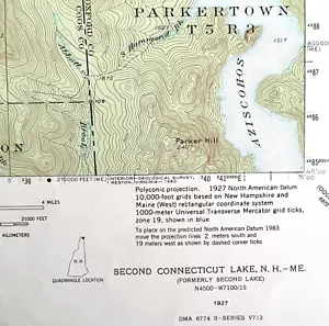
Map Second Connecticut Lake 1927 Topographic Geo Survey 1:62500 22 x 18" TOPO3
US $44.99US $44.99
Mon, May 12, 08:43 AMMon, May 12, 08:43 AM


Map Second Connecticut Lake 1927 Topographic Geo Survey 1:62500 22 x 18" TOPO3
US $44.99
or Best Offer
Condition:
Oops! Looks like we're having trouble connecting to our server.
Refresh your browser window to try again.
Shipping:
US $14.75 USPS Priority Mail®.
Located in: Cambridge, Maine, United States
Delivery:
Estimated between Thu, Jun 12 and Tue, Jun 17 to 94104
Returns:
30 days returns. Seller pays for return shipping.
Payments:
.
Special financing available. See terms and apply now- for PayPal Credit, opens in a new window or tab
Earn up to 5x points when you use your eBay Mastercard®. Learn moreabout earning points with eBay Mastercard
Shop with confidence
Seller assumes all responsibility for this listing.
eBay item number:187075152225
Item specifics
- US State
- Maine, New Hampshire
- Printing Technique
- Lithography
- Cartographer/Publisher
- USGS
- City
- Second Connecticut Lake
- Date Range
- 1920-1929
- Type
- Topographical Map
- Format
- Sheet Map
- Mexican State
- NA
- Year
- 1927
- Canadian Province
- NA
- Original/Reproduction
- Antique Original
- Country/Region
- United States of America
Item description from the seller
Seller Feedback
No feedback yet
More to explore :
- Connecticut Antique North America Topographical Maps,
- Connecticut Topographical Map Antique North America Sheet Maps,
- Antique Ordnance Survey Maps,
- Connecticut 1940-1949 Date Range Antique North America Topographical Maps,
- Antique Europe Ordnance Survey Maps,
- Antique Topographical Maps,
- Topographical Map Antique Atlas Maps,
- Topographical Map Antique Asia Atlas Maps,
- Antique World Topographical Maps,
- Woodcut Antique Topographical Maps