


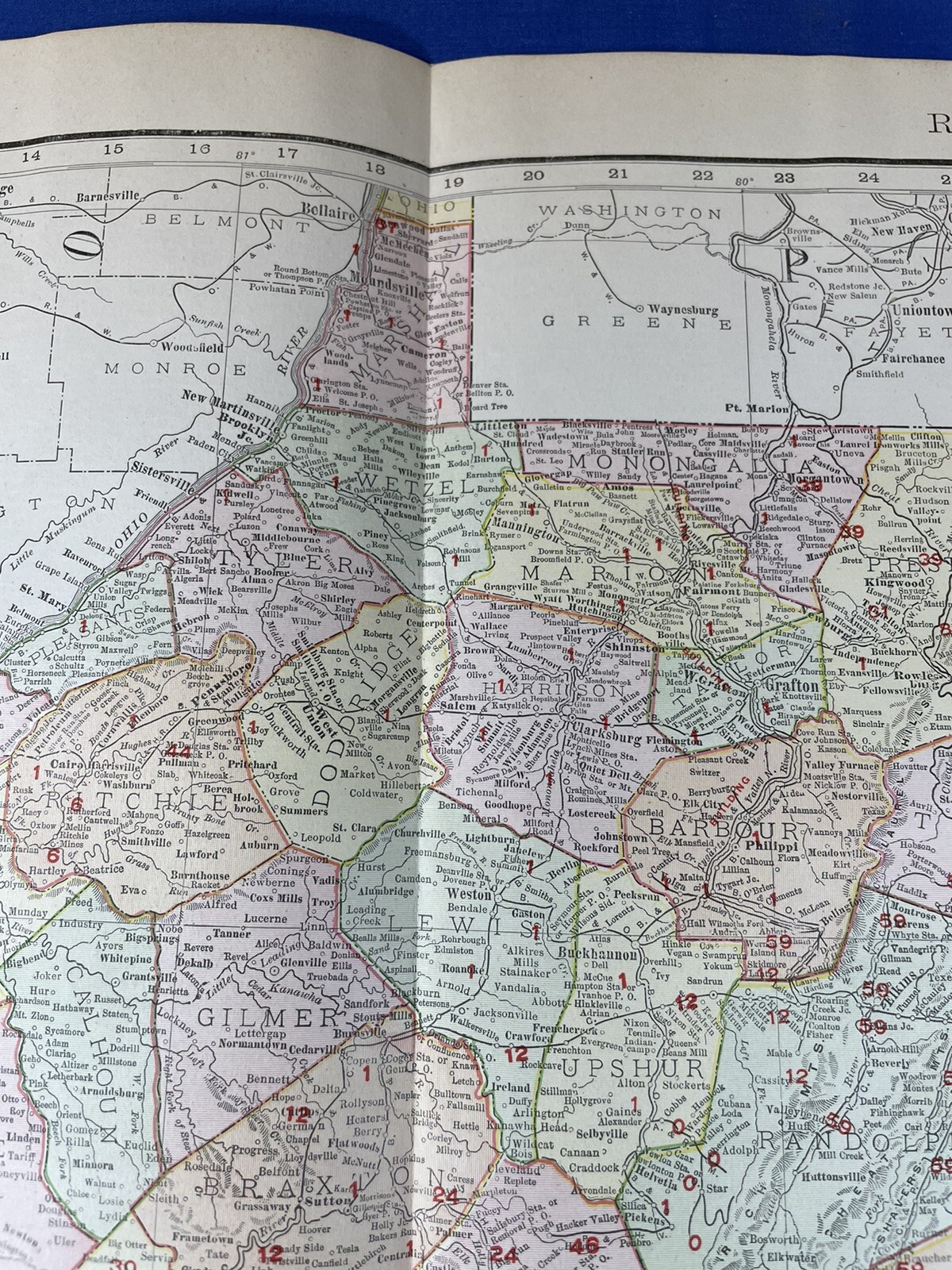


1906 Color Map WEST VIRGINIA 28x 20.5" RAILROAD Key, ADAMS Express, Cumberland
US $41.65
Was US $49.00 (15% off)
Condition:
“salvage from an atlas, 1 side will have light edge stain, no rips, no holes, photos will show any ”... Read moreabout condition
Sale ends in: 1d 2h
- Buy It Now1906 Color Map WEST VIRGINIA 28x 20.5" RAILROAD Key, ADAMS Express, Cumberland
Oops! Looks like we're having trouble connecting to our server.
Refresh your browser window to try again.
Shipping:
US $6.15 USPS Ground Advantage®.
Located in: Saco, Maine, United States
Delivery:
Estimated between Thu, May 22 and Wed, May 28 to 43230
Returns:
Seller does not accept returns.
Payments:
Special financing available. See terms and apply now- for PayPal Credit, opens in a new window or tab
Earn up to 5x points when you use your eBay Mastercard®. Learn moreabout earning points with eBay Mastercard
Shop with confidence
Seller assumes all responsibility for this listing.
eBay item number:196644136447
Item specifics
- Seller Notes
- Publication Year
- 1906
- Date Range
- 1900-1909
- Type
- State Map
- Printing Technique
- Lithography
- Format
- Atlas Map
- US State
- West Virginia
- Year
- 1906
- Cartographer/Publisher
- Rand McNally & Co.
- Original/Reproduction
- Antique Original
- Topic
- Historical Points
- Country/Region
- North America
Item description from the seller

Seller feedback (5,612)
- n***p (893)- Feedback left by buyer.Past 6 monthsVerified purchaseGreat seller! Great packing. Excellent communication. Better than the description. I feel like I got a great bargain . Shipping and packing was amazing.3 Antique Pendant Light Fixture Parts ~ Hanging Rods, Pipes ~ Restoration Parts (#197013667205)
- l***t (192)- Feedback left by buyer.Past monthVerified purchaseExtremely well packaged, shipped rapidly and exactly as described for a great price. Highly recommended seller! A+++
- n***u (280)- Feedback left by buyer.Past 6 monthsVerified purchaseItem as described, packed well, no issues. Fair price, good value. Shipping costs were very reasonable. Overall great transaction and wonderful seller! Thanks very much!
More to explore :
- West Virginia Antique North America Railroad Maps,
- West Virginia 1800-1899 Date Range Antique North America Railroad Maps,
- West Virginia Antique North America Maps & Atlases,
- Virginia Antique North America Railroad Maps,
- West Virginia Topographical Map Antique North America Folding Maps,
- West Virginia Antique North America Topographical Maps,
- West Virginia Lithography Antique North America Maps & Atlases,
- George Cram West Virginia Antique North America Maps & Atlases,
- West Virginia Antique Original Antique North America Folding Maps,
- Vintage Reproduction West Virginia Antique North America Maps & Atlases
Seller feedback (5,612)
- n***p (893)- Feedback left by buyer.Past 6 monthsVerified purchaseGreat seller! Great packing. Excellent communication. Better than the description. I feel like I got a great bargain . Shipping and packing was amazing.3 Antique Pendant Light Fixture Parts ~ Hanging Rods, Pipes ~ Restoration Parts (#197013667205)
- l***t (192)- Feedback left by buyer.Past monthVerified purchaseExtremely well packaged, shipped rapidly and exactly as described for a great price. Highly recommended seller! A+++
- n***u (280)- Feedback left by buyer.Past 6 monthsVerified purchaseItem as described, packed well, no issues. Fair price, good value. Shipping costs were very reasonable. Overall great transaction and wonderful seller! Thanks very much!