


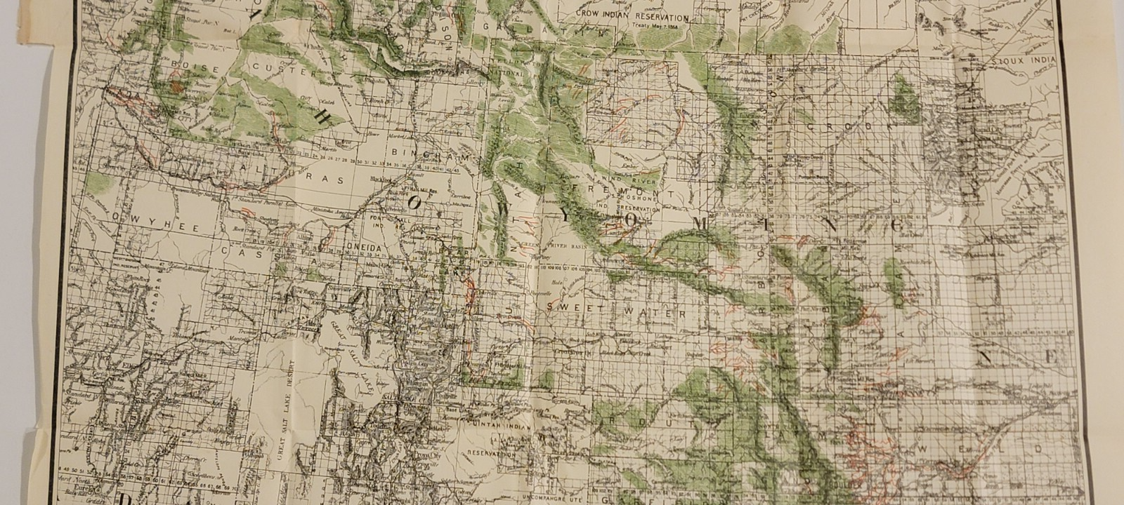
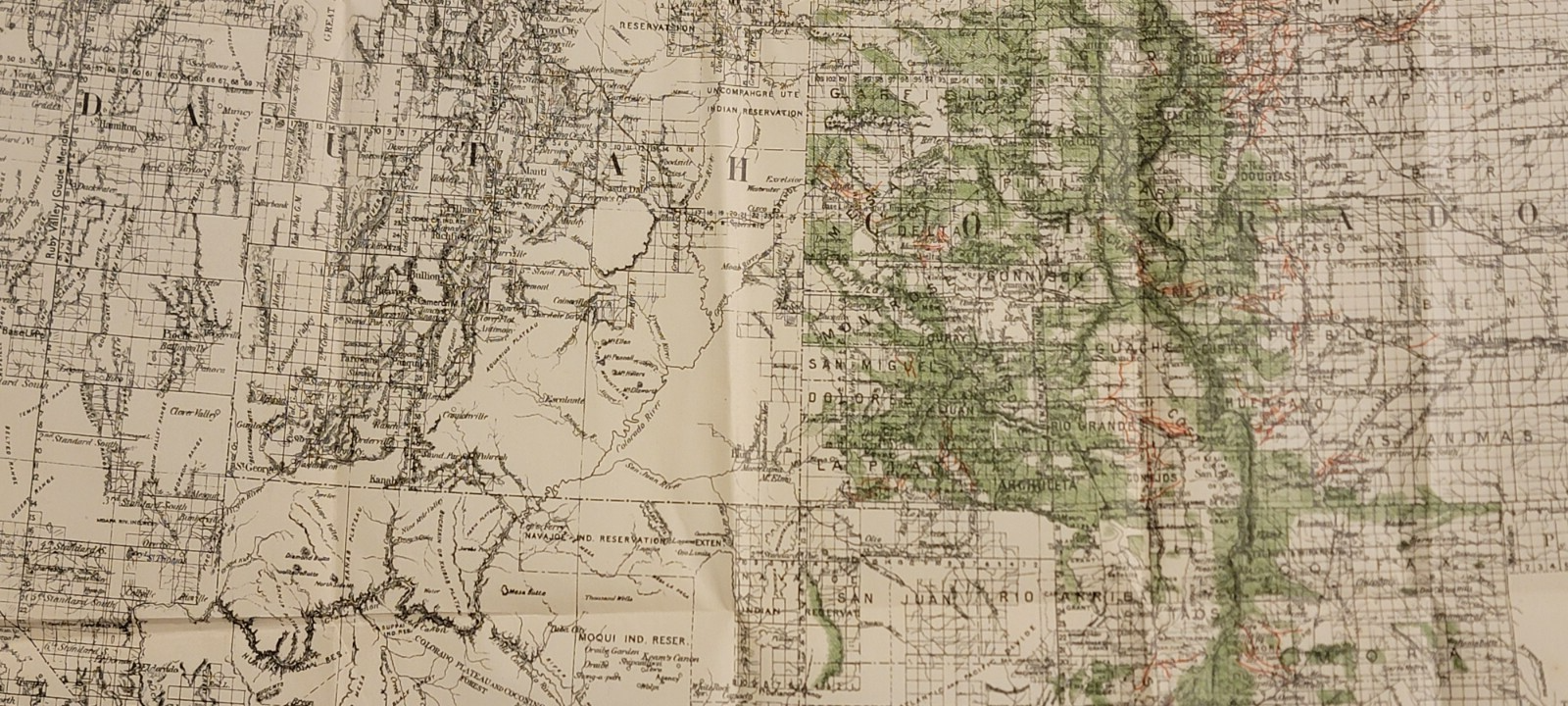


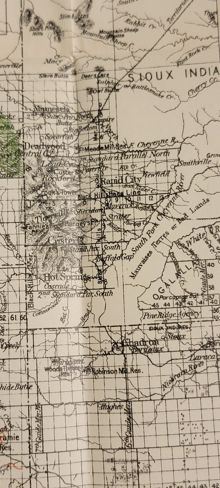


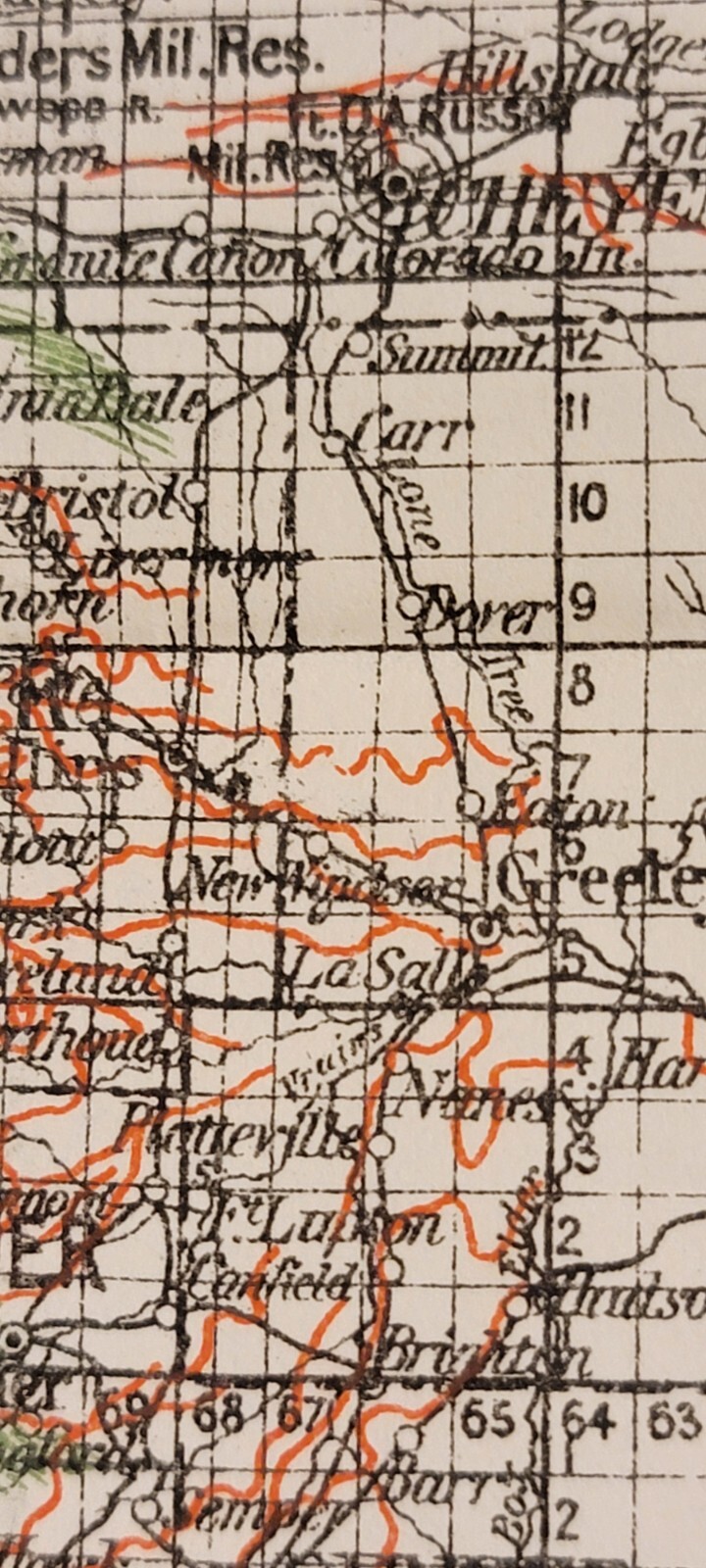


Detailed 1885 colored map Rocky Mountain Region forests, ditches Ensign
US $150.00
Condition:
- Buy It NowDetailed 1885 colored map Rocky Mountain Region forests, ditches Ensign
Oops! Looks like we're having trouble connecting to our server.
Refresh your browser window to try again.
Shipping:
Free USPS Ground Advantage®.
Located in: Lafayette, Colorado, United States
Delivery:
Estimated between Mon, May 12 and Sat, May 17 to 43230
Returns:
Seller does not accept returns.
Payments:
*No Interest if paid in full in 6 months on $149+. See terms and apply now- for PayPal Credit, opens in a new window or tab
Earn up to 5x points when you use your eBay Mastercard®. Learn moreabout earning points with eBay Mastercard
Shop with confidence
Seller assumes all responsibility for this listing.
eBay item number:197237286010
Item specifics
- Date Range
- 1800-1899
- Type
- Map
- Format
- Folding Map
- Printing Technique
- Lithography
- US State
- Arizona, Colorado, Idaho, Montana, Nebraska, Nevada, New Mexico, Texas, Utah, Rocky Mt. states
- Year
- 1885
- Original/Reproduction
- Original
- Country/Region
- United States of America
Item description from the seller
Seller feedback (62)
- 4***3 (2434)- Feedback left by buyer.Past 6 monthsVerified purchaseItem as described 👍, fast shipping 👍 very well packaged 👌 and nice contact 😁 - thank you very much 🌟🌟🌟🌟🌟Vintage Apple Computer lanyard pen Logo “The Power to Be Your Best" 1980s/1990s (#196904356009)
- y***_ (67)- Feedback left by buyer.Past 6 monthsVerified purchaseItem arrived as described and carefully packaged. Would do business with seller again.Antique detailed copperplate hand colored map Florida Johnson's Cyclopaedia 1897 (#196887383573)
- u***n (24)- Feedback left by buyer.Past 6 monthsVerified purchaseBeautiful box! Quick, easy transaction. Arrived perfectly!Vintage embossed Indian locking silver tone jewelry box books hearts (#196793245605)
More to explore :
- Antique Maritime Flags, Ensigns Flags,
- Antique Maritime Flags, Ensigns, & Pennants,
- North Polar Region Antique World Maps & Atlases,
- North Polar Region Antique Original Antique World Maps & Atlases,
- North Polar Region Lithography Antique World Maps & Atlases,
- Political Map Antique School Maps,
- Physical Map Antique Wall Maps,
- Topographical Map Antique Atlas Maps,
- City Map Antique Africa Atlas Maps,
- Topographical Map Antique Sheet Maps