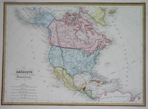


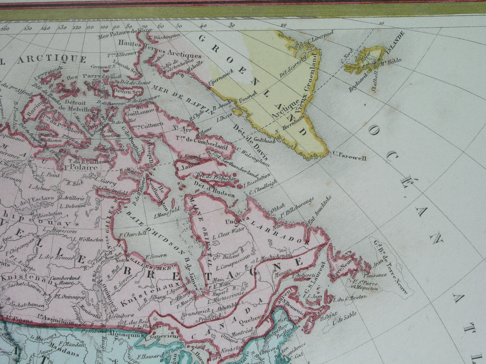


1856 NICE ORIGINAL MAP UNITED STATES CANADA TEXAS CALIFORNIA MEXICO NEW YORK
US $59.99
or Best Offer
or 4 interest-free payments of $15.00 available with
Condition:
“SOME STAINS, SOME SCATTERED SPOTTING AND FOXING ///// I INVITE YOU TO MY SHOP”
- Buy It Now1856 NICE ORIGINAL MAP UNITED STATES CANADA TEXAS CALIFORNIA MEXICO NEW YORK
Oops! Looks like we're having trouble connecting to our server.
Refresh your browser window to try again.
Shipping:
US $14.00 Economy Shipping from outside US.
International shipment of items may be subject to customs processing and additional charges.
Located in: Zary, Poland
Delivery:
Estimated between Fri, May 30 and Thu, Jun 12 to 94104
Returns:
Seller does not accept returns.
Payments:
.
4 interest-free payments of $15.00 available with Klarna.
Special financing available. See terms and apply now- for PayPal Credit, opens in a new window or tab
Earn up to 5x points when you use your eBay Mastercard®. Learn moreabout earning points with eBay Mastercard
Shop with confidence
Seller assumes all responsibility for this listing.
eBay item number:203801235207
Item specifics
- Seller Notes
- “SOME STAINS, SOME SCATTERED SPOTTING AND FOXING ///// I INVITE YOU TO MY SHOP”
- Cartographer/Publisher
- Malte Brun
- Mexican State
- Aguascalientes, Baja California, Baja California Sur, Campeche, Chiapas, Chihuahua, Coahuila, Colima, Durango, Guanajuato
- Printing Technique
- Copper Plate
- Original/Reproduction
- Antique Original
- Canadian Province
- Alberta, British Columbia, Manitoba, New Brunswick, Newfoundland & Labrador, Northwest Territories, Nova Scotia, Nunavut, Ontario, Prince Edward Island, Quebec
- Format
- Atlas Map
- Type
- Political Map
- Year
- 1856
- US State
- Alabama, California, Florida, Georgia, Illinois, Louisiana, Massachusetts, Mississippi, New Mexico, New York, Ohio, Pennsylvania, Texas, Virginia
- Date Range
- 1700-1799
- City
- New York Montreal Quebec Philadelphia Boston
- Country/Region
- Canada
Item description from the seller
Popular categories from this store
Seller feedback (1,146)
- n***y (148)- Feedback left by buyer.Past monthVerified purchaseThe engraving is exactly as described, and the seller offered it for a great value. The packing was very secure and the shipping was super fast. Highly recommend the store.
- .***. (888)- Feedback left by buyer.Past monthVerified purchaseItem Delivered Today, I was concerned about not having tracking, yet the item required a signature upon delivery! I am so proud to have received it and state this is an Excellent Seller, the item is exactly as advertised and I Could Not Be More Pleased! ⭐️⭐️⭐️⭐️⭐️
- u***i (146)- Feedback left by buyer.Past 6 monthsVerified purchaseItem as described. Packed well with fast shipping. In good condition for its age! Would buy from this seller again.
More to explore :
- United States of America New Mexico Antique North America Topographical Maps,
- United States of America New Mexico Antique North America Maps & Atlases,
- United States of America New Mexico Antique North America Atlas Maps,
- United States of America New Mexico Antique North America Sheet Maps,
- New York New Mexico Antique North America Maps & Atlases,
- United States of America New York Antique North America Topographical Maps,
- New York United States of America Antique North America Wall Maps,
- New York United States of America Antique North America County Maps,
- United States of America New York Antique North America City Maps,
- New York California Antique North America County Maps