
Admiralty Chart Map 2660A China Sea South Portion Western Sheet 1881 ( 1939 )
GBP 130.00GBP 130.00
Mon, May 19, 05:25 AMMon, May 19, 05:25 AM


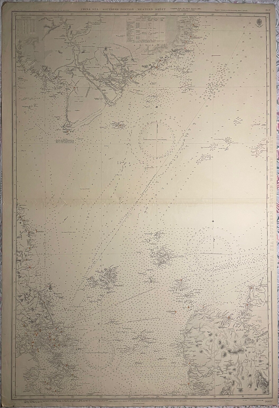


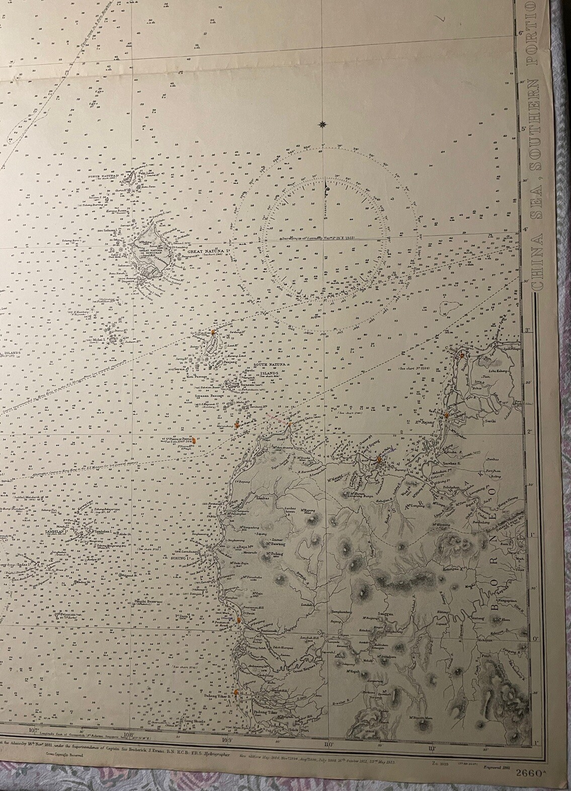
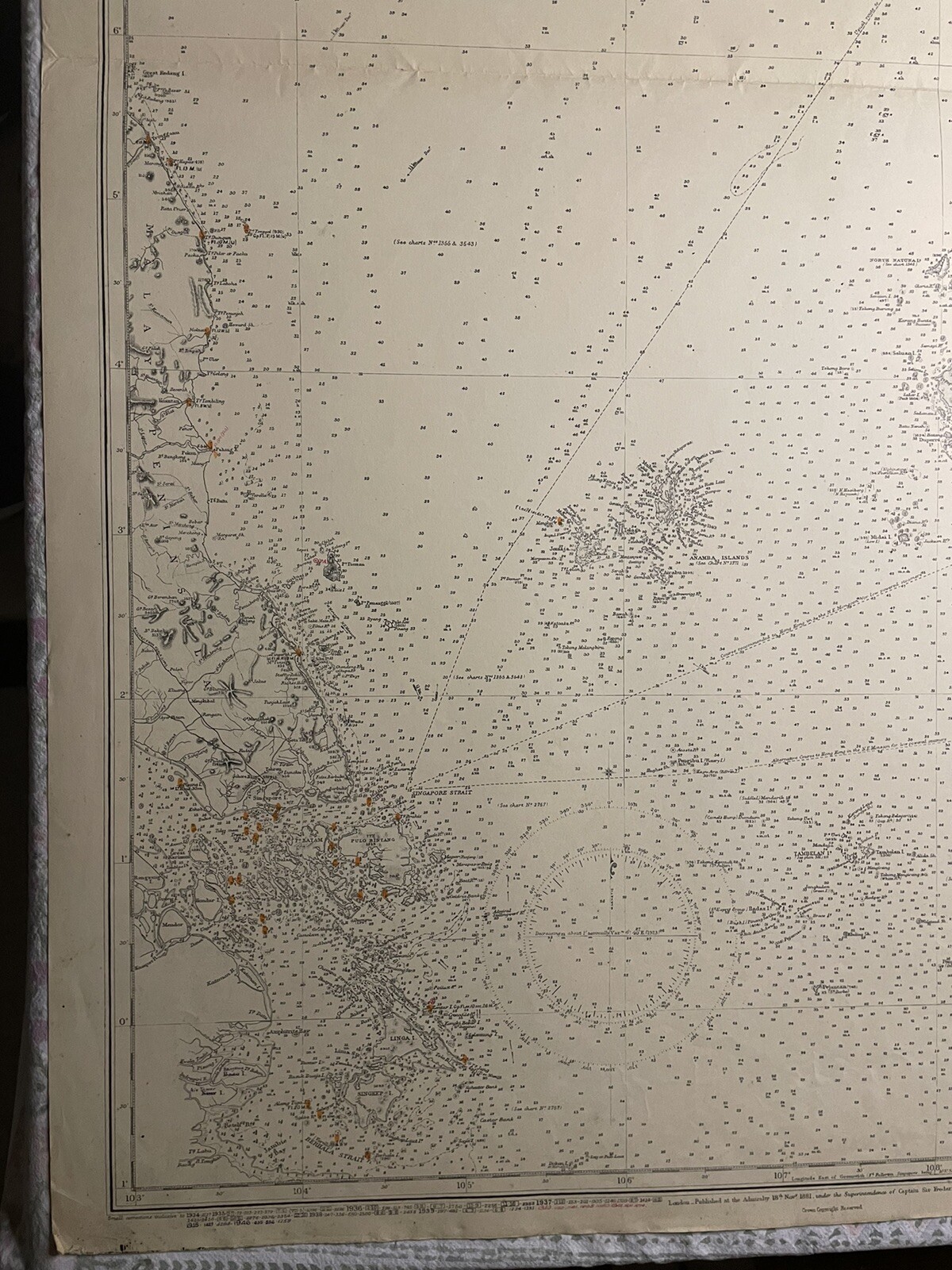


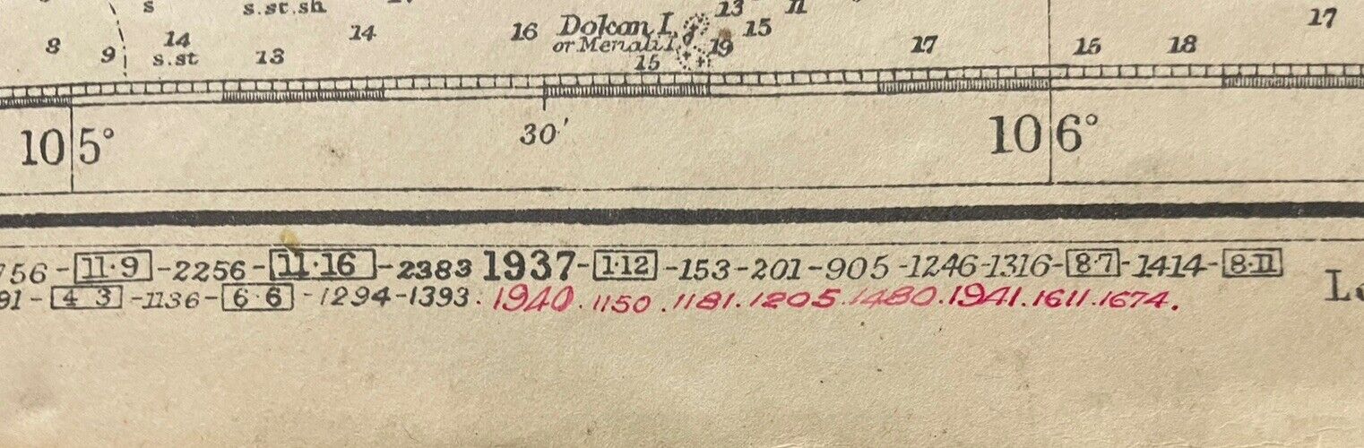


Admiralty Chart Map 2660A China Sea South Portion Western Sheet 1881 ( 1939 )
GBP 130.00
ApproximatelyUS $174.97
or Best Offer
Condition:
Oops! Looks like we're having trouble connecting to our server.
Refresh your browser window to try again.
Shipping:
GBP 17.19 (approx US $23.14) International Priority Shipping to United States via eBay's Global Shipping Program.
Located in: Frome, United Kingdom
Import charges:
Free amount confirmed at checkout
Delivery:
Estimated between Fri, Jun 13 and Mon, Jun 23 to 94104
Includes international tracking
Returns:
Seller does not accept returns.
Payments:
Earn up to 5x points when you use your eBay Mastercard®. Learn moreabout earning points with eBay Mastercard
Shop with confidence
Seller assumes all responsibility for this listing.
eBay item number:205302522503
Item specifics
- Date Range
- 1800-1899
- Type
- Nautical Map
- Format
- Sheet Map
- Year
- Engraved 1881
- Era
- 1800s
- Original/Reproduction
- Vintage Original
- Cartographer/Publisher
- Admiralty
- City
- Singapore
- Country/Region
- Brunei Darussalam, Cambodia, Indonesia, Singapore, Vietnam
Item description from the seller
Seller Feedback
No feedback yet
More to explore :
- Antique South America Sheet Maps,
- Western Hemisphere Physical Map Antique World Sheet Maps,
- Antique Asian Maps & Atlases China 1930-1939 Date Range,
- 1930-1939 Date Range Antique Sheet Maps,
- Western Hemisphere Antique World Sheet Maps,
- 1930-1939 Date Range Antique Europe Sheet Maps,
- 1930-1939 Date Range Topographical Map Antique North America Sheet Maps,
- Western Hemisphere Antique Original Antique World Sheet Maps,
- South Dakota Antique North American Maps & Atlases 1930-1939 Date Range,
- China Antique Asia Political Maps