
1844 ORIGINAL MAP CROATIA DALMATIA SPLIT ZADAR DUBROVNIK MONTENEGRO PODGORICA
US $72.49US $72.49
Thu, May 01, 02:29 PMThu, May 01, 02:29 PM


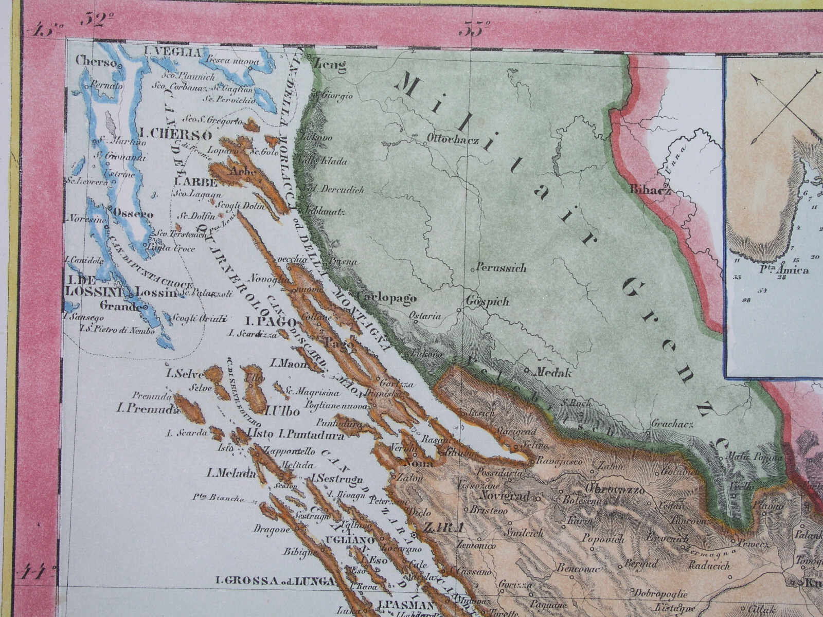


1844 ORIGINAL MAP CROATIA DALMATIA SPLIT ZADAR DUBROVNIK MONTENEGRO PODGORICA
Condition:
“SOME STAINS, SOME SCATTERED SPOTTING AND FOXING //// I INVITE YOU TO MY SHOP”
Ended: May 01, 2025 14:29:27 PDT
Oops! Looks like we're having trouble connecting to our server.
Refresh your browser window to try again.
Shipping:
US $15.00 Economy Shipping from outside US.
International shipment of items may be subject to customs processing and additional charges.
Located in: Zary, Poland
Delivery:
Estimated between Tue, Jun 17 and Mon, Jun 30 to 94104
Returns:
60 days returns. Buyer pays for return shipping. If you use an eBay shipping label, it will be deducted from your refund amount.
Payments:
Special financing available. See terms and apply now- for PayPal Credit, opens in a new window or tab
Earn up to 5x points when you use your eBay Mastercard®. Learn moreabout earning points with eBay Mastercard
Shop with confidence
Seller assumes all responsibility for this listing.
eBay item number:205438900268
Item specifics
- Seller Notes
- “SOME STAINS, SOME SCATTERED SPOTTING AND FOXING //// I INVITE YOU TO MY SHOP”
- Date Range
- 1700-1799
- Type
- Political Map
- Printing Technique
- Copper Plate
- Format
- Atlas Map
- Year
- 1873
- Cartographer/Publisher
- Sohr & Berghaus / Flemming
- Original/Reproduction
- Antique Original
- City
- Sibenik Trogir Kotor Knin Trogir Sinj Knin Budva Kotor Makarska
- Country/Region
- Bosnia & Herzegovina, Croatia, Montenegro
- County
- Balkans
Item description from the seller
Seller Feedback
No feedback yet
More to explore :
- Montenegro Antique Original Antique European Maps & Atlases,
- Croatia Antique Original Antique Europe City Maps,
- Montenegro Political Map Antique Europe Atlas Maps,
- Croatia Antique Original Antique Europe Political Maps,
- Montenegro Antique Europe Atlas Maps,
- Antique European Maps & Atlases Croatia,
- Antique European Maps & Atlases Croatia 1700-1799 Date Range,
- Croatia 1800-1899 Date Range Antique Europe Political Maps,
- Antique Original Nautical Map Antique Folding Maps,
- Antique Original River Map Antique Folding Maps