


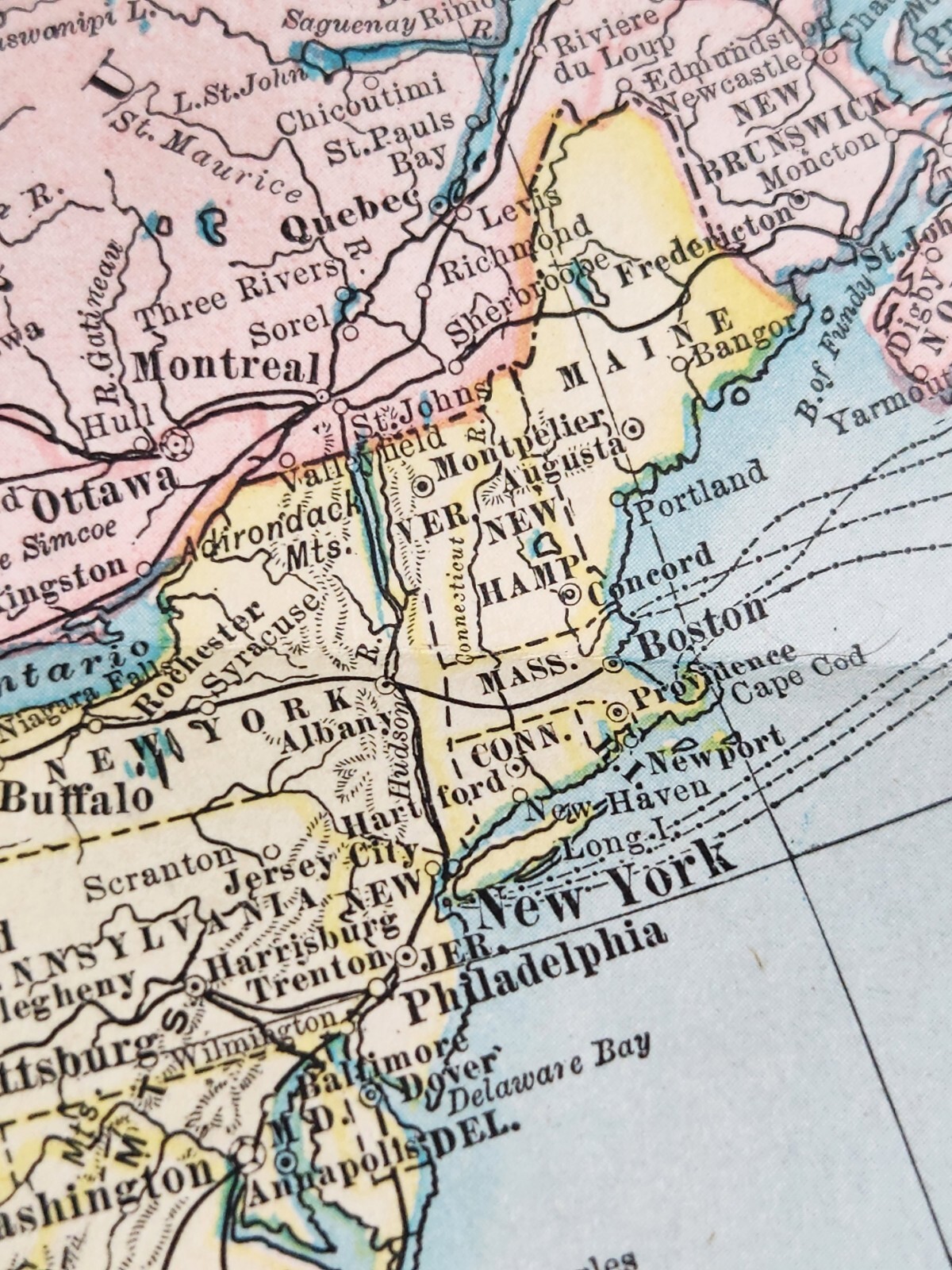


1899 Color Map NORTH AMERICA J. Martin Miller 16 x 22.5" Matthews-North

US $16.99
or Best Offer
Condition:
“Please see all pictures for condition details”
- Buy It Now1899 Color Map NORTH AMERICA J. Martin Miller 16 x 22.5" Matthews-Northrup Co.
Oops! Looks like we're having trouble connecting to our server.
Refresh your browser window to try again.
Shipping:
US $5.00 USPS Ground Advantage®.
Located in: Philadelphia, Pennsylvania, United States
Delivery:
Estimated between Mon, Jun 30 and Mon, Jul 7 to 94104
Returns:
Seller does not accept returns.
Payments:
Special financing available. See terms and apply now- for PayPal Credit, opens in a new window or tab
Earn up to 5x points when you use your eBay Mastercard®. Learn moreabout earning points with eBay Mastercard
Shop with confidence
Seller assumes all responsibility for this listing.
eBay item number:226380522515
Item specifics
- Seller Notes
- “Please see all pictures for condition details”
- Date Range
- 1800-1899
- Type
- World Atlas
- Format
- Atlas Map
- US State
- All
- Year
- 1899
- Cartographer/Publisher
- J. Martin Miller
- Original/Reproduction
- Antique Original
- City
- Washington
- Country/Region
- North America
Item description from the seller

Popular categories from this store
Seller feedback (1,368)
- n***n (202)- Feedback left by buyer.Past 6 monthsVerified purchasePackaged perfectly, as described and pictured, great value, and very kind seller. Left me a very thoughtful message as I was near the fires in Pasadena. Thank you so much!Three Pairs Matte Gold Tone Dangle Drop Pierced Earrings Vintage Unsigned (#226541000770)
- a***8 (483)- Feedback left by buyer.Past monthVerified purchaseShipping and packaging Amazing!!! And just as described very pleased, Very pleased with my purchase!!! Definitely a 5 star seller!!! Thank you Very much!!! Value amazing along with Awesome customer service!!! Aloha, Katy🌸
- s***1 (61)- Feedback left by buyer.Past monthVerified purchaseShipping was reasonable. Packaging was perfect. The item was sold as described and purchased for great value! I would recommend this seller.
More to explore :
- Nebraska 1800-1899 Antique North America Maps,
- Wyoming North America Maps & Atlases 1800-1899,
- Rand McNally & Co. 1800-1899 Date Range Antique North America Atlas Maps,
- Rand McNally & Co. 1800-1899 Date Range Antique North America Maps & Atlases,
- Washington Antique North America Maps & Atlases 1800-1899,
- Rand McNally & Co. Antique North America Railroad Maps,
- 1800-1899 Date Range County Map Antique North America Wall Maps,
- Antique North America Maps & Atlases,
- 1800-1899 Date Range Nautical Map Antique North America Folding Maps,
- 1800-1899 Date Range County Map Antique North America Sheet Maps
Popular categories from this store
Seller feedback (1,368)
- n***n (202)- Feedback left by buyer.Past 6 monthsVerified purchasePackaged perfectly, as described and pictured, great value, and very kind seller. Left me a very thoughtful message as I was near the fires in Pasadena. Thank you so much!Three Pairs Matte Gold Tone Dangle Drop Pierced Earrings Vintage Unsigned (#226541000770)
- a***8 (483)- Feedback left by buyer.Past monthVerified purchaseShipping and packaging Amazing!!! And just as described very pleased, Very pleased with my purchase!!! Definitely a 5 star seller!!! Thank you Very much!!! Value amazing along with Awesome customer service!!! Aloha, Katy🌸
- s***1 (61)- Feedback left by buyer.Past monthVerified purchaseShipping was reasonable. Packaging was perfect. The item was sold as described and purchased for great value! I would recommend this seller.