
1920 UNION - BOW CITY Township Plat Map IOWA - CRAWFORD COUNTY ORIGINAL (15x12)
US $34.88US $34.88
Wed, May 14, 06:53 PMWed, May 14, 06:53 PM
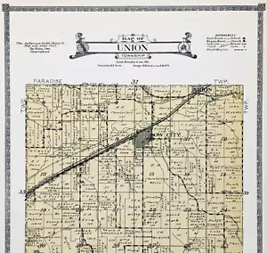


1920 UNION - BOW CITY Township Plat Map IOWA - CRAWFORD COUNTY ORIGINAL (15x12)
US $34.88
or Best Offer
Condition:
Oops! Looks like we're having trouble connecting to our server.
Refresh your browser window to try again.
Shipping:
Free USPS Ground Advantage®.
Located in: Carefree, Arizona, United States
Delivery:
Estimated between Thu, May 29 and Tue, Jun 3 to 94104
Returns:
30 days returns. Seller pays for return shipping.
Payments:
Special financing available. See terms and apply now- for PayPal Credit, opens in a new window or tab
Earn up to 5x points when you use your eBay Mastercard®. Learn moreabout earning points with eBay Mastercard
Shop with confidence
Seller assumes all responsibility for this listing.
eBay item number:226685182205
Item specifics
- Date Range
- 1920-1929
- Type
- Map
- US State
- AR, IA, KS, LA, MO, NE, Iowa
- Format
- Atlas Map
- Printing Technique
- Lithography
- Year
- 1920
- Original/Reproduction
- Antique Original
- Cartographer/Publisher
- G.W. Anderson, Des Moines Iowa
- City
- IOWA CITY UNION
- Country/Region
- United States of America
Item description from the seller
Seller Feedback
No feedback yet
More to explore :
- Iowa Antique Original Antique North America County Maps,
- Iowa 1920-1929 Date Range Antique North America County Maps,
- Iowa Antique North America County Maps,
- Iowa County Map Antique North America Folding Maps,
- Iowa County Map Antique North America Atlas Maps,
- Antique Original 1920-1929 Date Range Antique County Maps,
- Antique Original County Map Antique Wall Maps,
- Vintage Original County Map Antique Atlas Maps,
- Iowa Antique North America City Maps,
- Antique Original Antique Africa County Maps