
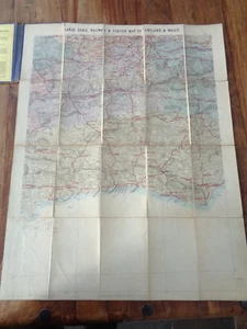
1876 LARGE SCALE RAILWAY & STATION MAP OF ENGLAND & WALES SHEET 22 by STANFORD ^
GBP 59.99GBP 59.99
Sun, Apr 27, 10:17 AMSun, Apr 27, 10:17 AM


1876 LARGE SCALE RAILWAY & STATION MAP OF ENGLAND & WALES SHEET 22 by STANFORD ^
Condition:
Ended: Apr 27, 2025 10:17:01 PDT
Oops! Looks like we're having trouble connecting to our server.
Refresh your browser window to try again.
Shipping:
GBP 25.00 (approx US $34.03) Express Int'l Postage.
International shipment of items may be subject to customs processing and additional charges.
Located in: Whitegate, Cheshire, United Kingdom
Delivery:
Estimated between Fri, Jun 20 and Mon, Jun 30 to 91768
Returns:
30 days returns. Buyer pays for return shipping. If you use an eBay shipping label, it will be deducted from your refund amount.
Payments:
Earn up to 5x points when you use your eBay Mastercard®. Learn moreabout earning points with eBay Mastercard
Shop with confidence
Seller assumes all responsibility for this listing.
eBay item number:226695743981
Item specifics
- Antique
- Yes
- Date Range
- 1800-1899
- Type
- Railroad Map
- Format
- Sheet Map
- Printing Technique
- Lithography
- Year
- 1876
- Era
- 1800s
- Cartographer/Publisher
- Stanford
- Original/Reproduction
- Antique Original
- City
- London
- Country/Region
- England
- County
- Sussex
Item description from the seller
Seller business information
VAT number: GB 216 0509 42
Seller Feedback
No feedback yet
More to explore :
- Wales Antique Europe Sheet Maps,
- Wales Antique Original Antique Europe Sheet Maps,
- England Antique Europe Sheet Maps,
- Wales 1800-1899 Date Range Antique Europe Sheet Maps,
- Wales Antique Europe Maps & Atlases,
- Antique European Maps & Atlases Wales London,
- England Antique Europe Maps & Atlases,
- England County Map Antique Europe Atlas Maps,
- Wales Copper Plate Antique Europe Atlas Maps,
- England City Map Antique Europe Atlas Maps