
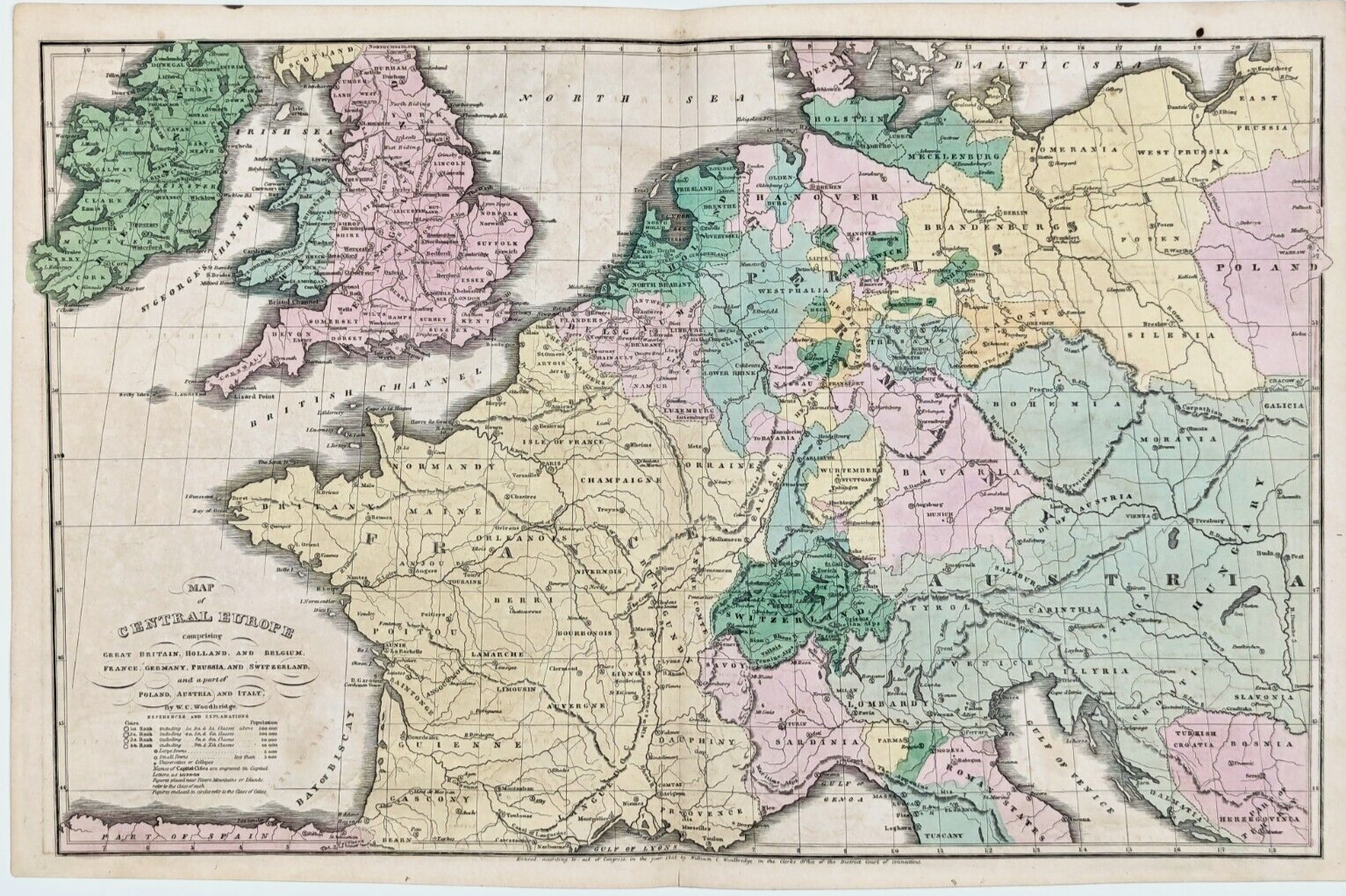
1832 CENTRAL EUROPE Map STUNNING ORIGINAL France (17x11) Austrian Empire Prussia
US $34.00US $34.00
Wed, May 14, 06:53 PMWed, May 14, 06:53 PM


1832 CENTRAL EUROPE Map STUNNING ORIGINAL France (17x11) Austrian Empire Prussia
US $34.00
or Best Offer
Condition:
“GOOD CONDITION, MINOR DISCOLORATION, CENTER CREASE AS ISSUED”
Oops! Looks like we're having trouble connecting to our server.
Refresh your browser window to try again.
Shipping:
Free USPS Ground Advantage®.
Located in: Monroe, Georgia, United States
Delivery:
Estimated between Wed, Jun 25 and Mon, Jun 30 to 94104
Returns:
30 days returns. Seller pays for return shipping.
Payments:
Special financing available. See terms and apply now- for PayPal Credit, opens in a new window or tab
Earn up to 5x points when you use your eBay Mastercard®. Learn moreabout earning points with eBay Mastercard
Shop with confidence
Seller assumes all responsibility for this listing.
eBay item number:226701020098
Item specifics
- Seller Notes
- “GOOD CONDITION, MINOR DISCOLORATION, CENTER CREASE AS ISSUED”
- Date Range
- 1800-1899
- Type
- Political Map
- Format
- Atlas Map
- Printing Technique
- Copper Plate
- Year
- 1832
- State
- Baden-Würtemberg
- Original/Reproduction
- Antique Original
- Cartographer/Publisher
- William Woodbridge
- City
- London
- Country/Region
- Austria, Belgium, Bosnia & Herzegovina, Denmark, England, France, Germany, Holland, Hungary, Ireland, Italy, Poland, Prussia, Switzerland, United Kingdom, Wales
Item description from the seller
Seller Feedback
No feedback yet
More to explore :
- Prussia Antique Europe Atlas Maps,
- Prussia Antique Europe Political Maps,
- France Antique Original Antique Europe County Maps,
- France Antique Original Antique Europe River Maps,
- Berlin Prussia Antique Europe Maps & Atlases,
- France Antique Original Antique Europe Railroad Maps,
- France Antique Europe Physical Maps,
- Prussia Copper Plate Antique Europe Maps & Atlases,
- France Antique Europe Railroad Maps,
- France Topographical Map Antique Europe Atlas Maps