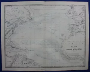

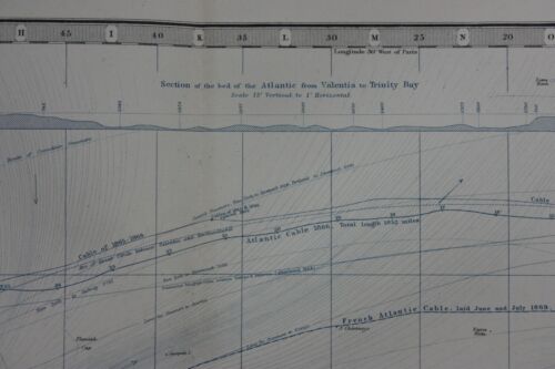
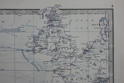

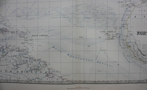


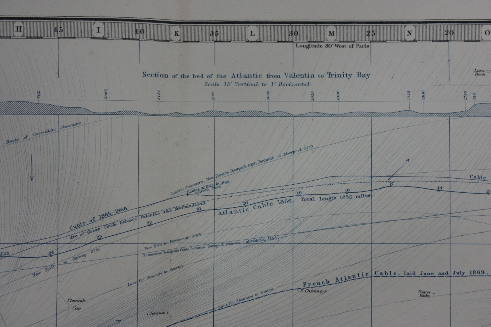
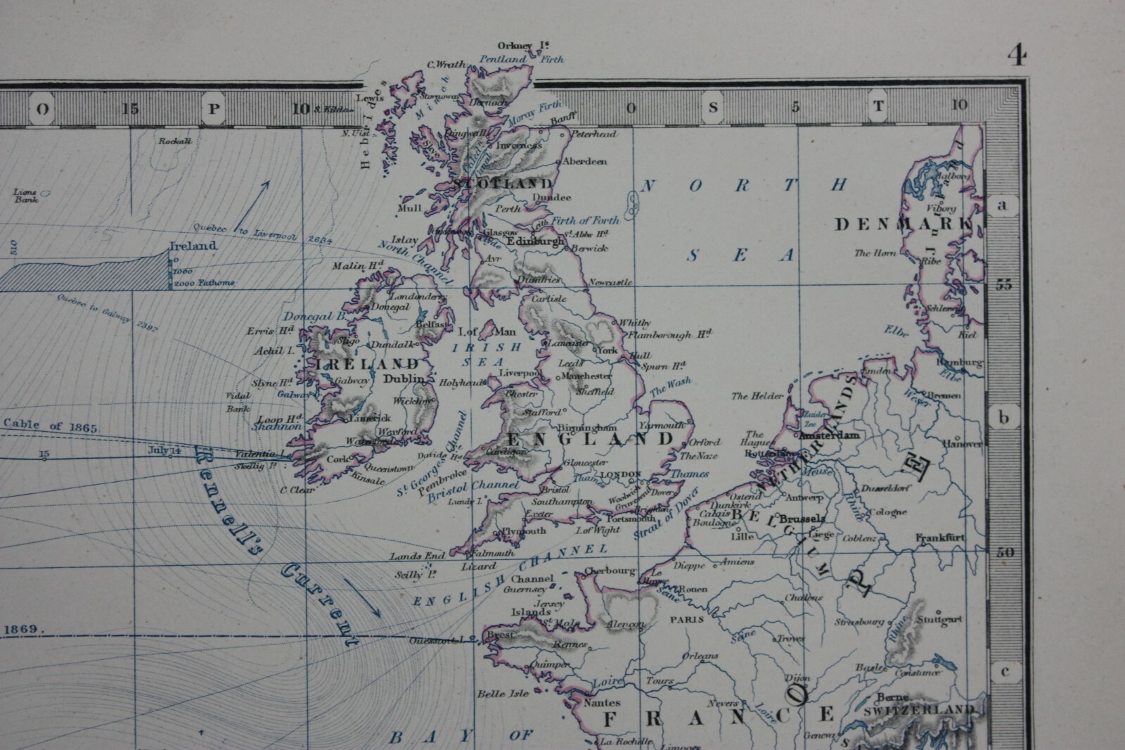

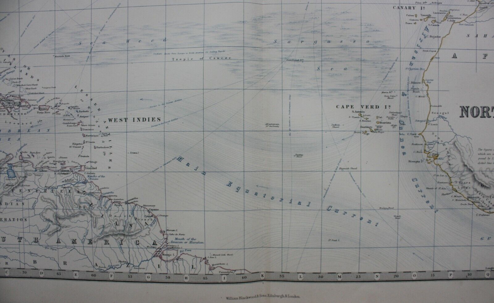

BASIN OF THE NORTH ATLANTIC OCEAN, large original antique map, Johnston, 1871
GBP 49.50
ApproximatelyUS $65.73
Condition:
“Very good condition. Centrefold, as published. Original colour. Please study all the photographs ”... Read moreabout condition
- Buy It NowBASIN OF THE NORTH ATLANTIC OCEAN, large original antique map, Johnston, 1871
Oops! Looks like we're having trouble connecting to our server.
Refresh your browser window to try again.
Shipping:
GBP 9.50 (approx US $12.61) Royal Mail International Tracked.
International shipment of items may be subject to customs processing and additional charges.
Located in: Ilkley, United Kingdom
Delivery:
Estimated between Wed, May 7 and Thu, May 15 to 43230
Please allow additional time if international delivery is subject to customs processing.
Returns:
30 days returns. Buyer pays for return shipping. If you use an eBay shipping label, it will be deducted from your refund amount.
Payments:
Earn up to 5x points when you use your eBay Mastercard®. Learn moreabout earning points with eBay Mastercard
Shop with confidence
Seller assumes all responsibility for this listing.
eBay item number:235993499111
Item specifics
- Seller Notes
- Antique
- Yes
- Map View
- World
- Cartographer/Publisher
- A.K. Johnston
- Printing Technique
- Lithography
- Date Range
- 1800-1899
- Original/Reproduction
- Antique Original
- Era
- 1800s
- Format
- Atlas Map
- Type
- Ocean Current Map
- Year
- 1871
Item description from the seller

Seller feedback (2,484)
- e***a (67)- Feedback left by buyer.Past monthVerified purchaseI am giving this purchase a 5-star rating, even though the map arrived more than a month late & the shipping tube had been severely mangled (no damage to the contents). Neither problem was the Seller's fault. The shipment was held by US Customs for a month (visible on the tracking documents) without explanation or contact. Seller remained in regular contact, offered to, and then refunded full purchase price during this hiatus. Upon successful delivery, Seller re-invoiced for the map, & I paid.
- r***o (2725)- Feedback left by buyer.Past 6 monthsVerified purchaseGreat Seller - This map arrived exactly as described it will be a great addition for my Ancestry research. The map arrived very well packaged and rolled carefully and placed into a postal tube. The delivery was well within the estimated time. I would have no hesitation in recommending this seller to any potential buyers - THANK YOU.PLYMOUTH, DEVONPORT, CITY PLAN, STREET PLAN, original antique map, Bacon, 1884 (#235500514934)
- w***r (126)- Feedback left by buyer.Past 6 monthsVerified purchaseNice, original 18th century print in good condition, as described by seller. Delivered safely, very well packaged. Excellent value.
More to explore :
- Antique Original Antique Ocean Current Maps,
- Antique Original Antique World Ocean Current Maps,
- Keith Johnston Antique Original Antique Maps, Atlases & Globes,
- Lithography Antique Original Antique World Ocean Current Maps,
- Alexander K. Johnston Antique Original Antique Political Maps,
- Antique Ocean Current Maps,
- Antique Original Antique North America Maps & Atlases,
- Antique Original Novelty Map Antique North America Atlas Maps,
- Antique Original Physical Map Antique North America Atlas Maps,
- Ocean Current Map Antique Atlas Maps
Seller feedback (2,484)
- e***a (67)- Feedback left by buyer.Past monthVerified purchaseI am giving this purchase a 5-star rating, even though the map arrived more than a month late & the shipping tube had been severely mangled (no damage to the contents). Neither problem was the Seller's fault. The shipment was held by US Customs for a month (visible on the tracking documents) without explanation or contact. Seller remained in regular contact, offered to, and then refunded full purchase price during this hiatus. Upon successful delivery, Seller re-invoiced for the map, & I paid.
- r***o (2725)- Feedback left by buyer.Past 6 monthsVerified purchaseGreat Seller - This map arrived exactly as described it will be a great addition for my Ancestry research. The map arrived very well packaged and rolled carefully and placed into a postal tube. The delivery was well within the estimated time. I would have no hesitation in recommending this seller to any potential buyers - THANK YOU.PLYMOUTH, DEVONPORT, CITY PLAN, STREET PLAN, original antique map, Bacon, 1884 (#235500514934)
- w***r (126)- Feedback left by buyer.Past 6 monthsVerified purchaseNice, original 18th century print in good condition, as described by seller. Delivered safely, very well packaged. Excellent value.