
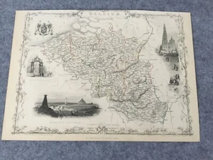
JOHN TALLIS 1851 BELGIUM ANTIQUE MAP STEEL ENGRAVED
US $19.99US $19.99
Wed, May 07, 05:34 PMWed, May 07, 05:34 PM
Picture 1 of 3


Gallery
Picture 1 of 3


Have one to sell?
JOHN TALLIS 1851 BELGIUM ANTIQUE MAP STEEL ENGRAVED

Condition:
“Fair condition. Trimmed on top. Sold as is.”
Ended: May 07, 2025 17:34:58 PDT
Oops! Looks like we're having trouble connecting to our server.
Refresh your browser window to try again.
Shipping:
US $25.00 Standard Shipping from outside US.
International shipment of items may be subject to customs processing and additional charges.
Located in: Sylvania, NSW, Australia
Delivery:
Estimated between Fri, Jul 25 and Tue, Aug 5 to 94104
Returns:
Seller does not accept returns.
Payments:
Special financing available. See terms and apply now- for PayPal Credit, opens in a new window or tab
Earn up to 5x points when you use your eBay Mastercard®. Learn moreabout earning points with eBay Mastercard
Shop with confidence
Seller assumes all responsibility for this listing.
eBay item number:236075170055
Item specifics
- Seller Notes
- “Fair condition. Trimmed on top. Sold as is.”
- Date Range
- 1851
- Type
- Map
- Printing Technique
- Steel Engraving
- Year
- 1851
- Cartographer/Publisher
- John Tallis
- Original/Reproduction
- Original
- Country/Region
- Belgium
- Maker
- John Tallis
Item description from the seller
Seller Feedback
No feedback yet
More to explore :
- Belgium Antique Europe Sheet Maps,
- Belgium Antique Europe County Maps,
- Belgium Antique Europe Topographical Maps,
- Belgium Antique Europe Political Maps,
- Belgium Antique Europe Folding Maps,
- Belgium Antique Original Antique Europe County Maps,
- Belgium Antique Original Antique Europe Folding Maps,
- Antique European Maps & Atlases Ghent Belgium,
- Brussels Belgium Antique Original Antique European Maps & Atlases,
- Belgium Liège Antique Original Antique European Maps & Atlases
Seller Feedback
No feedback yet