
1736 Plan of Ypres, Belgium Original Antique Map by Claude Du Bosc
GBP 40.00GBP 40.00
Sun, Jun 08, 01:16 AMSun, Jun 08, 01:16 AM


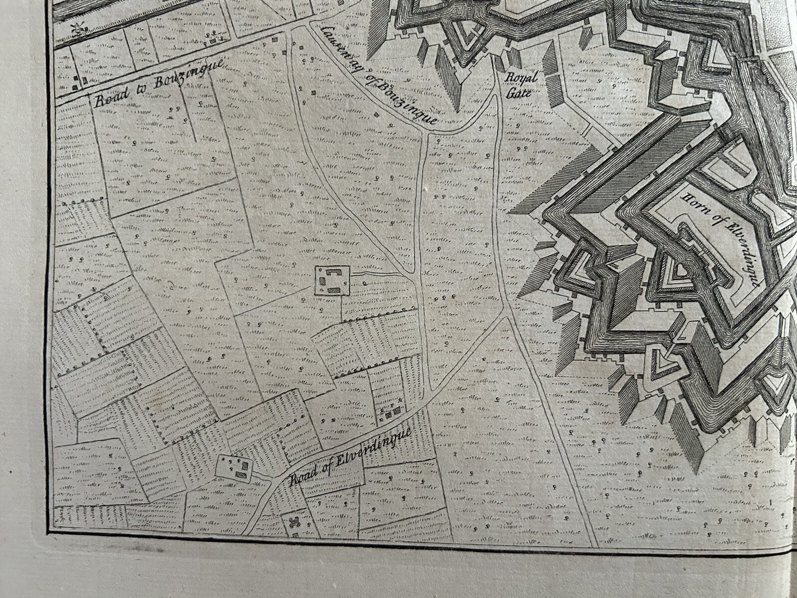

1736 Plan of Ypres, Belgium Original Antique Map by Claude Du Bosc
GBP 40.00
ApproximatelyUS $54.66
or Best Offer
Condition:
“The map has a few blemishes as you would expect for a map of this age.”
Oops! Looks like we're having trouble connecting to our server.
Refresh your browser window to try again.
Shipping:
GBP 12.00 (approx US $16.40) Parcelforce Global Express.
International shipment of items may be subject to customs processing and additional charges.
Located in: Manchester, United Kingdom
Delivery:
Estimated between Mon, Jul 7 and Thu, Jul 10 to 94104
Returns:
60 days returns. Seller pays for return shipping.
Payments:
Earn up to 5x points when you use your eBay Mastercard®. Learn moreabout earning points with eBay Mastercard
Shop with confidence
Seller assumes all responsibility for this listing.
eBay item number:255969456194
Item specifics
- Seller Notes
- “The map has a few blemishes as you would expect for a map of this age.”
- Date Range
- 1700-1799
- Antique
- Yes
- Type
- Political Map
- Format
- Atlas Map
- Printing Technique
- Copper Plate
- Year
- 1736
- Era
- 1700s
- Cartographer/Publisher
- Claude Du Bosc
- Original/Reproduction
- Antique Original
- City
- Ypres
- Country/Region
- Belgium
Item description from the seller
Seller Feedback
No feedback yet
More to explore :
- Belgium Antique Original Antique European Maps & Atlases,
- Belgium Antique Original Antique Europe County Maps,
- Belgium Antique Original Antique Europe Folding Maps,
- Belgium Antique Original Antique Europe Sheet Maps,
- Belgium Antique Original Antique Europe Atlas Maps,
- Belgium Ghent Antique Original Antique European Maps & Atlases,
- Brussels Belgium Antique Original Antique European Maps & Atlases,
- Belgium Antique Europe Topographical Maps,
- Belgium County Map Antique Europe Atlas Maps,
- Brussels Belgium Antique Europe City Maps