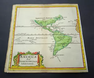


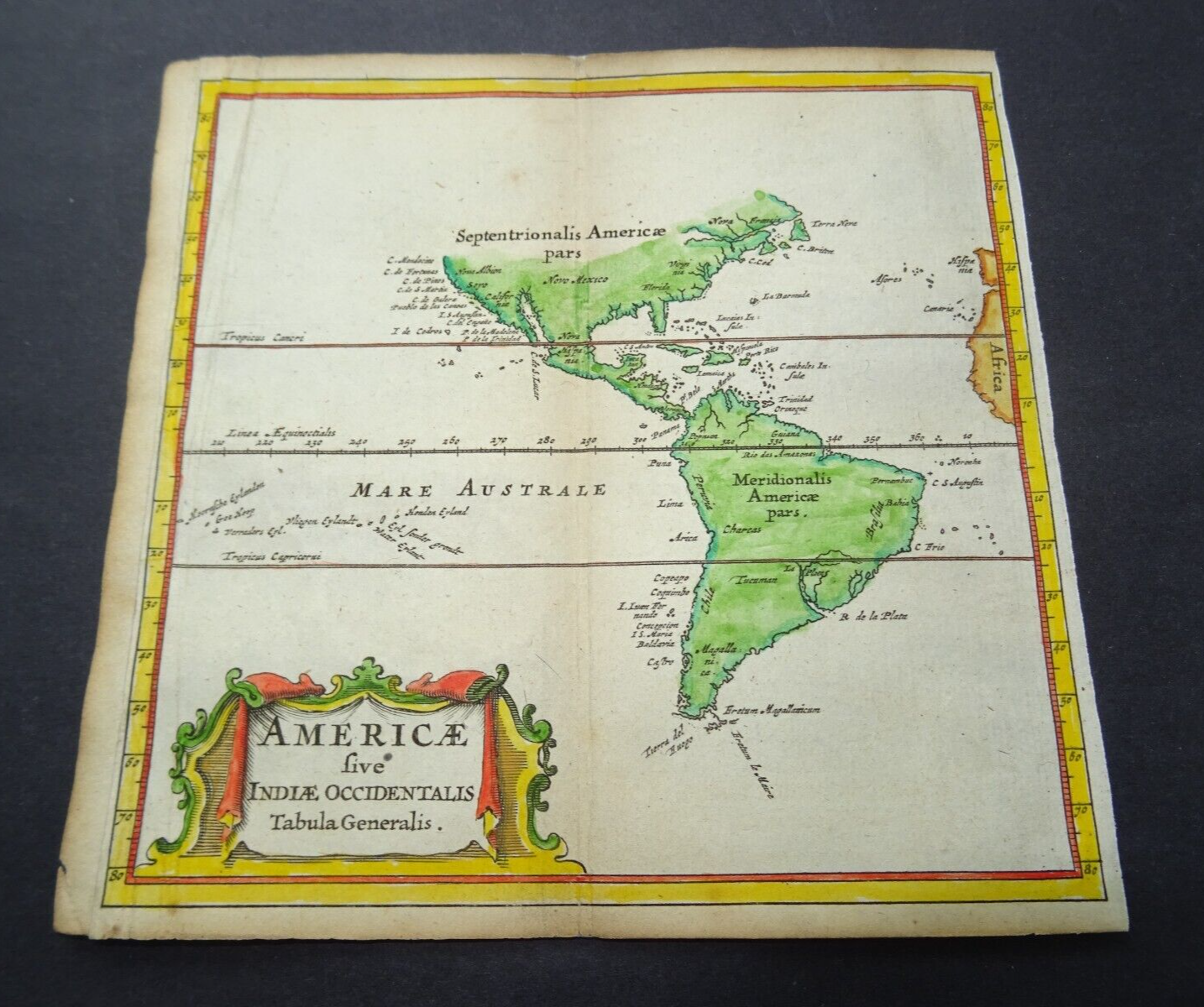


Antique Map of America by Petrus Bertius 1672

GBP 130.00
ApproximatelyUS $175.81
Condition:
- Buy It NowAntique Map of America by Petrus Bertius 1672
Oops! Looks like we're having trouble connecting to our server.
Refresh your browser window to try again.
Shipping:
GBP 10.00 (approx US $13.52) Royal Mail International Signed.
International shipment of items may be subject to customs processing and additional charges.
Located in: Bath, United Kingdom
Delivery:
Estimated between Mon, Jun 30 and Thu, Jul 10 to 94104
Returns:
Seller does not accept returns.
Payments:
Earn up to 5x points when you use your eBay Mastercard®. Learn moreabout earning points with eBay Mastercard
Shop with confidence
Seller assumes all responsibility for this listing.
eBay item number:256069088493
Item specifics
- Date Range
- 1600-1699
- Type
- Topographical Map
- Printing Technique
- Copper Plate
- Year
- 1672
- Era
- 1600s
- Cartographer/Publisher
- Petrus Bertius
- Original/Reproduction
- Antique Original
- Region
- America, USA
Item description from the seller

Seller feedback (467)
- *****- Feedback left by buyer.Past 6 monthsVerified purchaseGreat thank you. Fast shipping, well packaged, item arrived in expected condition as described. x
- 0***1 (1550)- Feedback left by buyer.Past monthVerified purchaseReceived OK, great map, well packaged, easy transaction, A1.
- t***a (253)- Feedback left by buyer.Past yearVerified purchaseArrived promptly and well packed. Item as described.Antique map of Kent by Richard Blome 1715 (#256392245593)
More to explore :
- Antique North America Maps & Atlases,
- Antique North America Michigan Maps,
- Antique North America Political Maps,
- Antique North America Topographical Maps,
- Antique North America Railroad Maps,
- Antique North America Atlas Maps,
- Antique South America Folding Maps,
- Antique Original Political Map Antique North America Wall Maps,
- Topographical Map Antique South America Atlas Maps,
- Topographical Map Antique North America Sheet Maps
Seller feedback (467)
- *****- Feedback left by buyer.Past 6 monthsVerified purchaseGreat thank you. Fast shipping, well packaged, item arrived in expected condition as described. x
- 0***1 (1550)- Feedback left by buyer.Past monthVerified purchaseReceived OK, great map, well packaged, easy transaction, A1.
- t***a (253)- Feedback left by buyer.Past yearVerified purchaseArrived promptly and well packed. Item as described.Antique map of Kent by Richard Blome 1715 (#256392245593)