
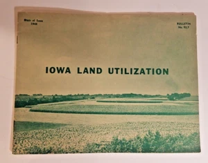
1949 Graphic Map Summary of Iowa Land Utilization Acres Crops Per County
US $17.49US $17.49
Tue, Jul 15, 05:27 AMTue, Jul 15, 05:27 AM
Picture 1 of 11


Gallery
Picture 1 of 11


Have one to sell?
1949 Graphic Map Summary of Iowa Land Utilization Acres Crops Per County
US $17.49
or Best Offer
Was US $24.99 (30% off)
Condition:
“Good Condition for age, see the photos.”
Ended: Jul 15, 2025 05:27:25 PDT
Oops! Looks like we're having trouble connecting to our server.
Refresh your browser window to try again.
Shipping:
US $14.40 USPS Ground Advantage®.
Located in: Marion, Iowa, United States
Delivery:
Estimated between Mon, Aug 4 and Sat, Aug 9 to 94104
Returns:
Seller does not accept returns.
Payments:
Special financing available. See terms and apply now- for PayPal Credit, opens in a new window or tab
Earn up to 5x points when you use your eBay Mastercard®. Learn moreabout earning points with eBay Mastercard
Shop with confidence
Seller assumes all responsibility for this listing.
eBay item number:256827299093
Item specifics
- Seller Notes
- “Good Condition for age, see the photos.”
Item description from the seller
Seller Feedback
No feedback yet
More to explore :
- Iowa Antique North America County Maps,
- Iowa County Map Antique North America Folding Maps,
- Iowa County Map Antique North America Atlas Maps,
- Iowa County Map Antique North America Atlas,
- Washington Iowa Antique North America County Maps,
- Vintage Reproduction Iowa Antique North America County Maps,
- 1940-1949 Date Range Antique County Maps,
- Antique County Maps,
- Iowa 1800-1899 Date Range Antique North America County Maps,
- County Map Antique School Maps