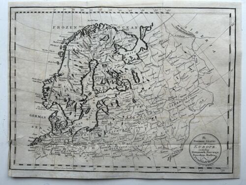
1800 Northern Europe Scandinavia Baltic States Original Antique Map
GBP 19.99GBP 19.99
Sat, May 10, 11:49 PMSat, May 10, 11:49 PM


1800 Northern Europe Scandinavia Baltic States Original Antique Map
GBP 19.99
ApproximatelyUS $26.92
or Best Offer
Condition:
Oops! Looks like we're having trouble connecting to our server.
Refresh your browser window to try again.
Shipping:
GBP 5.00 (approx US $6.73) Royal Mail International Standard.
International shipment of items may be subject to customs processing and additional charges.
Located in: Manchester, United Kingdom
Delivery:
Estimated between Wed, Jun 4 and Tue, Jun 17 to 94104
Returns:
60 days returns. Seller pays for return shipping.
Payments:
Earn up to 5x points when you use your eBay Mastercard®. Learn moreabout earning points with eBay Mastercard
Shop with confidence
Seller assumes all responsibility for this listing.
eBay item number:256890529591
Item specifics
- Date Range
- 1800-1899
- Antique
- Yes
- Type
- Political Map
- Format
- Atlas Map
- Year
- 1800
- Era
- 1800s
- Original/Reproduction
- Antique Original
- Cartographer/Publisher
- Cornelius Paas
- Country/Region
- Denmark, Estonia, Finland, Germany, Holland, Latvia, Lithuania, Poland, Prussia, Russia, Sweden
Item description from the seller
Seller Feedback
No feedback yet
More to explore :
- Antique Original 1800-1899 Date Range Antique Europe Sheet Maps,
- Antique Original 1800-1899 Date Range Antique Europe Folding Maps,
- Antique Original Antique Europe Wall Maps,
- Antique Original Antique Europe School Maps,
- Antique Original Antique Europe Geological Maps,
- Antique Original County Map Antique Europe Atlas Maps,
- Croatia Antique Original Antique Europe City Maps,
- Greece Antique Original Antique Europe Topographical Maps,
- Portugal Antique Original Antique Europe County Maps,
- Athens Antique Original Antique Europe Atlas Maps