
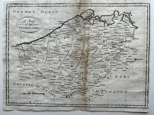
1800 Belgium Original Antique Map by Cornelius Paas 224 Years Old
GBP 19.99GBP 19.99
Sat, May 10, 11:49 PMSat, May 10, 11:49 PM
Picture 1 of 3


Gallery
Picture 1 of 3


Have one to sell?
1800 Belgium Original Antique Map by Cornelius Paas 224 Years Old
GBP 19.99
ApproximatelyUS $26.97
or Best Offer
Condition:
Oops! Looks like we're having trouble connecting to our server.
Refresh your browser window to try again.
Shipping:
GBP 5.00 (approx US $6.75) Royal Mail International Standard.
International shipment of items may be subject to customs processing and additional charges.
Located in: Manchester, United Kingdom
Delivery:
Estimated between Fri, Jul 25 and Thu, Aug 7 to 91768
Returns:
60 days returns. Seller pays for return shipping.
Payments:
Earn up to 5x points when you use your eBay Mastercard®. Learn moreabout earning points with eBay Mastercard
Shop with confidence
Seller assumes all responsibility for this listing.
eBay item number:256890529627
Item specifics
- Date Range
- 1800-1899
- Antique
- Yes
- Type
- Political Map
- Format
- Atlas Map
- Year
- 1800
- Era
- 1800s
- Original/Reproduction
- Antique Original
- Cartographer/Publisher
- Cornelius Paas
- Country/Region
- Belgium
Item description from the seller
Seller Feedback
No feedback yet
More to explore :
- Belgium Antique Original Antique European Maps & Atlases,
- Belgium Antique Original Antique Europe County Maps,
- Belgium Antique Original Antique Europe Folding Maps,
- Belgium Antique Original Antique Europe Sheet Maps,
- Belgium Antique Original Antique Europe Atlas Maps,
- Belgium Ghent Antique Original Antique European Maps & Atlases,
- Brussels Belgium Antique Original Antique European Maps & Atlases,
- Belgium Antique Europe City Maps,
- Brussels Belgium 1800-1899 Date Range Antique Europe Maps & Atlases,
- Belgium Antwerp Antique Europe City Maps