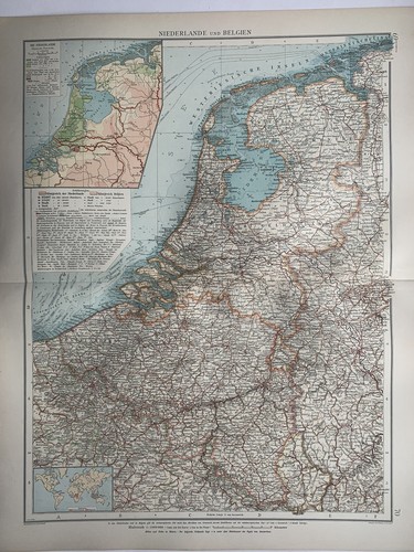
1899 Netherlands & Belgium Original Antique Map by Richard Andree
GBP 19.99GBP 19.99
Mon, May 12, 05:24 AMMon, May 12, 05:24 AM


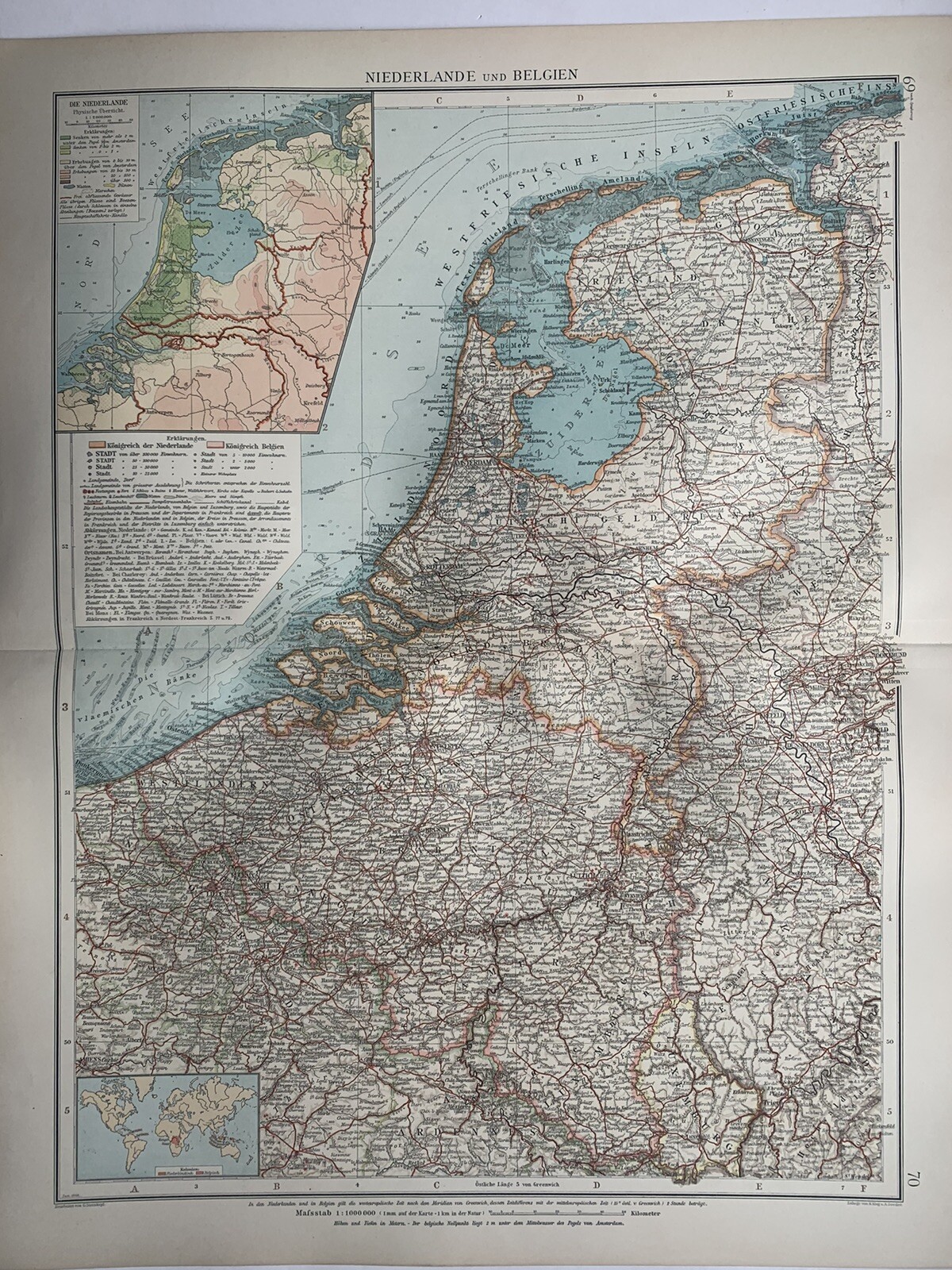


1899 Netherlands & Belgium Original Antique Map by Richard Andree
GBP 19.99
ApproximatelyUS $26.90
or Best Offer
Condition:
“The map is in good condition.”
Oops! Looks like we're having trouble connecting to our server.
Refresh your browser window to try again.
Shipping:
GBP 12.00 (approx US $16.15) Parcelforce Global Express.
International shipment of items may be subject to customs processing and additional charges.
Located in: Manchester, United Kingdom
Delivery:
Estimated between Mon, Jun 9 and Thu, Jun 12 to 94104
Returns:
60 days returns. Seller pays for return shipping.
Payments:
Earn up to 5x points when you use your eBay Mastercard®. Learn moreabout earning points with eBay Mastercard
Shop with confidence
Seller assumes all responsibility for this listing.
eBay item number:256891712209
Item specifics
- Seller Notes
- “The map is in good condition.”
- Date Range
- 1800-1899
- Antique
- Yes
- Type
- Political Map
- Format
- Atlas Map
- Printing Technique
- Lithography
- Year
- 1899
- Era
- 1800s
- Cartographer/Publisher
- Richard Andree
- Original/Reproduction
- Antique Original
- Country/Region
- Holland, Netherlands, Luxembourg, Belgium
Item description from the seller
Seller Feedback
No feedback yet
More to explore :
- Belgium Antique Original Antique European Maps & Atlases,
- Belgium Antique Original Antique Europe County Maps,
- Belgium Antique Original Antique Europe Folding Maps,
- Netherlands Antique Original Antique European Maps & Atlases,
- Belgium Antique Original Antique Europe Sheet Maps,
- Brussels Belgium Antique Original Antique European Maps & Atlases,
- Amsterdam Netherlands Antique Original Antique European Maps & Atlases,
- Antique European Maps & Atlases Netherlands,
- Netherlands Antique Europe Atlas Maps,
- Belgium Antique Europe Political Maps