
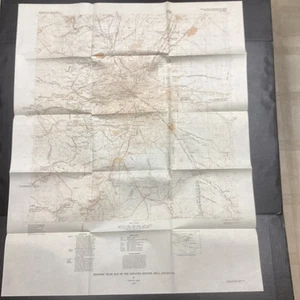
USGS Historic Trail Map Of The Greater Denver Area, Map 1-856-G, 1977
US $10.00US $10.00
Mon, May 05, 06:50 PMMon, May 05, 06:50 PM
Picture 1 of 6


Gallery
Picture 1 of 6


Have one to sell?
USGS Historic Trail Map Of The Greater Denver Area, Map 1-856-G, 1977
Condition:
Ended: May 05, 2025 18:50:01 PDT
Oops! Looks like we're having trouble connecting to our server.
Refresh your browser window to try again.
Shipping:
US $4.74 USPS Ground Advantage®.
Located in: Fort Collins, Colorado, United States
Delivery:
Estimated between Thu, Jul 17 and Mon, Jul 21 to 94104
Returns:
14 days returns. Buyer pays for return shipping. If you use an eBay shipping label, it will be deducted from your refund amount.
Payments:
Special financing available. See terms and apply now- for PayPal Credit, opens in a new window or tab
Earn up to 5x points when you use your eBay Mastercard®. Learn moreabout earning points with eBay Mastercard
Shop with confidence
Seller assumes all responsibility for this listing.
eBay item number:267234724446
Item specifics
- Type
- Railroad Map
- US State
- Colorado
- Format
- Folding Map
- Year
- 1977
- City
- Denver
Item description from the seller
Seller Feedback
No feedback yet
More to explore :
- County Map Antique Sheet Maps,
- Topographical Map Antique Wall Maps,
- Physical Map Antique Sheet Maps,
- Geological Map Antique Wall Maps,
- Railroad Map Antique Atlas Maps,
- Topographical Map Antique Atlas Maps,
- County Map Antique Atlas Maps,
- Railroad Map Antique Wall Maps,
- Nautical Map Antique Folding Maps,
- River Map Antique Atlas Maps