


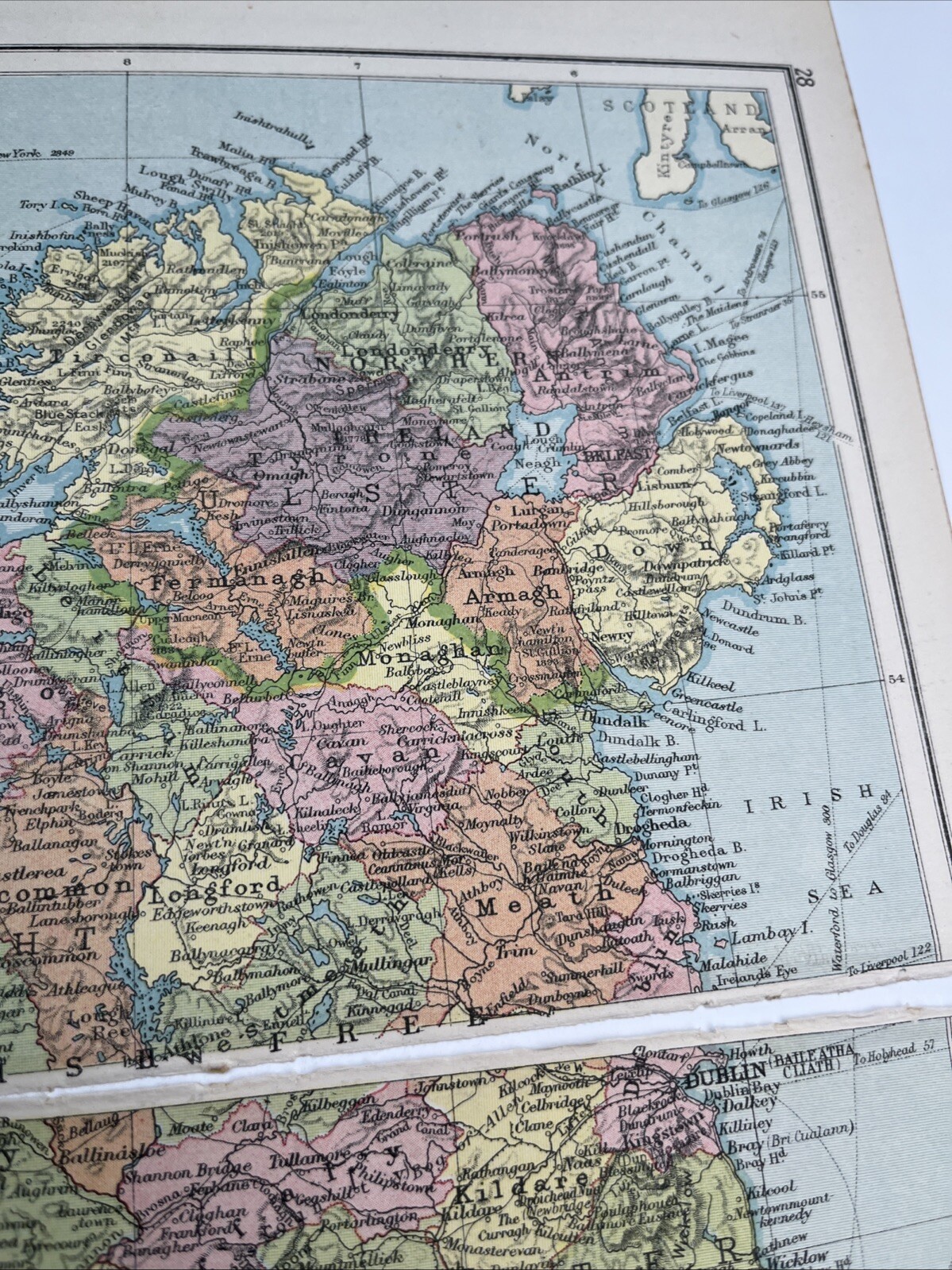

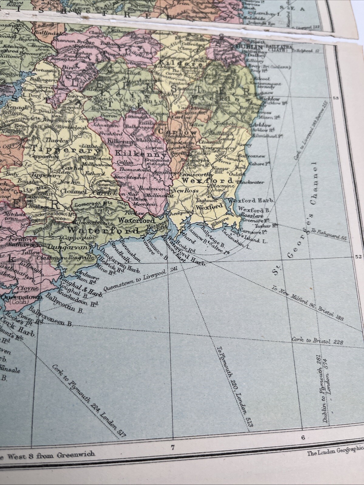
1930: Map Of Ireland With Railway Routes PA #28/29 Vintage Print A
GBP 7.50
ApproximatelyUS $9.97
or Best Offer
Condition:
2 available
- Buy It Now1930: Map Of Ireland With Railway Routes PA #28/29 Vintage Print A
Oops! Looks like we're having trouble connecting to our server.
Refresh your browser window to try again.
Shipping:
GBP 12.96 (approx US $17.23) International Priority Shipping to United States via eBay's Global Shipping Program.
Located in: Evington, Leicestershire, United Kingdom
Import charges:
Free amount confirmed at checkout
Delivery:
Estimated between Tue, May 20 and Tue, May 27 to 43230
Includes international tracking
Returns:
Seller does not accept returns.
Payments:
Earn up to 5x points when you use your eBay Mastercard®. Learn moreabout earning points with eBay Mastercard
Shop with confidence
Seller assumes all responsibility for this listing.
eBay item number:276995357467
Item specifics
- Antique
- Yes
- Year
- 1930
- Country/Region
- Scotland
Item description from the seller
Seller feedback (1,938)
- *****- Feedback left by buyer.Past 6 monthsVerified purchaseItem good as described. Well packaged. Communication good over problem of Royal Mail tardiness ( not seller's fault at all). Overall I can recommend Royal Mail notwithstanding.
- *****- Feedback left by buyer.Past monthVerified purchaseFast shipping, great packaging, and item as described. Good value for this item. Thank you!
- *****- Feedback left by buyer.Past 6 monthsVerified purchasePromptly dispatched and well packaged. As described and photographed. I would recommend this seller.
More to explore :
- Antique European Maps & Atlases Ireland 1930-1939 Date Range,
- Ireland Vintage Original Antique Europe Maps & Atlases,
- Ireland Antique Europe Maps & Atlases,
- Ireland Antique Europe Sheet Maps,
- Ireland Antique Europe Folding Maps,
- Dublin Ireland Antique Europe Atlas Maps,
- Ireland Meath Antique Europe County Maps,
- Antique European Maps & Atlases Ireland Galway,
- Antique European Maps & Atlases Ireland Londonderry,
- Antique European Maps & Atlases Ireland Kerry