

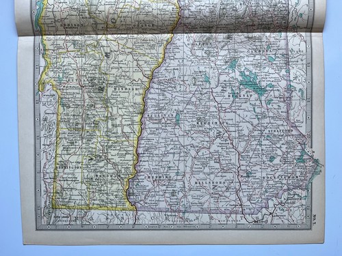

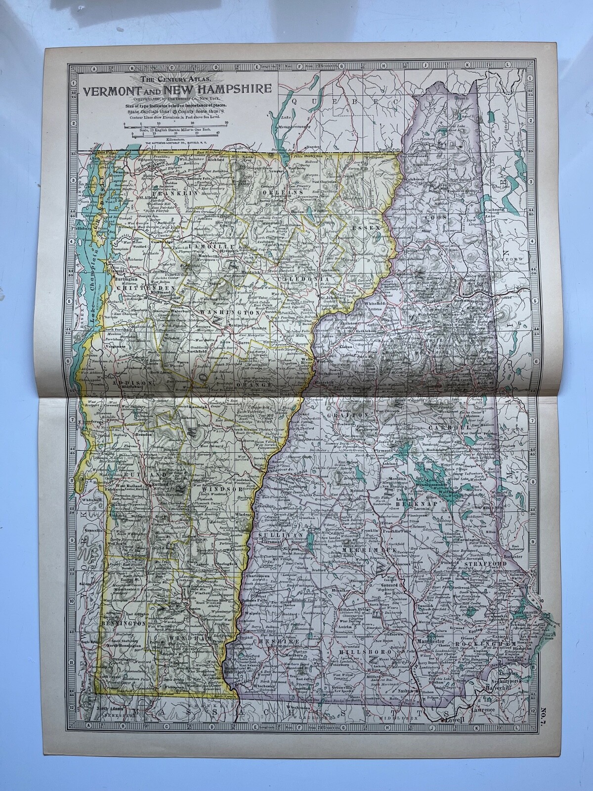
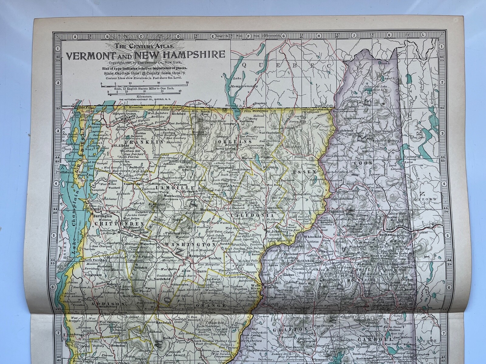
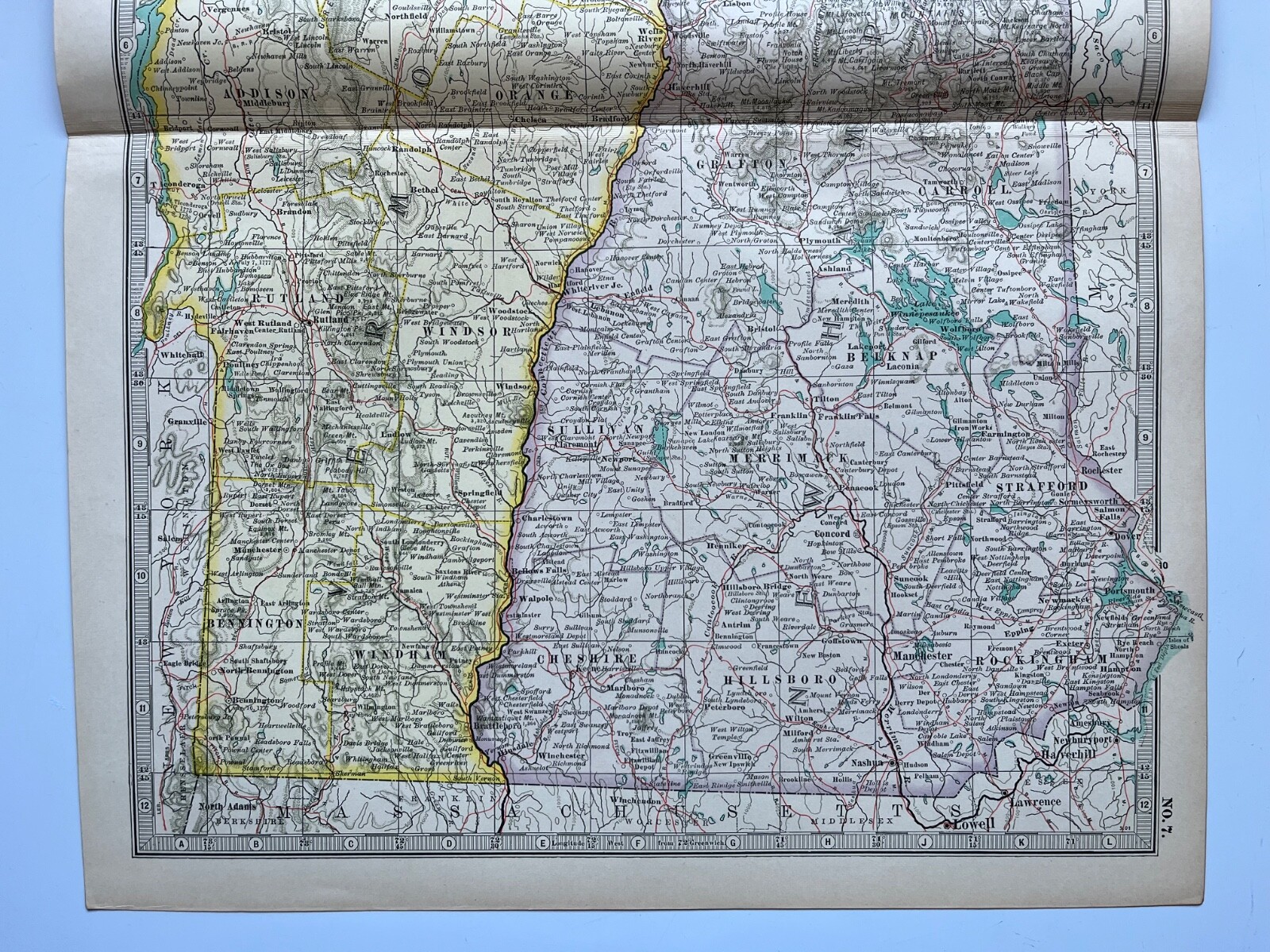
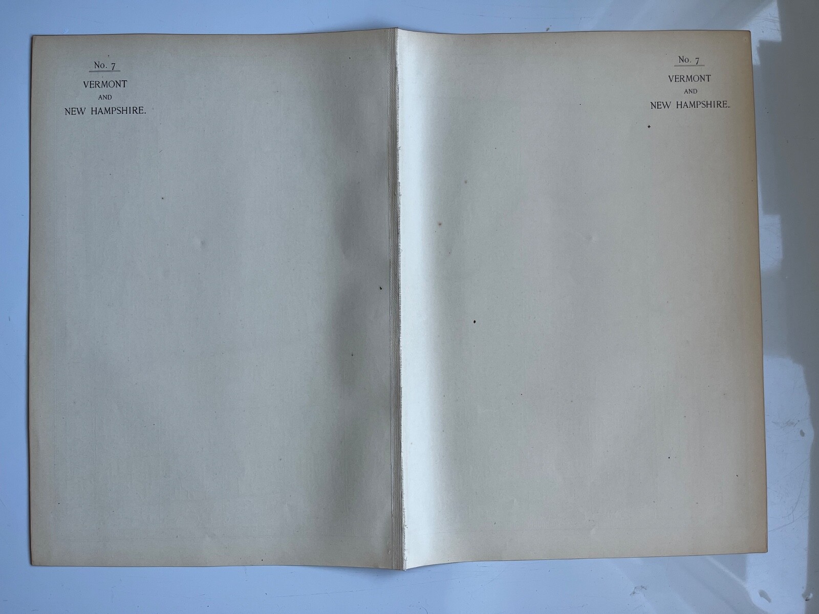

Map of Vermont and New Hampshire United States Century Atlas 1907
GBP 15.00
ApproximatelyUS $20.24
Condition:
“Antique original, some foxing and discoloration, centrefold”
- Buy It NowMap of Vermont and New Hampshire United States Century Atlas 1907
Oops! Looks like we're having trouble connecting to our server.
Refresh your browser window to try again.
Shipping:
GBP 4.20 (approx US $5.67) Royal Mail International Standard.
International shipment of items may be subject to customs processing and additional charges.
Located in: Horncastle, United Kingdom
Delivery:
Estimated between Thu, Jun 5 and Wed, Jun 18 to 94104
Returns:
14 days returns. Buyer pays for return shipping. If you use an eBay shipping label, it will be deducted from your refund amount.
Payments:
Earn up to 5x points when you use your eBay Mastercard®. Learn moreabout earning points with eBay Mastercard
Shop with confidence
Seller assumes all responsibility for this listing.
eBay item number:296840076872
Item specifics
- Seller Notes
- “Antique original, some foxing and discoloration, centrefold”
- Antique
- Yes
- Date Range
- 1900-1909
- Type
- Political Map
- Printing Technique
- Lithography
- Format
- Atlas Map
- US State
- New Hampshire
- Year
- 1907
- Era
- 1900s
- Original/Reproduction
- Antique Original
- Country/Region
- North America, United States of America
Item description from the seller

Popular categories from this store
Seller feedback (753)
- t***e (146)- Feedback left by buyer.Past 6 monthsVerified purchaseGreat Seller. A+. Fast shipping and courteous communication. Packaged expertly, the item arrived as described. All around Incredible value.Scotland antique map 1843 engraving (#296739016353)
- l***a (1584)- Feedback left by buyer.Past 6 monthsVerified purchaseThe prints arrived in excellent condition and were very well packaged. A five star seller. They were as described by the seller. Thank you!!Highland Tartan Macdonald antique chromolithograph 1875 (#296828516509)
- h***g (1096)- Feedback left by buyer.Past 6 monthsVerified purchaseAntique print received as described, promptly and well packed, thank you good seller!!!Richmond Railway Bridge, Surrey antique engraving 1852 (#296809956998)
More to explore :
- United States of America New Hampshire Antique North America Atlas Maps,
- New Hampshire Antique North America Atlas Maps,
- New Hampshire County Map Antique North America Atlas,
- Lithography New Hampshire Antique North America Atlas Maps,
- United States of America New Hampshire Antique North America Folding Maps,
- United States of America New Hampshire Antique North America Topographical Maps,
- Vermont County Map Antique North America Atlas,
- United States of America Railroad Map Antique North America Atlas Maps,
- United States of America Geological Map Antique North America Atlas Maps,
- Antique North American Maps & Atlases New Hampshire
Popular categories from this store
Seller feedback (753)
- t***e (146)- Feedback left by buyer.Past 6 monthsVerified purchaseGreat Seller. A+. Fast shipping and courteous communication. Packaged expertly, the item arrived as described. All around Incredible value.Scotland antique map 1843 engraving (#296739016353)
- l***a (1584)- Feedback left by buyer.Past 6 monthsVerified purchaseThe prints arrived in excellent condition and were very well packaged. A five star seller. They were as described by the seller. Thank you!!Highland Tartan Macdonald antique chromolithograph 1875 (#296828516509)
- h***g (1096)- Feedback left by buyer.Past 6 monthsVerified purchaseAntique print received as described, promptly and well packed, thank you good seller!!!Richmond Railway Bridge, Surrey antique engraving 1852 (#296809956998)