


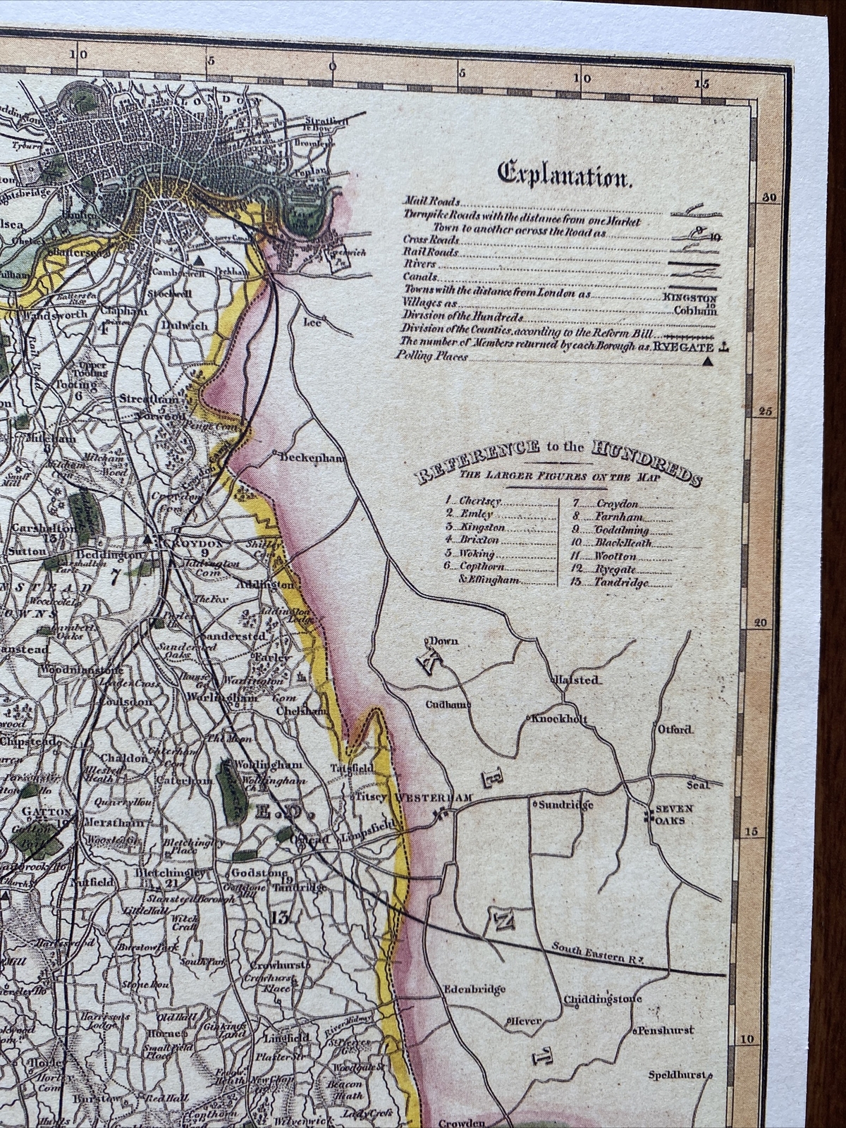


3 x Old Antique Vintage maps & views Surrey, England: 1600's & 1800's: Reprint
GBP 12.00
ApproximatelyUS $15.81
Condition:
“These maps are book plates taken very carefully from 3 different book of maps printed in 1980's and ”... Read moreabout condition
- Buy It Now3 x Old Antique Vintage maps & views Surrey, England: 1600's & 1800's: Reprint
Oops! Looks like we're having trouble connecting to our server.
Refresh your browser window to try again.
Shipping:
GBP 8.00 (approx US $10.54) Royal Mail International Standard.
International shipment of items may be subject to customs processing and additional charges.
Located in: Sheffield, United Kingdom
Delivery:
Estimated between Sat, May 17 and Sat, May 31 to 43230
Please note the delivery estimate is greater than 3 business days.
Please allow additional time if international delivery is subject to customs processing.
Returns:
Seller does not accept returns.
Payments:
Earn up to 5x points when you use your eBay Mastercard®. Learn moreabout earning points with eBay Mastercard
Shop with confidence
Seller assumes all responsibility for this listing.
eBay item number:304096188508
Item specifics
- Seller Notes
- Date Range
- 1600-1699
- Type
- County Map
- Format
- Wall/ Poster Map
- Year
- 1610, 1830, 1840
- Era
- 1800s
- Cartographer/Publisher
- John Speed
- Original/Reproduction
- Antique Reproduction
- Country/Region
- England
- County
- Surrey
- Map Type
- Countries/ Borders
- Antique/ Modern
- Antique
Item description from the seller
Seller feedback (3,296)
- *****- Feedback left by buyer.Past 6 monthsVerified purchaseAs described. Well protected with cardboard in envelope for international mail England to Australia. Seller recommended. Thanks A+
- *****- Feedback left by buyer.Past yearVerified purchaseSpeedy delivery and item as described. Well packaged Excellent communication with seller and only charged one postage as bought two items, refunding extra Thank you
- *****- Feedback left by buyer.Past 6 monthsVerified purchaseBrilliant seller .. Posted the same day I bought and packaged really well
This is a private listing and your identity will not be disclosed to anyone except the seller.
More to explore :
- Antique European Maps & Atlases England Surrey,
- Antique European Maps & Atlases Surrey 1800-1899 Date Range,
- Antique European Maps & Atlases Surrey,
- Antique European Maps & Atlases England 1600-1699 Date Range,
- England 1600-1699 Date Range Antique Europe Folding Maps,
- Antique European Maps & Atlases England 1800-1899 Date Range,
- England Antique Europe Maps & Atlases,
- England London Antique European Maps & Atlases 1800-1899 Date Range,
- England Antique Europe City Maps,
- England European Antique Maps & Atlases Devon 1800-1899 Date Range