


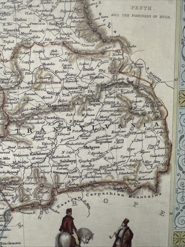


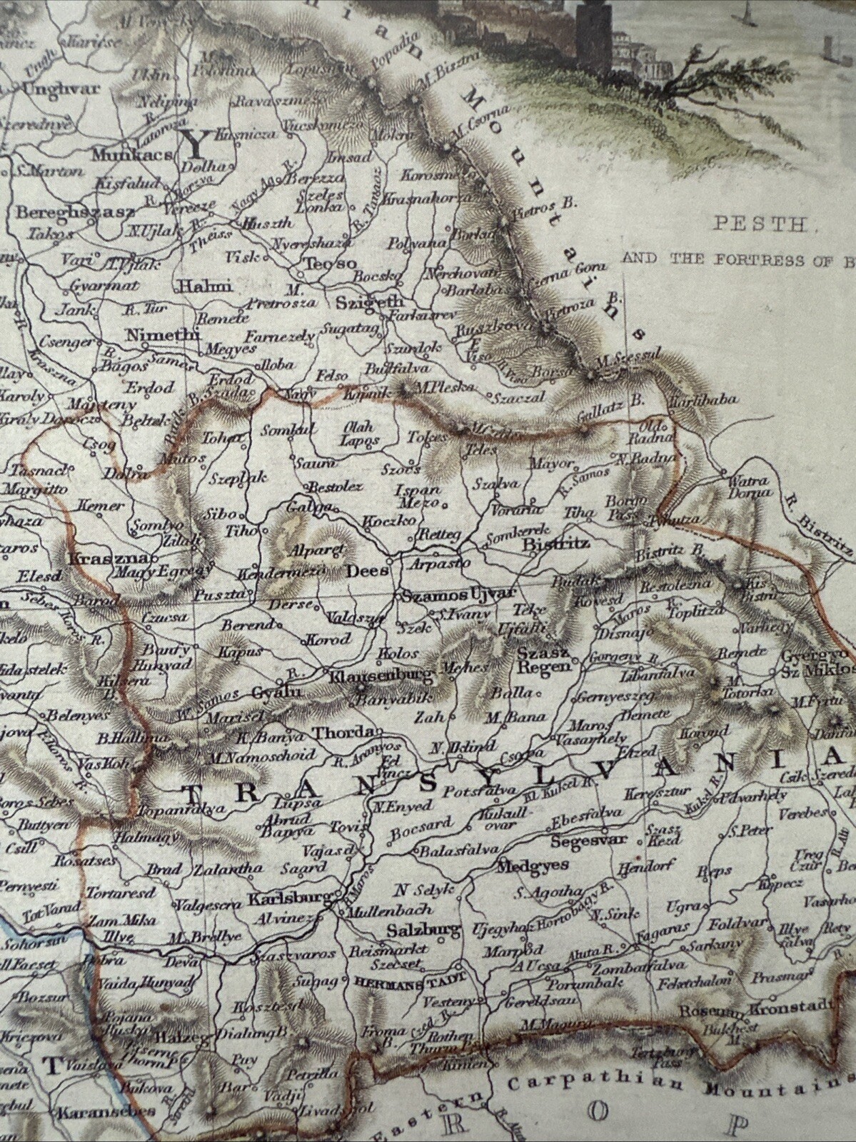
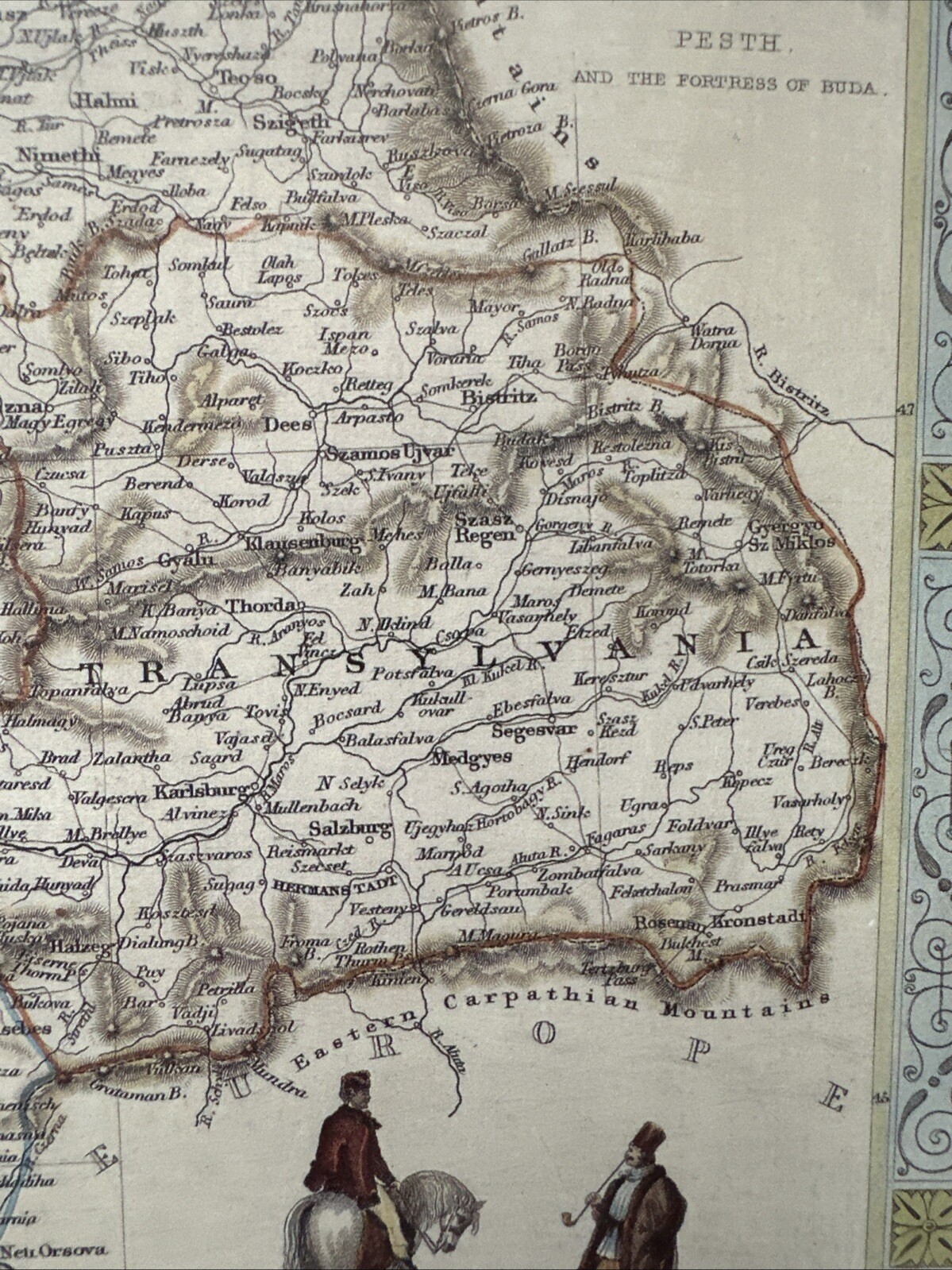


Antique old picture map 1800s Hungary, Pesth, Danube Tallis: 1851c Reprint
GBP 5.99
ApproximatelyUS $8.06
Condition:
“This map is a book plate taken very carefully from a book of maps published in 1989. The map is in ”... Read moreabout condition
Last one1 sold
- Buy It NowAntique old picture map 1800s Hungary, Pesth, Danube Tallis: 1851c Reprint
Oops! Looks like we're having trouble connecting to our server.
Refresh your browser window to try again.
Shipping:
GBP 15.41 (approx US $20.73) International Priority Shipping to United States via eBay's Global Shipping Program.
Located in: Sheffield, United Kingdom
Import charges:
Free amount confirmed at checkout
Delivery:
Estimated between Thu, Jul 3 and Mon, Jul 14 to 94104
Includes international tracking
Returns:
Seller does not accept returns.
Payments:
Earn up to 5x points when you use your eBay Mastercard®. Learn moreabout earning points with eBay Mastercard
Shop with confidence
Seller assumes all responsibility for this listing.
eBay item number:305874052350
Item specifics
- Seller Notes
- Antique
- Yes
- Size
- 12.5" x 9.25"
- Cartographer/Publisher
- tallis
- Date Range
- 1800-1899
- Type
- County Map
- Format
- Wall/Poster Map
- Year
- 1851
- Era
- 1800s
- Original/Repro
- Vintage Reproduction
- Original/Reproduction
- Antique Reproduction
- Country/Region
- Hungary
- Age
- 1800-1849
- Map Type
- Countries/Borders
Item description from the seller
Seller feedback (3,306)
This item (1)
All items (3,306)
- *****- Feedback left by buyer.Past yearVerified purchaseGreat comment.excellent item thank you.
- *****- Feedback left by buyer.Past 6 monthsVerified purchaseAs described. Well protected with cardboard in envelope for international mail England to Australia. Seller recommended. Thanks A+
- *****- Feedback left by buyer.Past monthVerified purchaseItem exactly as described, quick dispatch and delivery. Overall, excellent service from this highly recommended seller.Buy with 100% confidence !
- *****- Feedback left by buyer.Past monthVerified purchasegreat repro Tudor map, very well packed & instantly delivered. 1st class seller!
This is a private listing and your identity will not be disclosed to anyone except the seller.
More to explore :
- Hungary 1800-1899 Date Range Antique Europe Political Maps,
- Antique European Maps & Atlases 1800-1899 Date Range Hungary,
- Hungary 1800-1899 Date Range Antique Europe City Maps,
- Hungary 1800-1899 Date Range Antique Europe Atlas Maps,
- Hungary Antique Europe Political Maps,
- Hungary Antique Original Antique Europe County Maps,
- Hungary Lithography Antique Europe Atlas Maps,
- Budapest Hungary Antique Original Antique European Maps & Atlases,
- Texas Antique Maps 1800-1899,
- Budapest Hungary Lithography Antique Europe Maps & Atlases