
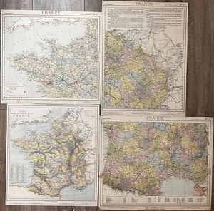
Lot Of 4 Original Antique France Maps From The 1800’s
US $74.99US $74.99
Sat, May 10, 03:15 AMSat, May 10, 03:15 AM
Picture 1 of 5


Gallery
Picture 1 of 5


Have one to sell?
Lot Of 4 Original Antique France Maps From The 1800’s

US $74.99
or Best Offer
Condition:
Oops! Looks like we're having trouble connecting to our server.
Refresh your browser window to try again.
Shipping:
US $5.75 Economy Shipping.
Located in: Saratoga Springs, New York, United States
Delivery:
Estimated between Mon, Jul 21 and Mon, Jul 28 to 94104
Returns:
Seller does not accept returns.
Payments:
.
Special financing available. See terms and apply now- for PayPal Credit, opens in a new window or tab
Earn up to 5x points when you use your eBay Mastercard®. Learn moreabout earning points with eBay Mastercard
Shop with confidence
Seller assumes all responsibility for this listing.
eBay item number:306097912974
Item specifics
- Date Range
- 1800-1899
- Type
- Physical Map
- Format
- Atlas Map
- Printing Technique
- Lithography
- Year
- 1800
- Original/Reproduction
- Antique Original
- Country/Region
- France
Item description from the seller
Seller Feedback
No feedback yet
More to explore :
- France Antique Original Antique Europe Political Maps,
- France Antique Original Antique Europe Topographical Maps,
- France Antique Original Antique Europe County Maps,
- France Antique Original Antique Europe City Maps,
- France Antique Original Antique Europe Sheet Maps,
- France Antique Original Antique Europe Novelty Maps,
- France Antique Original Antique Europe Railroad Maps,
- France 1800-1899 Date Range Antique Europe River Maps,
- Abraham Ortelius France Antique Original Antique Europe Maps & Atlases,
- Original 1800-1899 Antique World Maps & Atlases
Seller Feedback
No feedback yet