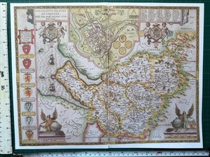


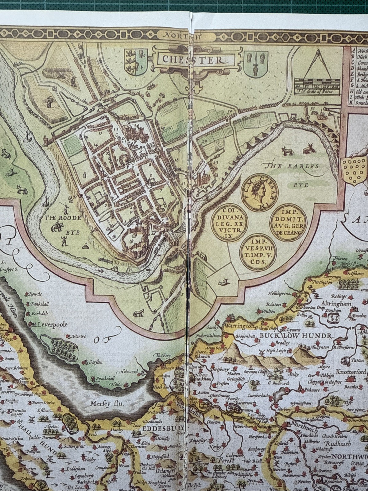


Old Antique Tudor map Cheshire, Chester, England Speed 1600's Reprint
GBP 4.99
ApproximatelyUS $6.76
Condition:
“This map is a book plate taken very carefully from a book of maps printed in 1988. It is printed on ”... Read moreabout condition
2 available
- Buy It NowOld Antique Tudor map Cheshire, Chester, England Speed 1600's Reprint
Oops! Looks like we're having trouble connecting to our server.
Refresh your browser window to try again.
Shipping:
GBP 15.37 (approx US $20.82) International Priority Shipping to United States via eBay's Global Shipping Program.
Located in: Sheffield, United Kingdom
Import charges:
Free amount confirmed at checkout
Delivery:
Estimated between Fri, Jun 13 and Tue, Jun 24 to 94104
Includes international tracking
Returns:
Seller does not accept returns.
Payments:
Earn up to 5x points when you use your eBay Mastercard®. Learn moreabout earning points with eBay Mastercard
Shop with confidence
Seller assumes all responsibility for this listing.
eBay item number:306259642143
Item specifics
- Seller Notes
- Antique
- Yes
- Date Range
- 1600-1699
- Type
- County Map
- Format
- Wall/ Poster Map
- Year
- 1610
- Era
- 1600s
- Cartographer/Publisher
- John Speed
- Original/Reproduction
- Antique Reproduction
- Country/Region
- England
- County
- Cheshire
- Map Type
- Countries/ Borders
- Antique/ Modern
- Antique
Item description from the seller
Seller feedback (3,303)
- *****- Feedback left by buyer.Past 6 monthsVerified purchaseAs described. Well protected with cardboard in envelope for international mail England to Australia. Seller recommended. Thanks A+
- *****- Feedback left by buyer.Past monthVerified purchasegreat repro Tudor map, very well packed & instantly delivered. 1st class seller!
- *****- Feedback left by buyer.Past yearVerified purchaseSpeedy delivery and item as described. Well packaged Excellent communication with seller and only charged one postage as bought two items, refunding extra Thank you
This is a private listing and your identity will not be disclosed to anyone except the seller.
More to explore :
- Antique European Maps & Atlases England Cheshire,
- England European Antique Maps & Atlases Cheshire 1800-1899 Date Range,
- Antique European Maps & Atlases Cheshire,
- Cheshire Antique Europe County Maps,
- Antique European Maps & Atlases England 1600-1699 Date Range,
- England Antique Europe Maps & Atlases,
- England County Map Antique Europe Atlas Maps,
- England Copper Plate Maps & Atlases European Antique 1600-1699 Date Range,
- London England Antique Europe Folding Maps,
- Antique European Maps & Atlases England Warwickshire