
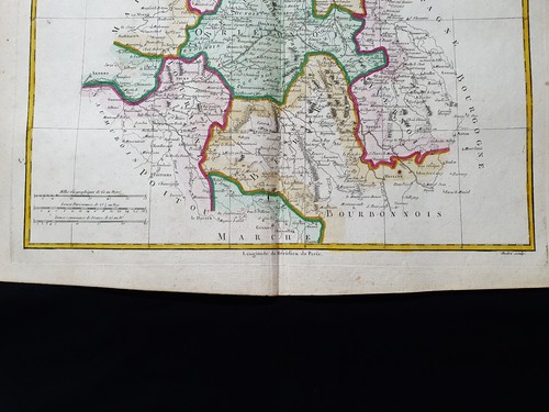
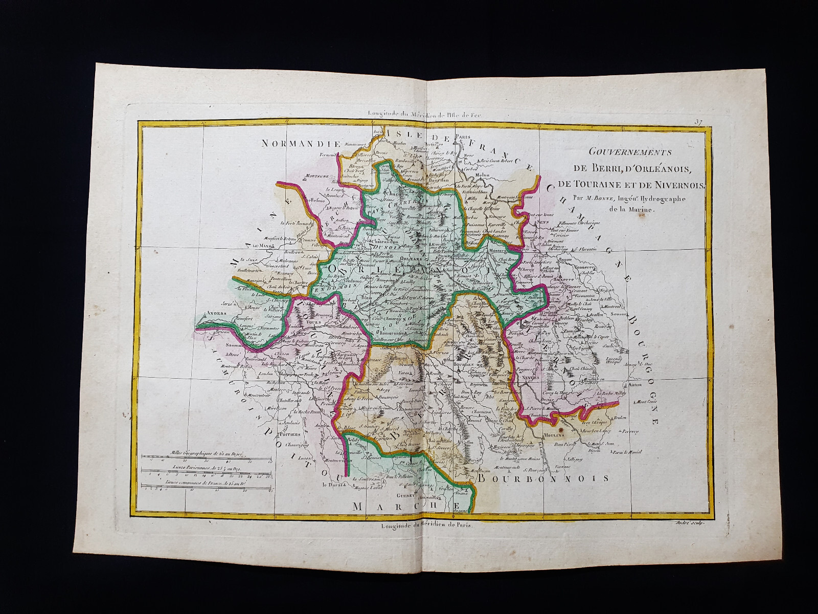
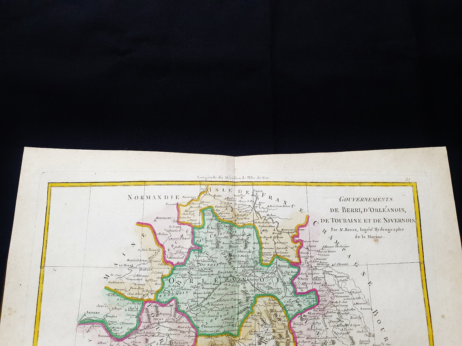
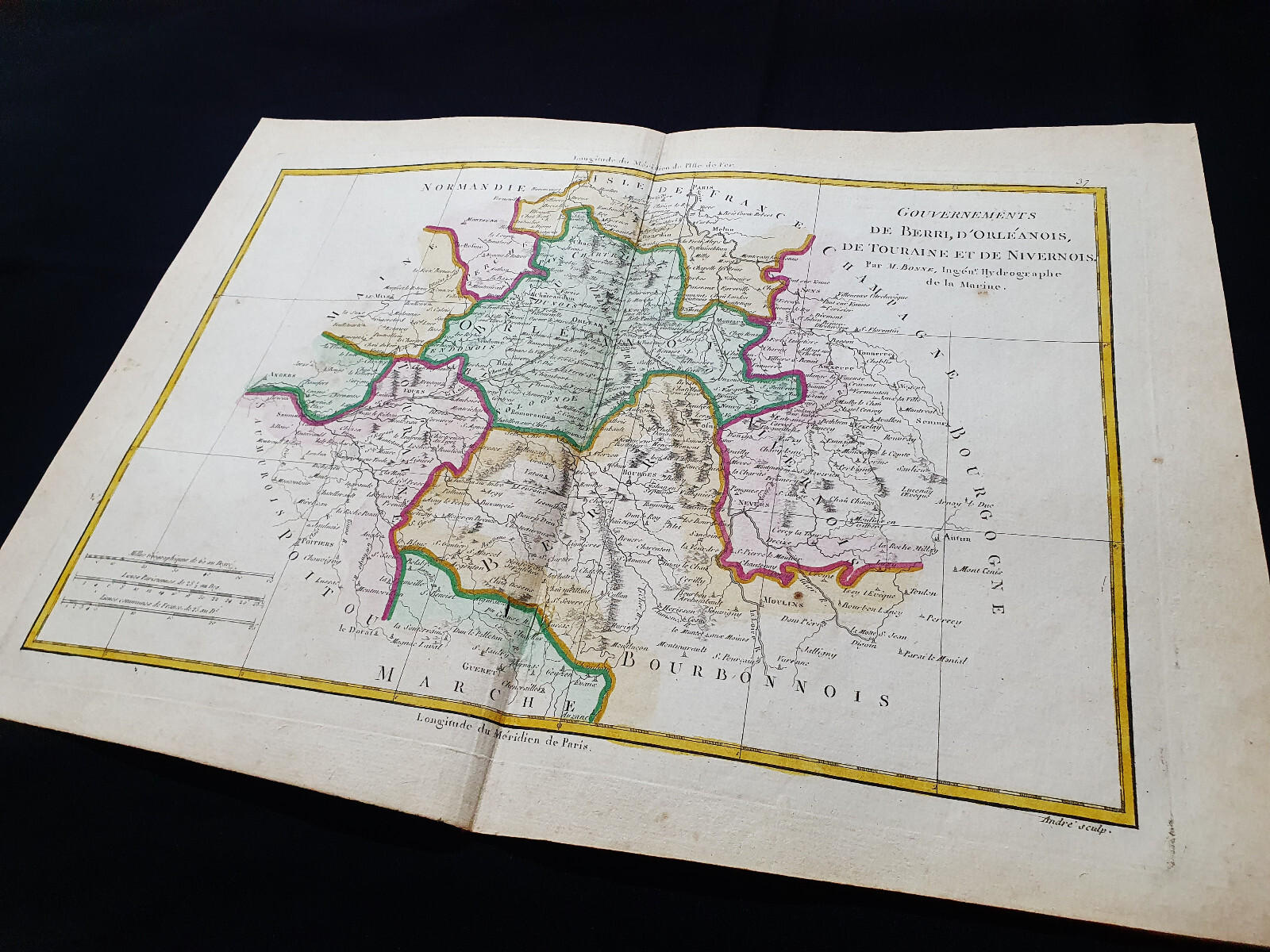
1787 BONNE rare map of FRANCE, BERRY, ORLEANOIS, TOURAINE, TOURS, LOIRET, INDRE
US $14.99US $14.99
Wed, May 07, 09:29 PMWed, May 07, 09:29 PM
Picture 1 of 5


Gallery
Picture 1 of 5


Have one to sell?
1787 BONNE rare map of FRANCE, BERRY, ORLEANOIS, TOURAINE, TOURS, LOIRET, INDRE

Condition:
Ended: May 07, 2025 21:29:01 PDT
Oops! Looks like we're having trouble connecting to our server.
Refresh your browser window to try again.
Shipping:
US $16.90 Economy Shipping from outside US.
International shipment of items may be subject to customs processing and additional charges.
Located in: Casa Carpentera, Italy
Delivery:
Estimated between Thu, Aug 7 and Fri, Aug 22 to 94104
Returns:
14 days returns. Buyer pays for return shipping. If you use an eBay shipping label, it will be deducted from your refund amount.
Payments:
Special financing available. See terms and apply now- for PayPal Credit, opens in a new window or tab
Earn up to 5x points when you use your eBay Mastercard®. Learn moreabout earning points with eBay Mastercard
Shop with confidence
Seller assumes all responsibility for this listing.
eBay item number:316726176393
Item specifics
- Date Range
- 1700-1799
- Type
- Nautical Map
- Format
- Folding Map
- Printing Technique
- Copper Plate
- Year
- 1787
- Original/Reproduction
- Antique Original
- Cartographer/Publisher
- Rigobert Bonne
- City
- Paris
- Country/Region
- Andorra, Belgium, France, Luxembourg
Item description from the seller
Seller Feedback
No feedback yet
More to explore :
- Paris France Antique Maps,
- France City Map Antique Europe Atlas Maps,
- France Topographical Map Antique Europe Atlas Maps,
- France County Map Antique Europe Atlas Maps,
- France Political Map Antique Europe Atlas Maps,
- France Antique Europe Railroad Maps,
- France Antique Europe Novelty Maps,
- France Antique Europe City Maps,
- Antique European Maps & Atlases Lyon France,
- France Lithography Antique Europe Topographical Maps
Seller Feedback
No feedback yet