
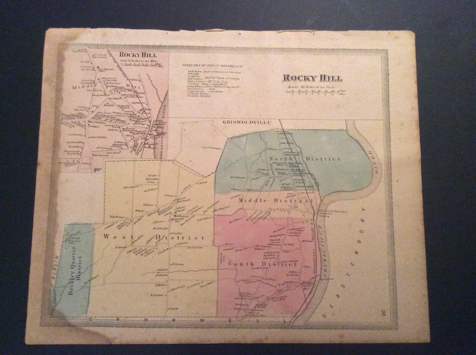
Map of Rocky Hill, Connecticut from 1869 Baker & Tilden Hartford County Atlas.
US $14.00
or Best Offer
Condition:
- Buy It NowMap of Rocky Hill, Connecticut from 1869 Baker & Tilden Hartford County Atlas.
Oops! Looks like we're having trouble connecting to our server.
Refresh your browser window to try again.
Shipping:
Free USPS Media MailTM.
Located in: Enfield, Connecticut, United States
Delivery:
Estimated between Wed, Jun 11 and Tue, Jun 17 to 94104
Returns:
Seller does not accept returns.
Payments:
Special financing available. See terms and apply now- for PayPal Credit, opens in a new window or tab
Earn up to 5x points when you use your eBay Mastercard®. Learn moreabout earning points with eBay Mastercard
Shop with confidence
Seller assumes all responsibility for this listing.
eBay item number:323756101670
Item specifics
- Format
- Atlas
- Year
- 1869
- US State
- Connecticut
- Country/Region
- United States of America
- Date Range
- 1800-1899
- Type
- County Map
- Original/Reproduction
- Antique Original
Item description from the seller
Seller feedback (5)
- eBay automated feedback- Feedback left by buyer.Past 6 monthsThis seller successfully completed an order.
- o***n (9606)- Feedback left by buyer.More than a year agoVerified purchaseReceived as described in good time.Map of Bristol, Connecticut from 1869 Hartford County Baker & Tilden Atlas. (#323754780925)
- 2***2 (2115)- Feedback left by buyer.More than a year agoVerified purchaseThank you for listing this item! A+++Map of Collinsville, Connecticut from 1869 Baker & Tilden Hartford County Atlas. (#323754805121)
More to explore :
- County Map Antique Atlas Maps,
- County Map Antique Atlas,
- Contemporary County Map Antique Atlas Maps,
- County Map Antique Europe Atlas Maps,
- Connecticut Antique North America County Maps,
- Lithography County Map Antique Atlas Maps,
- Copper Plate County Map Antique Atlas Maps,
- Indiana County Map Antique North America Atlas Maps,
- Delaware County Map Antique North America Atlas Maps,
- Pennsylvania County Map Antique North America Atlas Maps