
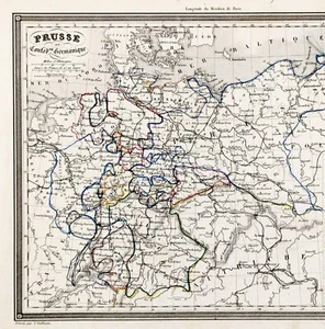
1845 PRUSSIA - GERMAN CONFEDERATION Map Original ALEXANDRE VUILLEMIN (10x7.5)
US $36.88US $36.88
Wed, May 14, 06:53 PMWed, May 14, 06:53 PM
Picture 1 of 3


Gallery
Picture 1 of 3


Have one to sell?
1845 PRUSSIA - GERMAN CONFEDERATION Map Original ALEXANDRE VUILLEMIN (10x7.5)
US $36.88
or Best Offer
Condition:
Oops! Looks like we're having trouble connecting to our server.
Refresh your browser window to try again.
Shipping:
Free USPS Ground Advantage®.
Located in: Monroe, Georgia, United States
Delivery:
Estimated between Tue, Jul 29 and Mon, Aug 4 to 94104
Returns:
30 days returns. Seller pays for return shipping.
Payments:
.
Special financing available. See terms and apply now- for PayPal Credit, opens in a new window or tab
Earn up to 5x points when you use your eBay Mastercard®. Learn moreabout earning points with eBay Mastercard
Shop with confidence
Seller assumes all responsibility for this listing.
eBay item number:326518151619
Item specifics
- Date Range
- 1800-1899
- Type
- Political Map
- Format
- Atlas Map
- Printing Technique
- Lithography
- Year
- 1845
- State
- Bavaria
- Original/Reproduction
- Antique Original
- Cartographer/Publisher
- ALEXANDRE VUILLEMIN
- City
- Frankfurt
- Country/Region
- Austria, Germany, Poland, Prussia
Item description from the seller
Seller Feedback
No feedback yet
More to explore :
- Prussia Antique Original Antique European Maps & Atlases,
- Prussia Antique Europe Atlas Maps,
- Prussia Antique Europe Political Maps,
- Antique European Maps & Atlases Prussia,
- Prussia Copper Plate Antique Original Antique European Maps & Atlases,
- Berlin Prussia Antique Europe Maps & Atlases,
- Antique European Maps & Atlases Berlin Prussia,
- Prussia Copper Plate Antique Europe Maps & Atlases,
- Prussia 1800-1899 Date Range Antique Europe Political Maps,
- Antique Original City Map Antique Atlas Maps