


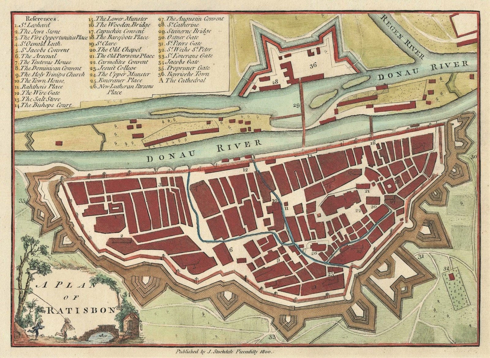

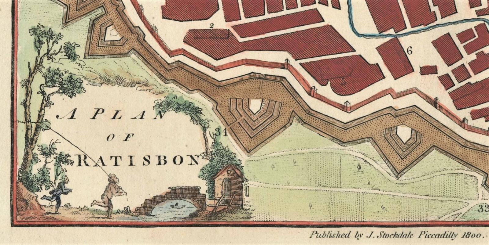


Antique Map "A Plan of Ratisbon" (Regensburg) John Andrews / Stockdale, 1772
GBP 80.00
ApproximatelyUS $107.27
or Best Offer
Condition:
- Buy It NowAntique Map "A Plan of Ratisbon" (Regensburg) John Andrews / Stockdale, 1772
Oops! Looks like we're having trouble connecting to our server.
Refresh your browser window to try again.
Shipping:
GBP 18.00 (approx US $24.14) International Tracked Postage.
International shipment of items may be subject to customs processing and additional charges.
Located in: London, United Kingdom
Delivery:
Estimated between Mon, May 5 and Mon, May 12 to 43230
Please allow additional time if international delivery is subject to customs processing.
Returns:
Seller does not accept returns.
Payments:
Earn up to 5x points when you use your eBay Mastercard®. Learn moreabout earning points with eBay Mastercard
Shop with confidence
Seller assumes all responsibility for this listing.
eBay item number:335603690007
Item specifics
- Antique
- Yes
- Date Range
- 1700-1799
- Type
- City Map
- Format
- Sheet Map
- Printing Technique
- Copper Plate
- Year
- 1772
- Era
- 1700s
- State
- Bavaria
- Cartographer/Publisher
- John Andrews / John Stockdale
- Original/Reproduction
- Antique Original
- City
- Regensburg
- Country/Region
- Germany
Item description from the seller

Popular categories from this store
Seller feedback (262)
- f***5 (3)- Feedback left by buyer.Past 6 monthsVerified purchaseThe package was sent quickly and securely with protection for the maps on all sides. An authenticity letter was also placed with the map. It is in the condition as described and displayed (really good). I would definitely purchase from this seller again. Thank you.Antique Map "Tarawera District, New Zealand" Royal Geographical Society, 1886 (#335450217107)
- u***i (144)- Feedback left by buyer.Past monthVerified purchaseItem as described. Packed well with fast shipping. In good condition for its age! Would buy from this seller again.
- 8***u (12)- Feedback left by buyer.Past 6 monthsVerified purchaseThe item is as described and well-packed, shipping is fast, an excellent seller!Antique Engraving "Dinner Party at a Mandarin's House" (China) Allom, 1843 (#335066658239)
More to explore :
- John Bartholomew Political Map Antique Atlas Maps,
- John Bartholomew Antique Atlas Maps,
- John Bartholomew Antique Topographical Maps,
- John Cary Antique Atlas Maps,
- John Bartholomew Antique Political Maps,
- John Bartholomew Antique Maps, Atlases & Globes,
- John Speed Antique Maps, Atlases & Globes,
- John Cary Antique Maps, Atlases & Globes,
- John Bartholomew Antique World Maps & Atlases,
- John Senex Antique Maps, Atlases & Globes
Popular categories from this store
Seller feedback (262)
- f***5 (3)- Feedback left by buyer.Past 6 monthsVerified purchaseThe package was sent quickly and securely with protection for the maps on all sides. An authenticity letter was also placed with the map. It is in the condition as described and displayed (really good). I would definitely purchase from this seller again. Thank you.Antique Map "Tarawera District, New Zealand" Royal Geographical Society, 1886 (#335450217107)
- u***i (144)- Feedback left by buyer.Past monthVerified purchaseItem as described. Packed well with fast shipping. In good condition for its age! Would buy from this seller again.
- 8***u (12)- Feedback left by buyer.Past 6 monthsVerified purchaseThe item is as described and well-packed, shipping is fast, an excellent seller!Antique Engraving "Dinner Party at a Mandarin's House" (China) Allom, 1843 (#335066658239)