


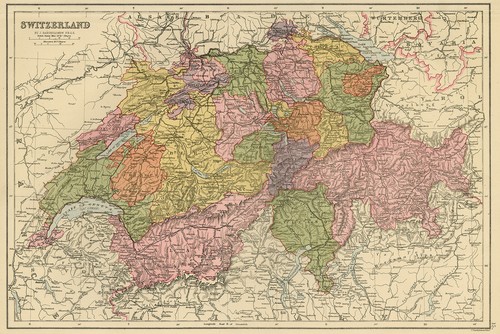


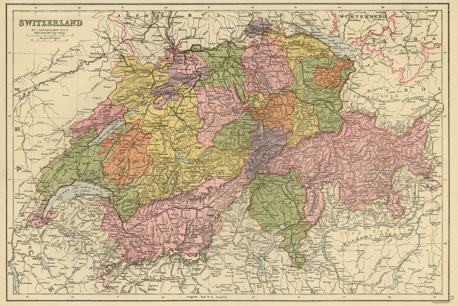


2 Antique Maps-SWITZERLA
US $87.50
or Best Offer
$78.75 with coupon code
or 4 interest-free payments of $21.88 available with
Condition:
“Very good, given age. A small crease in the top margin, with a small tear in right top, consolidated ”... Read moreabout condition
- Buy It Now2 Antique Maps-SWITZERLAND-CANTON-VALAIS-BERN-BASEL-Bartholomew-Bernard-ca. 1820
Oops! Looks like we're having trouble connecting to our server.
Refresh your browser window to try again.
Shipping:
Free Standard Shipping from outside US.
International shipment of items may be subject to customs processing and additional charges.
Located in: Zeeland, Netherlands
Delivery:
Estimated between Wed, Jun 4 and Fri, Jun 20 to 94104
Returns:
30 days returns. Buyer pays for return shipping. If you use an eBay shipping label, it will be deducted from your refund amount.
Payments:
.
4 interest-free payments of $21.88 available with Klarna.
Special financing available. See terms and apply now- for PayPal Credit, opens in a new window or tab
Earn up to 5x points when you use your eBay Mastercard®. Learn moreabout earning points with eBay Mastercard
Shop with confidence
Seller assumes all responsibility for this listing.
eBay item number:356047054479
Item specifics
- Seller Notes
- Subject
- Maps
- Size
- Small
- Features
- Unframed
- Height (Inches)
- 12.6
- Width (Inches)
- 17.6
- Width (Centimeters)
- 44.7
- Orientation
- Landscape
- Height (Centimeters)
- 32.0
- Size (CM)
- Medium (up to 90cm.)
- Type
- Topographical Map
- Artist
- A. Benard
- Style
- Realism
- Culture
- European
- Material
- Paper
- Original/Licensed Reprint
- Original
- Production Technique
- Lithograph
- Region of Origin
- Europe
- Theme
- Topographical
- Year of Production
- 1820
- Framing
- Unframed
- Image Orientation
- Landscape
- Unit of Sale
- Set
- Medium
- Lithograph
- Item Length
- Not applicable
- Country/Region of Manufacture
- Europe
- Time Period Produced
- 1800-1849
- Item Height
- 17.6 in
- Item Width
- 12.5 in
- Country/Region
- Switzerland
- City
- Not applicable
- Date Range
- 1800-1899
- Original/Reproduction
- Antique Original
- Format
- Atlas Map
- Cartographer/Publisher
- J. Bartholomew - A. Benard
- Printing Technique
- Lithography
- Year
- 1820
- Cartographer
- J. Bartholomew - A. Benard
- Signed
- Plate signed
- Color
- Multi-Color
- County
- Not applicable
Item description from the seller
Seller business information
VAT number: NL 820763196B01

Popular categories from this store
Seller feedback (8,558)
- o***e (928)- Feedback left by buyer.Past monthVerified purchaseReceived as advertised & quickly from The Netherlands. Wanted some type of art related to forefather-born name Dallicker (some art Dalliker). I was kind of anxious opening package uncertain or original as I never dealt in original sketches and paintings so i did not know what to expect, then I realize the expertise of the seller - original 1760 paper & the COA as I was wondering of provenance - so the two page document with signature was appreciated & relied on positive Feedback
- v***0 (51)- Feedback left by buyer.More than a year agoVerified purchaseThe engraving is indeed beautiful, accurately described. The wrapping was exceptionally secure and professional. I truly appreciated the seller's excellent communication and their willingness to understand the story behind my acquisition of the item, adjusting the price accordingly. Despite shipping delays (not the seller's fault), the seller followed up on all my queries promptly. I highly recommend this seller.Original Print-ANIMAL-CARTHORSE-SEINE-PARIS-Dupont-1899 (#354605066426)
- o***o (1025)- Feedback left by buyer.Past 6 monthsVerified purchaseGreat eBay Seller—item fully as described, well-packaged, and shipped in a timely manner. Highly recommend!
More to explore :
- Antique European Maps & Atlases Bern Switzerland,
- Bern Switzerland Antique Original Antique European Maps & Atlases,
- John Bartholomew Antique Topographical Maps,
- John Bartholomew Antique Political Maps,
- John Bartholomew Antique Atlas Maps,
- Antique European Maps & Atlases Bern,
- Switzerland Antique Europe Topographical Maps,
- Switzerland Antique Europe Political Maps,
- Switzerland Antique Europe City Maps,
- Switzerland Antique Europe Folding Maps
Popular categories from this store
Seller feedback (8,558)
- o***e (928)- Feedback left by buyer.Past monthVerified purchaseReceived as advertised & quickly from The Netherlands. Wanted some type of art related to forefather-born name Dallicker (some art Dalliker). I was kind of anxious opening package uncertain or original as I never dealt in original sketches and paintings so i did not know what to expect, then I realize the expertise of the seller - original 1760 paper & the COA as I was wondering of provenance - so the two page document with signature was appreciated & relied on positive Feedback
- v***0 (51)- Feedback left by buyer.More than a year agoVerified purchaseThe engraving is indeed beautiful, accurately described. The wrapping was exceptionally secure and professional. I truly appreciated the seller's excellent communication and their willingness to understand the story behind my acquisition of the item, adjusting the price accordingly. Despite shipping delays (not the seller's fault), the seller followed up on all my queries promptly. I highly recommend this seller.Original Print-ANIMAL-CARTHORSE-SEINE-PARIS-Dupont-1899 (#354605066426)
- o***o (1025)- Feedback left by buyer.Past 6 monthsVerified purchaseGreat eBay Seller—item fully as described, well-packaged, and shipped in a timely manner. Highly recommend!