


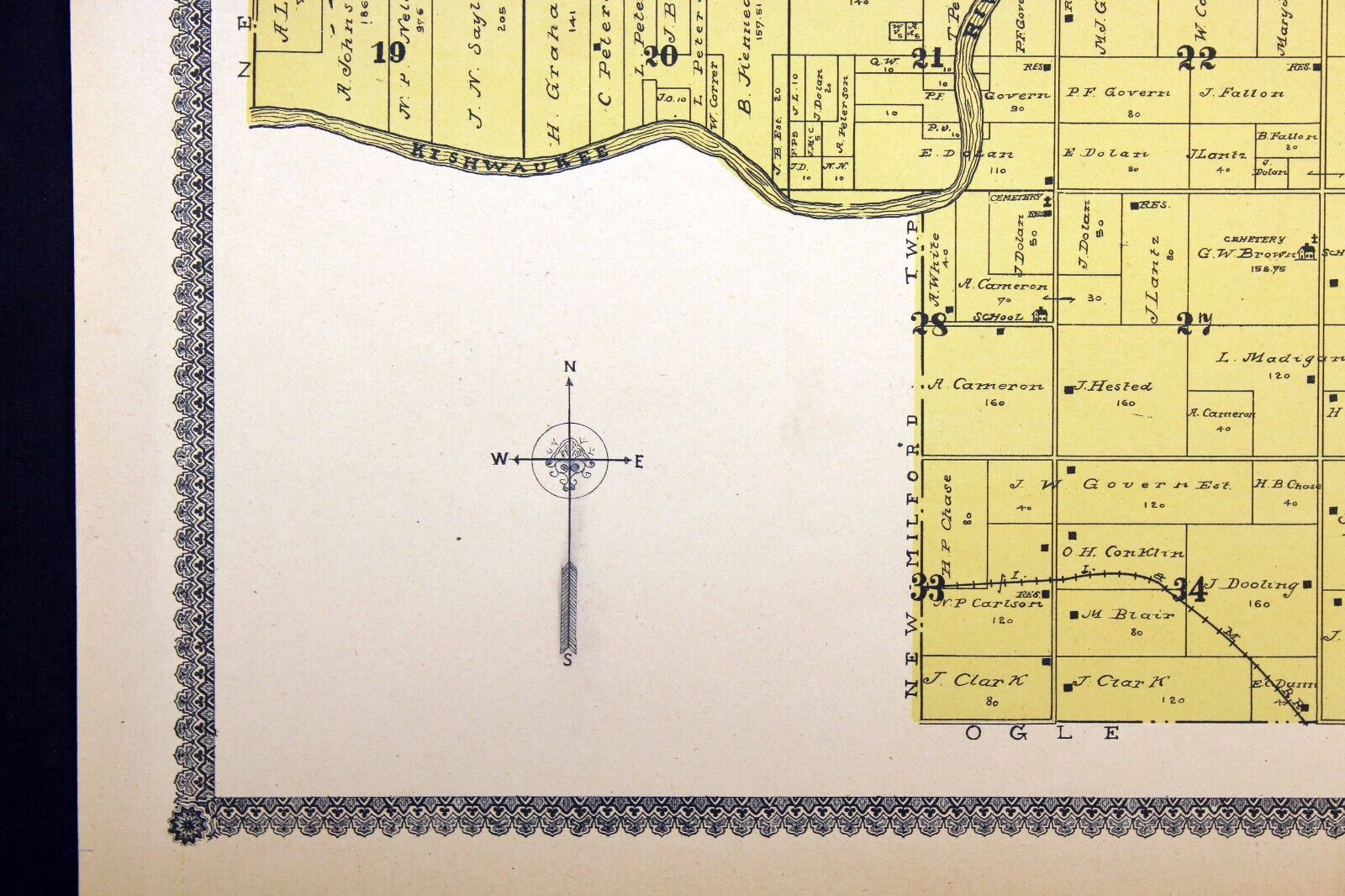


1905 Plat Map Cherry Valley Township Winnebago County Illinois Kishwaukee River
US $27.50
or Best Offer
Condition:
“Excellent condition (see photos).”
Oops! Looks like we're having trouble connecting to our server.
Refresh your browser window to try again.
Shipping:
US $6.15 USPS Ground Advantage®.
Located in: Corunna, Michigan, United States
Delivery:
Estimated between Fri, May 23 and Wed, May 28 to 43230
Returns:
30 days returns. Seller pays for return shipping.
Payments:
Special financing available. See terms and apply now- for PayPal Credit, opens in a new window or tab
Earn up to 5x points when you use your eBay Mastercard®. Learn moreabout earning points with eBay Mastercard
Shop with confidence
Seller assumes all responsibility for this listing.
eBay item number:365089749053
Item specifics
- Seller Notes
- “Excellent condition (see photos).”
- Date Range
- 1900-1909
- Type
- Plat Map
- Format
- Atlas
- US State
- Illinois
- Printing Technique
- Engraving
- Year
- 1905
- Original/Reproduction
- Antique Original
- Cartographer/Publisher
- Geo. A. Ogle & Co.
- Country/Region
- United States of America
Item description from the seller

Seller feedback (10,014)
This item (1)
All items (10,014)
- r***1 (573)- Feedback left by buyer.Past monthVerified purchaseBeautiful item, sent very fast and packaged for protection. The quality of the item was the best possible for an antique map and the price/shipping were reasonable. I highly recommend the seller.
- i***j (657)- Feedback left by buyer.Past monthVerified purchaseSmooth transaction, item as described. fast shipping, good packing and great value.
- a***e (840)- Feedback left by buyer.Past 6 monthsVerified purchasePerfect transaction item exactly as seller described, great price, fast shipping, great packaging, very pleased, A 1 transaction.
- 9***w (173)- Feedback left by buyer.Past 6 monthsVerified purchaseGreat communication with seller. Map is wonderful condition. Packaged in a sturdy tube. Thank you. Recommend seller! Slow shipping was USPS fault, not the seller.1915 Map of The World on Mercator's Projection Color 17" x 28" (#365089751959)
More to explore :
- Illinois County Map Antique North America Folding Maps,
- Illinois County Map Antique North America Atlas Maps,
- Illinois Antique North America County Maps,
- Illinois County Map Antique North America Atlas,
- Washington Illinois Antique North America County Maps,
- Illinois Antique Original Antique North America County Maps,
- Vintage Reproduction Illinois Antique North America County Maps,
- Illinois 1800-1899 Date Range Antique North America County Maps,
- Antique County Maps,
- County Map Antique Sheet Maps
Seller feedback (10,014)
This item (1)
All items (10,014)
- r***1 (573)- Feedback left by buyer.Past monthVerified purchaseBeautiful item, sent very fast and packaged for protection. The quality of the item was the best possible for an antique map and the price/shipping were reasonable. I highly recommend the seller.
- i***j (657)- Feedback left by buyer.Past monthVerified purchaseSmooth transaction, item as described. fast shipping, good packing and great value.
- a***e (840)- Feedback left by buyer.Past 6 monthsVerified purchasePerfect transaction item exactly as seller described, great price, fast shipping, great packaging, very pleased, A 1 transaction.
- 9***w (173)- Feedback left by buyer.Past 6 monthsVerified purchaseGreat communication with seller. Map is wonderful condition. Packaged in a sturdy tube. Thank you. Recommend seller! Slow shipping was USPS fault, not the seller.1915 Map of The World on Mercator's Projection Color 17" x 28" (#365089751959)