
1876 Warner & Beers Railroad Map United States & Dominion Canada Dakota Oklahoma
US $120.00US $120.00
Sat, Apr 26, 09:15 AMSat, Apr 26, 09:15 AM


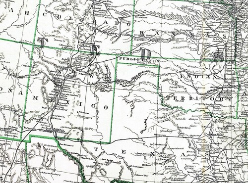


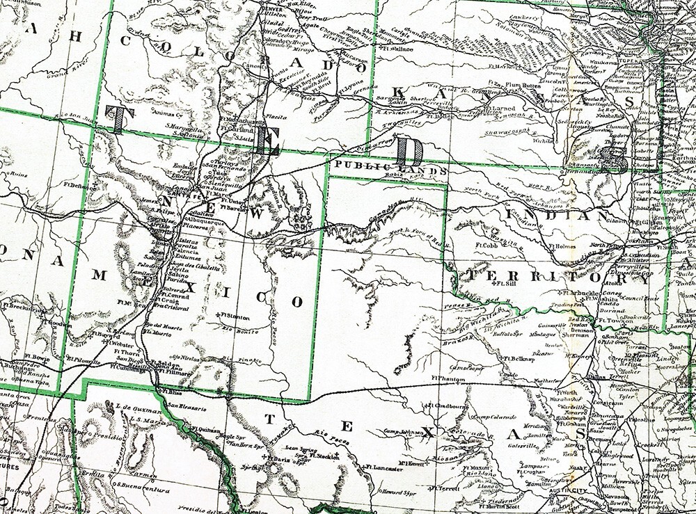
1876 Warner & Beers Railroad Map United States & Dominion Canada Dakota Oklahoma
US $120.00
or Best Offer
Was US $150.00 (20% off)
Condition:
“Good condition with light tonal ageing printed on a strong page with nice color and a centerfold as ”... Read moreabout condition
Ended: Apr 26, 2025 09:15:21 PDT
Oops! Looks like we're having trouble connecting to our server.
Refresh your browser window to try again.
Shipping:
US $4.99 USPS Ground Advantage®.
Located in: Fairview, Pennsylvania, United States
Delivery:
Estimated between Fri, Jul 11 and Fri, Jul 18 to 94104
Returns:
30 days returns. Seller pays for return shipping.
Payments:
.
Special financing available. See terms and apply now- for PayPal Credit, opens in a new window or tab
Earn up to 5x points when you use your eBay Mastercard®. Learn moreabout earning points with eBay Mastercard
Shop with confidence
Seller assumes all responsibility for this listing.
eBay item number:365107858520
Item specifics
- Seller Notes
- Date Range
- 1800-1899
- Type
- Railroad Map
- US State
- IL, IN, MI, OH, WI, Illinois
- Format
- Atlas Map
- Year
- 1876
- Canadian Province
- Ontario, Quebec
- Original/Reproduction
- Antique Original
- Cartographer/Publisher
- Warner & Beers
- Country/Region
- United States of America
Item description from the seller
Seller Feedback
No feedback yet
More to explore :
- United States of America Oklahoma Antique North America Topographical Maps,
- United States of America Oklahoma Antique North America Maps & Atlases,
- United States of America Railroad Map Antique North America Folding Maps,
- United States of America Railroad Map Antique North America Sheet Maps,
- United States of America Railroad Map Antique North America Atlas Maps,
- United States of America Texas Antique North America Railroad Maps,
- George Cram United States of America Antique North America Railroad Maps,
- Antique Railroad Maps,
- United States of America Nautical Map Antique North America Folding Maps,
- Railroad Map Antique Folding Maps