
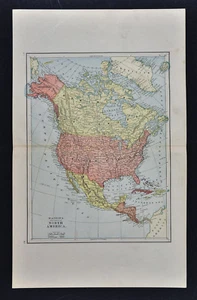
1885 Watson Map - North America - United States Canada Mexico Alaska Cuba Arctic
US $19.99US $19.99
Wed, May 14, 05:35 AMWed, May 14, 05:35 AM
Picture 1 of 2

Gallery
Picture 1 of 2


Have one to sell?
1885 Watson Map - North America - United States Canada Mexico Alaska Cuba Arctic
US $19.99
or Best Offer
Condition:
“Very Good Condition, 11 by 15 inches (28x38cm) on a page measuring 14 by 22" (35x56cm), see the pics ”... Read moreabout condition
Oops! Looks like we're having trouble connecting to our server.
Refresh your browser window to try again.
Shipping:
US $4.99 USPS Ground Advantage®.
Located in: Fairview, Pennsylvania, United States
Delivery:
Estimated between Mon, Aug 4 and Sat, Aug 9 to 94104
Returns:
30 days returns. Seller pays for return shipping.
Payments:
Special financing available. See terms and apply now- for PayPal Credit, opens in a new window or tab
Earn up to 5x points when you use your eBay Mastercard®. Learn moreabout earning points with eBay Mastercard
Shop with confidence
Seller assumes all responsibility for this listing.
eBay item number:405244496920
Item specifics
- Seller Notes
- Original/Reproduction
- Antique Original
- US State
- AL, FL, GA, MS, NC, SC, AR, IA, KS, LA, MO, NE, AZ, CA, CO, NM, NV, UT, CT, MA, ME, NH, RI, VT, DC, DE, MD, NJ, NY, PA, IL, IN, MI, OH, WI, MN, MT, ND, SD, WY, OK, TX, VA, WV, KY, TN
- City
- Washington
- Type
- Political Map
- Format
- Atlas Map
- Date Range
- 1800-1899
- Canadian Province
- Alberta, British Columbia, Manitoba, New Brunswick, Newfoundland & Labrador, Northwest Territories, Nova Scotia, Ontario, Prince Edward Island, Quebec, Saskatchewan, Yukon
- Country/Region
- United States of America
- Cartographer/Publisher
- Watson
- Year
- 1885
Item description from the seller
Seller Feedback
No feedback yet
More to explore :
- United States of America Alaska Antique North America Geological Maps,
- United States of America Alaska Antique North America Maps & Atlases,
- Canada Alaska Antique North America Maps & Atlases,
- United States of America New Mexico Antique North America Topographical Maps,
- United States of America New Mexico Antique North America Maps & Atlases,
- Alaska Antique North America Railroad Maps,
- Alaska Antique North America Geological Maps,
- United States of America Antique North America Railroad Maps,
- United States of America Antique North America County Maps,
- United States of America Antique North America River Maps