


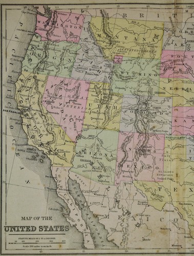

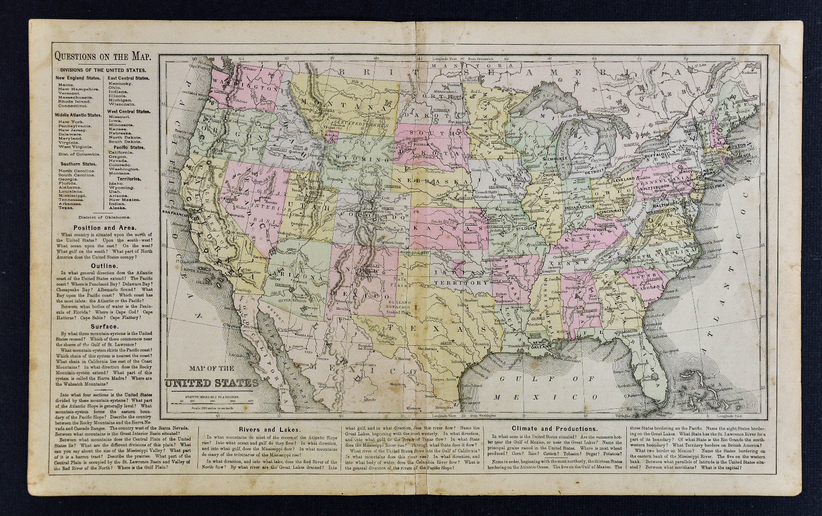
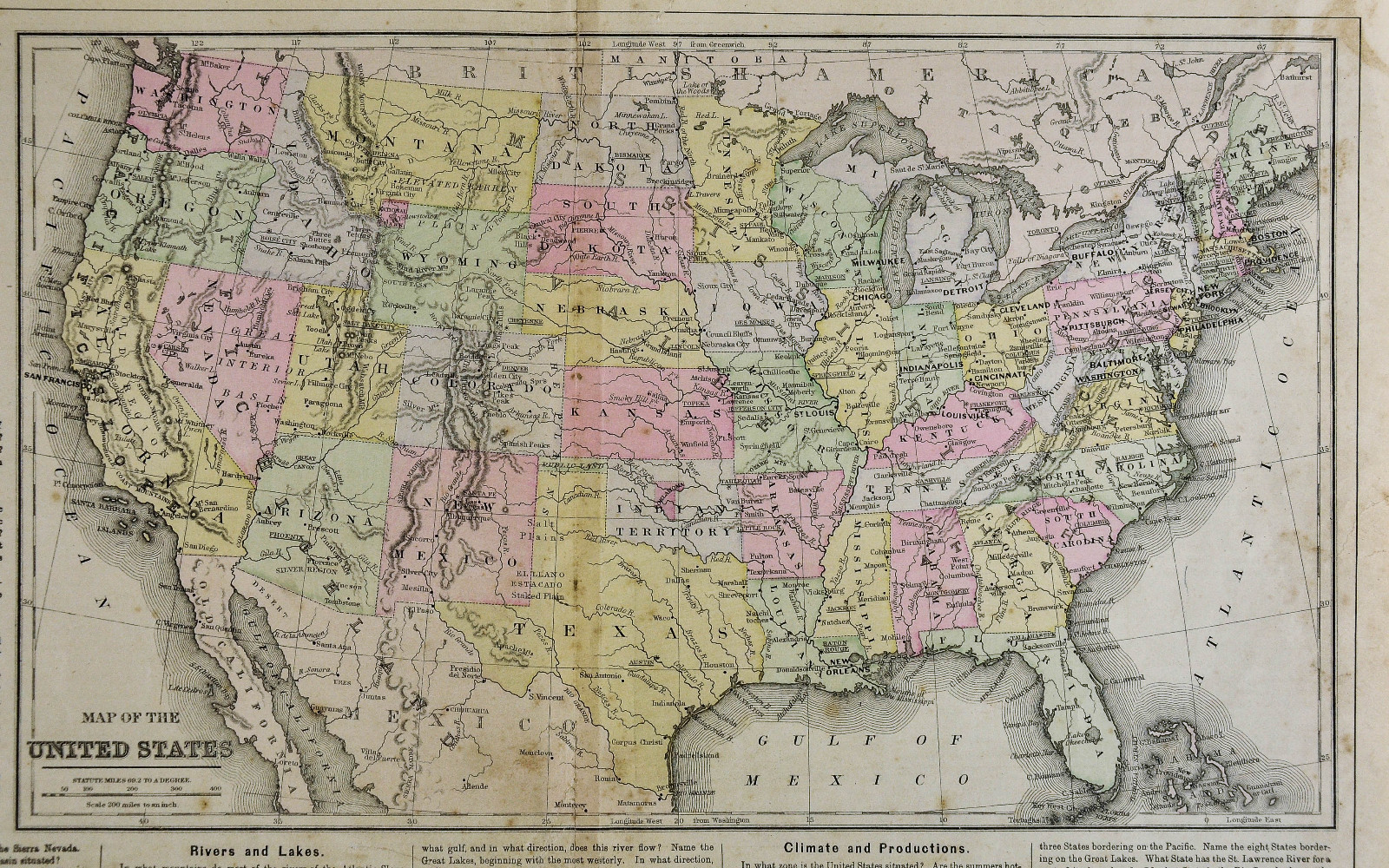

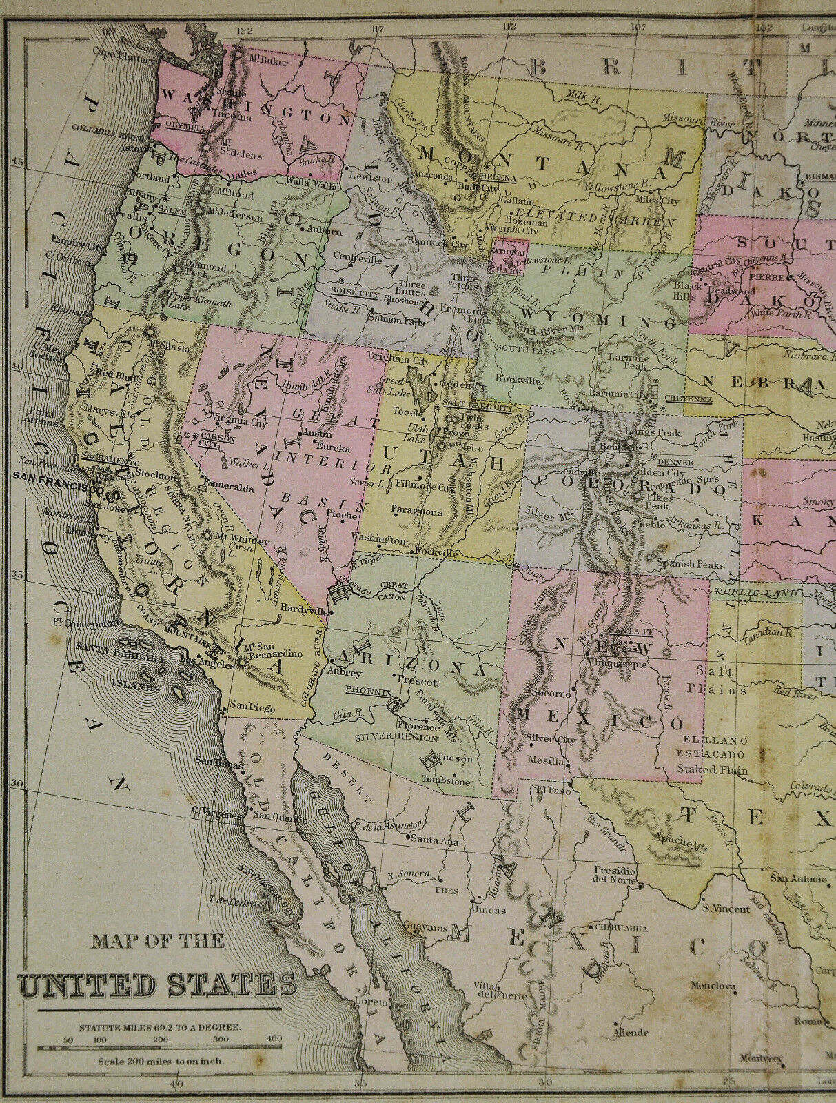


c 1889 Cowperthwait Map - United States - Indian Territory & Oklahoma Lands Rush
US $24.50
or Best Offer
Was US $35.00 (30% off)
Condition:
“Fair, see the pics and description below, 9 by 15 inches on a 11 3/4 by 19" page”
Sale ends in: 2d 18h
- Buy It Nowc 1889 Cowperthwait Map - United States - Indian Territory & Oklahoma Lands Rush
Oops! Looks like we're having trouble connecting to our server.
Refresh your browser window to try again.
Shipping:
US $4.99 USPS Ground Advantage®.
Located in: Fairview, Pennsylvania, United States
Delivery:
Estimated between Fri, May 30 and Thu, Jun 5 to 94104
Returns:
30 days returns. Seller pays for return shipping.
Payments:
Special financing available. See terms and apply now- for PayPal Credit, opens in a new window or tab
Earn up to 5x points when you use your eBay Mastercard®. Learn moreabout earning points with eBay Mastercard
Shop with confidence
Seller assumes all responsibility for this listing.
eBay item number:405293450207
Item specifics
- Seller Notes
- “Fair, see the pics and description below, 9 by 15 inches on a 11 3/4 by 19" page”
- Topic
- Maps
- Year
- 1889
- Publication Year
- 1889
- US State
- AL, FL, GA, MS, NC, SC, AR, IA, KS, LA, MO, NE, AZ, CA, CO, NM, NV, UT, CT, MA, ME, NH, RI, VT, DC, DE, MD, NJ, NY, PA, ID, OR, WA, IL, IN, MI, OH, WI, MN, MT, ND, SD, WY, OK, TX, Oklahoma, Texas, VA, WV, KY, TN
- Original/Reproduction
- Antique Original
- Date Range
- 1800-1899
- City
- Washington
- Type
- Political Map
- Format
- Atlas Map
- Country/Region
- United States of America
- Cartographer/Publisher
- Cowperthwait
Item description from the seller

Popular categories from this store
Seller feedback (19,857)
- l***4 (120)- Feedback left by buyer.Past 6 monthsVerified purchaseVery nice. Received as seller described on their web site. It was well packaged and at a decent cost. Seller was good at communication and is willing to work with the customer.
- u***g (41)- Feedback left by buyer.Past 6 monthsVerified purchaseGreat seller! Packaged safely and shipped quickly. Great communicator and very knowledgeable. Everything showed up exactly as decribed. Incredible value. 12/10 recommendWest Point WWII Map Operation in Italy Allied Advances from Jan 1944 to Jan 1945 (#365096664387)
- 3***d (375)- Feedback left by buyer.Past monthVerified purchaseItem as described, very reasonable price, fast shipping, carefully packaged. Would buy from this seller again
More to explore :
- United States of America Oklahoma Antique North America Topographical Maps,
- United States of America Oklahoma Antique North America Maps & Atlases,
- Northwest Territories United States of America Antique North American Maps & Atlases,
- United States of America Oklahoma Vintage Original Antique North American Maps & Atlases,
- George Cram United States of America Oklahoma Antique North America Maps & Atlases,
- United States of America City Map Antique North America Folding Maps,
- United States of America Geological Map Antique North America Atlas Maps,
- United States of America County Map Antique North America Wall Maps,
- United States of America Railroad Map Antique North America Atlas Maps,
- United States of America Geological Map Antique North America Folding Maps
Popular categories from this store
Seller feedback (19,857)
- l***4 (120)- Feedback left by buyer.Past 6 monthsVerified purchaseVery nice. Received as seller described on their web site. It was well packaged and at a decent cost. Seller was good at communication and is willing to work with the customer.
- u***g (41)- Feedback left by buyer.Past 6 monthsVerified purchaseGreat seller! Packaged safely and shipped quickly. Great communicator and very knowledgeable. Everything showed up exactly as decribed. Incredible value. 12/10 recommendWest Point WWII Map Operation in Italy Allied Advances from Jan 1944 to Jan 1945 (#365096664387)
- 3***d (375)- Feedback left by buyer.Past monthVerified purchaseItem as described, very reasonable price, fast shipping, carefully packaged. Would buy from this seller again