Picture 1 of 9


Gallery
Picture 1 of 9


Have one to sell?
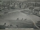
Authentic 1876 ILLINOIS Twp. Map ~ LAKE FOREST - ELGIN - WAUKEGAN - St CHARLES +

US $48.88
or Best Offer
or 4 interest-free payments of $12.22 available with
Condition:
“Always Quick N Free S&H ~ Browse through over 5000 Rare, Authentic, Antique & Collectible Maps in ”... Read moreabout condition
- Buy It NowAuthentic 1876 ILLINOIS Twp. Map ~ LAKE FOREST - ELGIN - WAUKEGAN - St CHARLES +
Oops! Looks like we're having trouble connecting to our server.
Refresh your browser window to try again.
Shipping:
Free USPS Ground Advantage®.
Located in: Marana, Arizona, United States
Delivery:
Estimated between Tue, Jul 29 and Mon, Aug 4 to 91768
Returns:
30 days returns. Buyer pays for return shipping. If you use an eBay shipping label, it will be deducted from your refund amount.
Payments:
.
4 interest-free payments of $12.22 available with Klarna.
Special financing available. See terms and apply now- for PayPal Credit, opens in a new window or tab
Earn up to 5x points when you use your eBay Mastercard®. Learn moreabout earning points with eBay Mastercard
Shop with confidence
Seller assumes all responsibility for this listing.
eBay item number:405294593225
Item specifics
- Seller Notes
- Cartographer/Publisher
- Warner & Beers - Union Atlas Co.
- Original/Reproduction
- Antique Original
- Format
- Atlas Map
- REF
- REF#ILLINOIS1876/121320
- Type
- County Map
- Year
- 1876
- US State
- IL, IN, MI, OH, WI, Illinois
- Date Range
- 1800-1899
- Country/Region
- United States of America
Item description from the seller

Seller feedback (9,610)
- 1***l (18)- Feedback left by buyer.Past 6 monthsVerified purchaseFinally! The "ancestral plat map" arrived and is well worth the long wait!. It is as nice or even nicer than what the seller described. It was packaged adequately, I don't know why it took from 11 April to 5 May to be delivered, but I suspect this was outside the control/responsibility of the seller. I am grateful that this irreplaceable old document was not forever "lost in the mail." Thank you, thank you, thank you!1872 Plat Map ~ FENTON Twp., WHITESIDE Co., ILLINOIS - (15x18)-#10 (#405722860174)
- t***i (1205)- Feedback left by buyer.Past 6 monthsVerified purchasefast shipping...expertly packaged...received as shown/described...great communication...no issues...awesome seller!
- a***z (871)- Feedback left by buyer.Past 6 monthsVerified purchaseOutstanding transaction: Great communication; prompt shipping; secure packaging. Item as shown and described on ebay. Highly recommend MapHatter shop to all ebay buyers!!
More to explore :
- St. Louis Illinois Antique North America Maps & Atlases,
- Illinois County Map Antique North America Atlas Maps,
- Illinois County Map Antique North America Folding Maps,
- Illinois City Map Antique North America Atlas Maps,
- Illinois Railroad Map Antique North America Atlas Maps,
- Illinois Antique North America Railroad Maps,
- Illinois Antique North America Sheet Maps,
- Illinois Lithography Antique North America Atlas Maps,
- Illinois Lithography Antique North America Folding Maps,
- Chicago Illinois Antique North America City Maps
Seller feedback (9,610)
- 1***l (18)- Feedback left by buyer.Past 6 monthsVerified purchaseFinally! The "ancestral plat map" arrived and is well worth the long wait!. It is as nice or even nicer than what the seller described. It was packaged adequately, I don't know why it took from 11 April to 5 May to be delivered, but I suspect this was outside the control/responsibility of the seller. I am grateful that this irreplaceable old document was not forever "lost in the mail." Thank you, thank you, thank you!1872 Plat Map ~ FENTON Twp., WHITESIDE Co., ILLINOIS - (15x18)-#10 (#405722860174)
- t***i (1205)- Feedback left by buyer.Past 6 monthsVerified purchasefast shipping...expertly packaged...received as shown/described...great communication...no issues...awesome seller!
- a***z (871)- Feedback left by buyer.Past 6 monthsVerified purchaseOutstanding transaction: Great communication; prompt shipping; secure packaging. Item as shown and described on ebay. Highly recommend MapHatter shop to all ebay buyers!!