
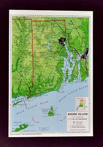
1958 McNally Map - Rhode Island - Providence Newport Narrangansett Bay Warwick
US $9.98US $9.98
Fri, May 16, 06:38 AMFri, May 16, 06:38 AM
Picture 1 of 1
Gallery
Picture 1 of 1

Have one to sell?
1958 McNally Map - Rhode Island - Providence Newport Narrangansett Bay Warwick

US $9.98
or Best Offer
Was US $12.48 (20% off)
Condition:
“Excellent condition, see the pics and description below”
Ended: May 16, 2025 06:38:11 PDT
Oops! Looks like we're having trouble connecting to our server.
Refresh your browser window to try again.
Shipping:
US $4.99 USPS Ground Advantage®.
Located in: Fairview, Pennsylvania, United States
Delivery:
Estimated between Thu, Jul 17 and Wed, Jul 23 to 94104
Returns:
30 days returns. Seller pays for return shipping.
Payments:
Special financing available. See terms and apply now- for PayPal Credit, opens in a new window or tab
Earn up to 5x points when you use your eBay Mastercard®. Learn moreabout earning points with eBay Mastercard
Shop with confidence
Seller assumes all responsibility for this listing.
eBay item number:405419768113
Item specifics
- Seller Notes
- “Excellent condition, see the pics and description below”
- Original/Reproduction
- Antique Original
- Type
- Political Map
- US State
- CT, MA, ME, NH, RI, VT, Rhode Island
- City
- Providence
- Date Range
- 1950-1959
- Format
- Atlas Map
- Country/Region
- United States of America
- Cartographer/Publisher
- Rand McNally & Co.
- Year
- 1958
Item description from the seller

Popular categories from this store
Seller feedback (19,887)
- u***g (42)- Feedback left by buyer.Past 6 monthsVerified purchaseGreat seller! Packaged safely and shipped quickly. Great communicator and very knowledgeable. Everything showed up exactly as decribed. Incredible value. 12/10 recommendWest Point WWII Map Operation in Italy Allied Advances from Jan 1944 to Jan 1945 (#365096664387)
- l***4 (123)- Feedback left by buyer.Past 6 monthsVerified purchaseVery nice. Received as seller described on their web site. It was well packaged and at a decent cost. Seller was good at communication and is willing to work with the customer.1857 Morse Map North Carolina Cape Hatteras Raleigh Durham Asheville Beaufort NC (#365504242256)
- x***u (151)- Feedback left by buyer.Past 6 monthsVerified purchaseMy second order from this seller. As before, the shipping was fast and the map was well packed and protected. Included with the original map was a photocopy of the title page of the book the map came from. Definitely one of my favorite sellers!
More to explore :
- Providence Rhode Island Antique North America Atlas Maps,
- Providence Rhode Island Antique North America County Maps,
- Providence Rhode Island Antique North America Maps & Atlases,
- Providence Rhode Island Antique North America City Maps,
- Providence Lithography Rhode Island Antique North America Maps & Atlases,
- Newport Rhode Island Antique North America Maps & Atlases,
- Providence Rhode Island Antique Original Antique North American Maps & Atlases,
- Newport Rhode Island Antique North American Maps & Atlases 1800-1899 Date Range,
- Rhode Island Contemporary Antique North America Maps & Atlases,
- Copper Plate Rhode Island Antique North America Maps & Atlases
Popular categories from this store
Seller feedback (19,887)
- u***g (42)- Feedback left by buyer.Past 6 monthsVerified purchaseGreat seller! Packaged safely and shipped quickly. Great communicator and very knowledgeable. Everything showed up exactly as decribed. Incredible value. 12/10 recommendWest Point WWII Map Operation in Italy Allied Advances from Jan 1944 to Jan 1945 (#365096664387)
- l***4 (123)- Feedback left by buyer.Past 6 monthsVerified purchaseVery nice. Received as seller described on their web site. It was well packaged and at a decent cost. Seller was good at communication and is willing to work with the customer.1857 Morse Map North Carolina Cape Hatteras Raleigh Durham Asheville Beaufort NC (#365504242256)
- x***u (151)- Feedback left by buyer.Past 6 monthsVerified purchaseMy second order from this seller. As before, the shipping was fast and the map was well packed and protected. Included with the original map was a photocopy of the title page of the book the map came from. Definitely one of my favorite sellers!