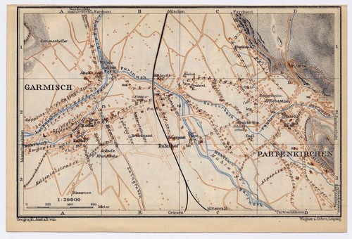
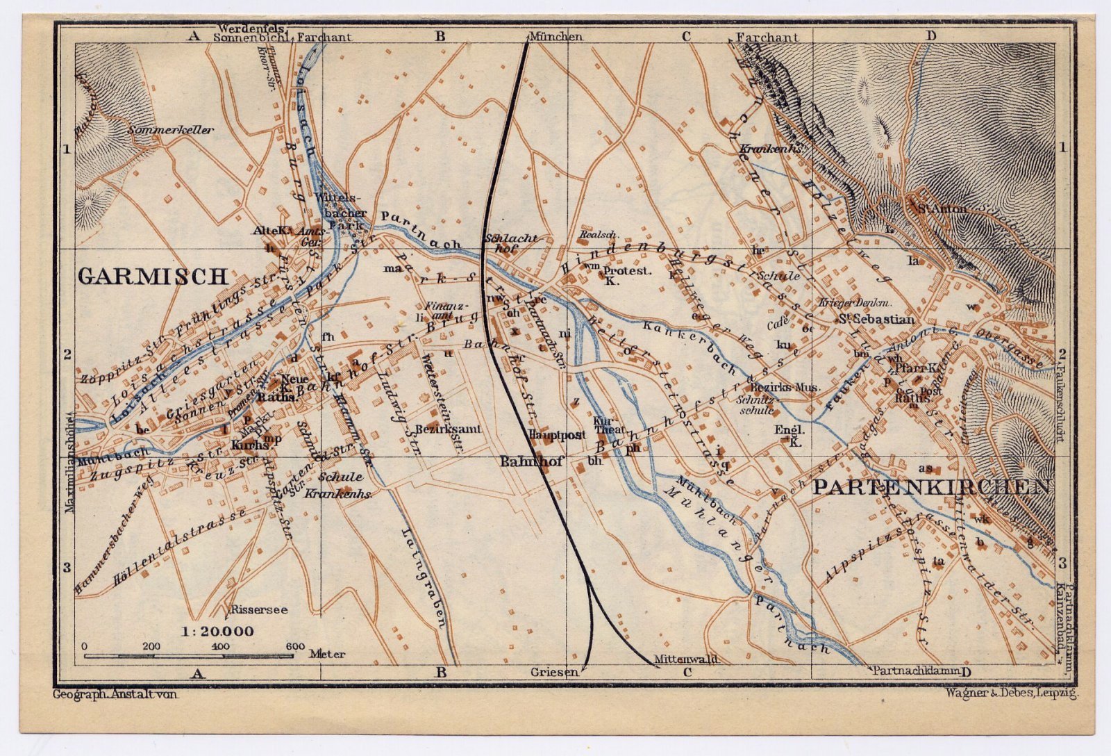
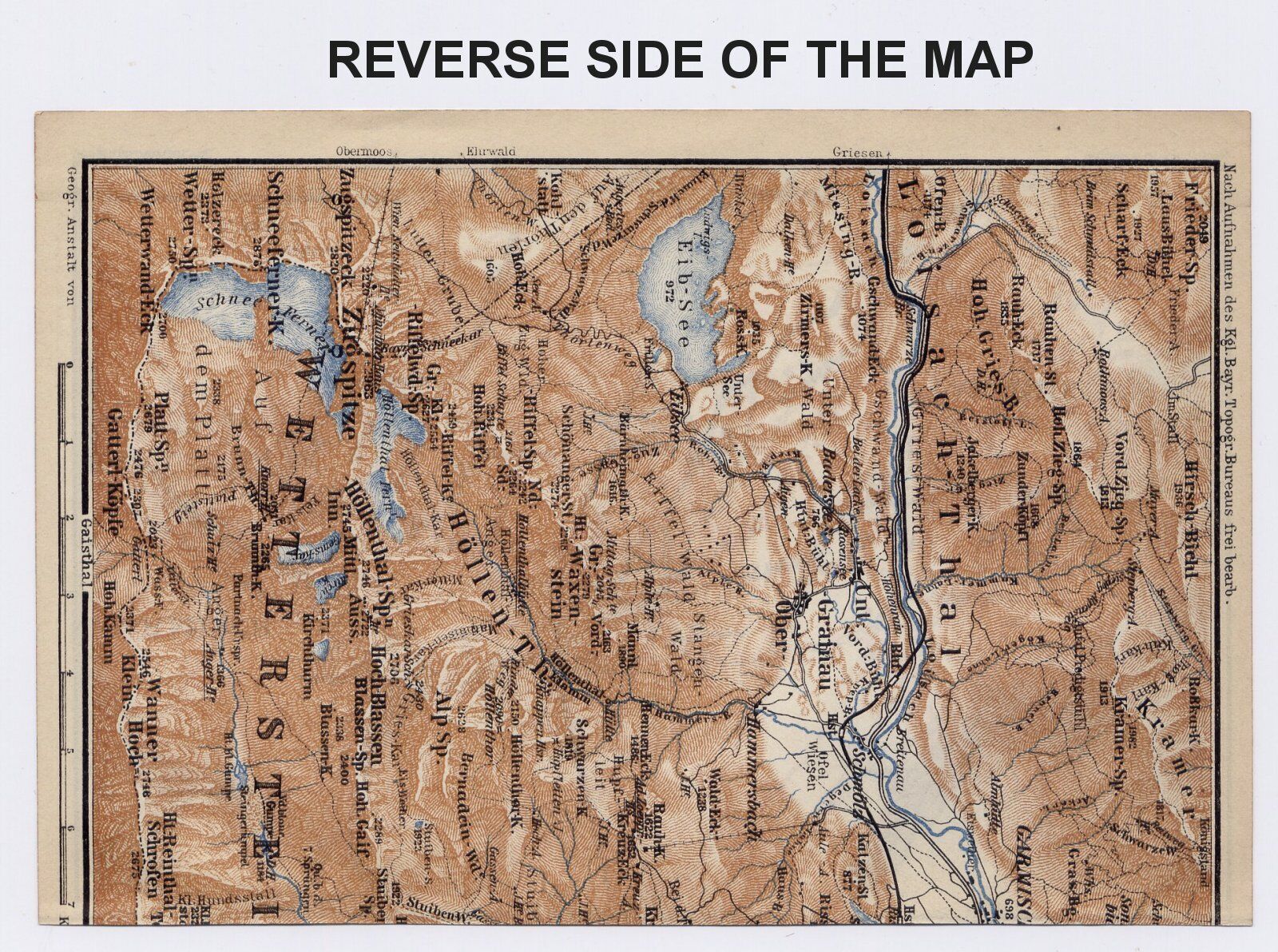
1929 ORIGINAL VINTAGE MAP OF GARMISCH-PARTENKIRCHEN / BAYERN BAVARIA GERMANY
US $28.75US $28.75
Sat, Apr 26, 11:32 AMSat, Apr 26, 11:32 AM


1929 ORIGINAL VINTAGE MAP OF GARMISCH-PARTE
US $28.75
or Best Offer
Condition:
“MAP SIZE: 6" x 4" (15 x 10 cm). CONDITION: GOOD”
Oops! Looks like we're having trouble connecting to our server.
Refresh your browser window to try again.
Shipping:
Free Standard Shipping from Canada.
International shipment of items may be subject to customs processing and additional charges.
Located in: Montreal, Quebec, Canada
Delivery:
Estimated between Tue, Jun 10 and Wed, Jun 18 to 94104
Returns:
60 days returns. Seller pays for return shipping.
Payments:
Special financing available. See terms and apply now- for PayPal Credit, opens in a new window or tab
Earn up to 5x points when you use your eBay Mastercard®. Learn moreabout earning points with eBay Mastercard
Shop with confidence
Seller assumes all responsibility for this listing.
eBay item number:405783645816
Item specifics
- Seller Notes
- “MAP SIZE: 6" x 4" (15 x 10 cm). CONDITION: GOOD”
- Publication Year
- 1929
- Type
- City Map
- Year
- 1929
- Country/Region
- Germany
- State
- Bavaria
- Region
- Germany
- Topic
- Antiques
- MAP SIZE
- 6" x 4" (15 x 10 cm).
- Maker
- Baedeker
- City
- GARMISCH-PARTENKIRCHEN
- Date Range
- 1920-1929
Item description from the seller
Seller Feedback
No feedback yet
More to explore :
- Germany Bavaria Antique Original Antique Europe Maps & Atlases,
- Antique European Maps & Atlases Bavaria Germany,
- Germany Bavaria Antique Europe Atlas Maps,
- Munich Germany Bavaria Antique Europe Maps & Atlases,
- Germany Lithography Bavaria Antique Europe Maps & Atlases,
- Germany Copper Plate Bavaria Antique Europe Maps & Atlases,
- Germany 1920-1929 Date Range Antique Europe Atlas Maps,
- Germany Bavaria 1700-1799 Date Range Antique Europe Maps & Atlases,
- Bavaria Antique Original Antique European Maps & Atlases,
- Vintage Original Antique World Maps & Atlases 1920-1929 Date Range