


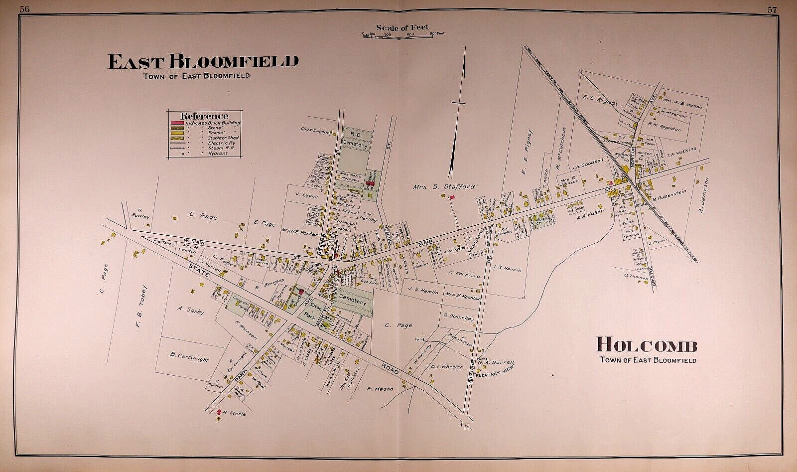

1904 Map ~ EAST BLOOMFIELD - HOLCOMB, ONTARIO Co., NEW YORK ~ (18x34)-#12
US $63.92
or Best Offer
Was US $68.00 (6% off)
Condition:
“This map is not *new* or in *new* condition. It was removed from a 1904 Ontario County, New York ”... Read moreabout condition
- Buy It Now1904 Map ~ EAST BLOOMFIELD - HOLCOMB, ONTARIO Co., NEW YORK ~ (18x34)-#12
Oops! Looks like we're having trouble connecting to our server.
Refresh your browser window to try again.
Shipping:
Free USPS Ground Advantage®.
Located in: San Antonio, Texas, United States
Delivery:
Estimated between Tue, May 6 and Mon, May 12 to 43230
Includes 5 business days handling time after receipt of cleared payment.
Returns:
30 days returns. Buyer pays for return shipping. If you use an eBay shipping label, it will be deducted from your refund amount.
Payments:
Special financing available. See terms and apply now- for PayPal Credit, opens in a new window or tab
Earn up to 5x points when you use your eBay Mastercard®. Learn moreabout earning points with eBay Mastercard
Shop with confidence
Seller assumes all responsibility for this listing.
eBay item number:405783894871
Item specifics
- Seller Notes
- Date Range
- 1900-1909
- Type
- Plat Map
- US State
- New York
- Format
- Plat Atlas Map
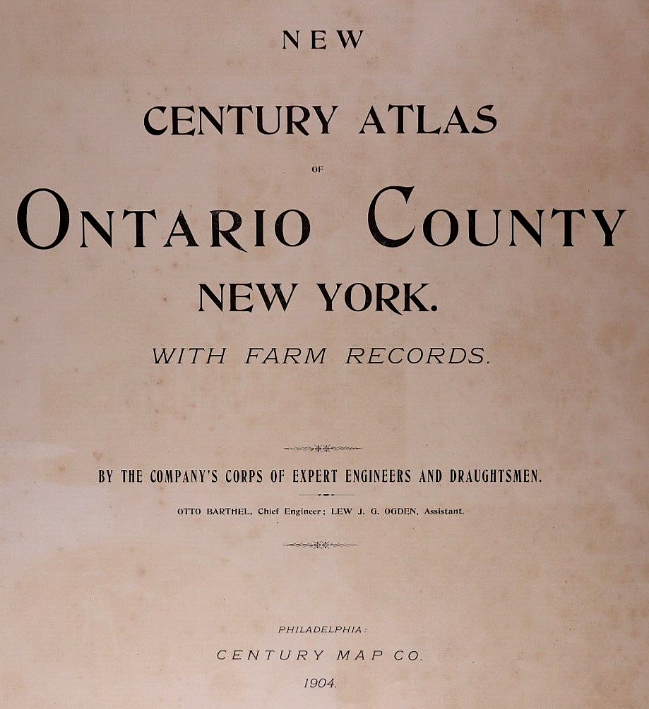
- Title page
- The book cover and title page are not included in the sale.
- Year
- 1904
- Packaging
- All maps are shipped in a secure water-resistant mailing tube
- Cartographer/Publisher
- Century Map Co.
- Original/Reproduction
- Antique Original
- Family
- Property Owner Names / Property Lines / Family History - Ancestry
- Shipping
- Free S&H USA - Calculated S&H Worldwide
- Country/Region
- United States of America
Item description from the seller

Seller feedback (9,507)
- n***d (88)- Feedback left by buyer.Past 6 monthsVerified purchaseExtraordinary piece of history, fast shipping,great packaging, as described, affordable prices. Outstanding seller. 10k recommended.
- r***c (132)- Feedback left by buyer.Past monthVerified purchaseItem was packaged well and delivered as described. Quick shipping and good communication from seller. A+ transaction. Thank you!
- r***5 (6000)- Feedback left by buyer.Past 6 monthsVerified purchaseNice map at a fair price, accurately described. A seller I have previously bought from before and will buy from in the future. Packaged well, shipped fast and free!1871 Plat Map ~ ROCKTON Twp., BELOIT CITY, WINNEBAGO Co., ILLINOIS ~(15x17)-#010 (#405400075912)
More to explore :
- Ontario New York New York Antique North America Maps & Atlases,
- Ontario New York Antique North America Maps & Atlases,
- Rand McNally & Co. New York Antique North America Maps & Atlases,
- New York New York Antique North America City Maps,
- New York New York Antique North America Railroad Maps,
- Rand McNally & Co. New York Antique North America Atlas Maps,
- Antique North American Maps & Atlases New York,
- New York Antique North America City Maps,
- New York Geological Map Antique North America Folding Maps,
- New York New Jersey Antique North America Railroad Maps
Seller feedback (9,507)
- n***d (88)- Feedback left by buyer.Past 6 monthsVerified purchaseExtraordinary piece of history, fast shipping,great packaging, as described, affordable prices. Outstanding seller. 10k recommended.
- r***c (132)- Feedback left by buyer.Past monthVerified purchaseItem was packaged well and delivered as described. Quick shipping and good communication from seller. A+ transaction. Thank you!
- r***5 (6000)- Feedback left by buyer.Past 6 monthsVerified purchaseNice map at a fair price, accurately described. A seller I have previously bought from before and will buy from in the future. Packaged well, shipped fast and free!1871 Plat Map ~ ROCKTON Twp., BELOIT CITY, WINNEBAGO Co., ILLINOIS ~(15x17)-#010 (#405400075912)